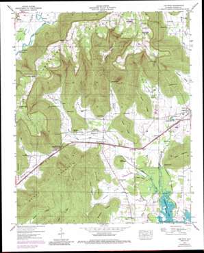
Lim Rock Topo Map Alabama
To zoom in, hover over the map of Lim Rock
USGS Topo Quad 34086f2 - 1:24,000 scale
| Topo Map Name: | Lim Rock |
| USGS Topo Quad ID: | 34086f2 |
| Print Size: | ca. 21 1/4" wide x 27" high |
| Southeast Coordinates: | 34.625° N latitude / 86.125° W longitude |
| Map Center Coordinates: | 34.6875° N latitude / 86.1875° W longitude |
| U.S. State: | AL |
| Filename: | o34086f2.jpg |
| Download Map JPG Image: | Lim Rock topo map 1:24,000 scale |
| Map Type: | Topographic |
| Topo Series: | 7.5´ |
| Map Scale: | 1:24,000 |
| Source of Map Images: | United States Geological Survey (USGS) |
| Alternate Map Versions: |
Lim Rock AL 1936 Download PDF Buy paper map Lim Rock AL 1947, updated 1974 Download PDF Buy paper map Lim Rock AL 1947, updated 1986 Download PDF Buy paper map Lim Rock AL 1950 Download PDF Buy paper map Lim Rock AL 2011 Download PDF Buy paper map Lim Rock AL 2014 Download PDF Buy paper map |
1:24,000 Topo Quads surrounding Lim Rock
> Back to 34086e1 at 1:100,000 scale
> Back to 34086a1 at 1:250,000 scale
> Back to U.S. Topo Maps home
Lim Rock topo map: Gazetteer
Lim Rock: Basins
McAllister Sinks elevation 288m 944′Lim Rock: Crossings
Flippo Ford elevation 183m 600′Lim Rock: Gaps
Coffey Narrows elevation 456m 1496′Soap Gap elevation 214m 702′
Stephens Gap elevation 219m 718′
Lim Rock: Lakes
Beasley Pond elevation 188m 616′Long Pond (historical) elevation 193m 633′
Ned Hole elevation 185m 606′
Proctor Pond (historical) elevation 198m 649′
Reese Pond elevation 188m 616′
Turtle Pond (historical) elevation 182m 597′
Yellow Pond elevation 186m 610′
Lim Rock: Mines
Kennedy Mine elevation 186m 610′Naught Mine elevation 467m 1532′
Shelton Mine elevation 467m 1532′
Lim Rock: Populated Places
Lim Rock elevation 189m 620′Pierceton (historical) elevation 466m 1528′
Wininger elevation 477m 1564′
Lim Rock: Ridges
Gormley Ridge elevation 204m 669′Gullet Ridge elevation 201m 659′
Leslie Ridge elevation 298m 977′
Lizzard Ridge elevation 298m 977′
Wrights Ridge elevation 313m 1026′
Lim Rock: Springs
Blue Spring elevation 185m 606′Frasier Spring elevation 195m 639′
Isbell Spring elevation 191m 626′
Seabolt Spring elevation 185m 606′
Selby Spring elevation 201m 659′
Lim Rock: Streams
Aspel Branch elevation 182m 597′Blue Spring Creek elevation 181m 593′
Caney Cove Creek elevation 183m 600′
Guess Creek elevation 186m 610′
Talkington Branch elevation 194m 636′
Yellow Branch elevation 181m 593′
Lim Rock: Summits
Cotton Mountain elevation 378m 1240′Little Mountain elevation 234m 767′
McCoy Mountain elevation 460m 1509′
Nat Mountain elevation 489m 1604′
Lim Rock: Valleys
Berrys Cove elevation 192m 629′Blue Spring Cove elevation 189m 620′
Caney Cove elevation 184m 603′
Carver Hollow elevation 193m 633′
Farr Hollow elevation 195m 639′
Gentles Cove elevation 187m 613′
Hall Hollow elevation 187m 613′
Schiffman Cove elevation 194m 636′
Lim Rock digital topo map on disk
Buy this Lim Rock topo map showing relief, roads, GPS coordinates and other geographical features, as a high-resolution digital map file on DVD:


