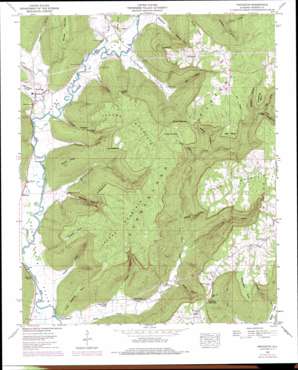
Princeton Topo Map Alabama
To zoom in, hover over the map of Princeton
USGS Topo Quad 34086g2 - 1:24,000 scale
| Topo Map Name: | Princeton |
| USGS Topo Quad ID: | 34086g2 |
| Print Size: | ca. 21 1/4" wide x 27" high |
| Southeast Coordinates: | 34.75° N latitude / 86.125° W longitude |
| Map Center Coordinates: | 34.8125° N latitude / 86.1875° W longitude |
| U.S. State: | AL |
| Filename: | o34086g2.jpg |
| Download Map JPG Image: | Princeton topo map 1:24,000 scale |
| Map Type: | Topographic |
| Topo Series: | 7.5´ |
| Map Scale: | 1:24,000 |
| Source of Map Images: | United States Geological Survey (USGS) |
| Alternate Map Versions: |
Princeton AL 1936 Download PDF Buy paper map Princeton AL 1948, updated 1973 Download PDF Buy paper map Princeton AL 1948, updated 1977 Download PDF Buy paper map Princeton AL 1948, updated 1977 Download PDF Buy paper map Princeton AL 1951, updated 1951 Download PDF Buy paper map Princeton AL 2011 Download PDF Buy paper map Princeton AL 2014 Download PDF Buy paper map |
1:24,000 Topo Quads surrounding Princeton
> Back to 34086e1 at 1:100,000 scale
> Back to 34086a1 at 1:250,000 scale
> Back to U.S. Topo Maps home
Princeton topo map: Gazetteer
Princeton: Capes
Big Bend elevation 493m 1617′Blessington Point elevation 477m 1564′
Bouldin Point elevation 522m 1712′
Horseshoe Bend elevation 488m 1601′
Little Nashville Point elevation 393m 1289′
Logan Point elevation 492m 1614′
Rutledge Point elevation 475m 1558′
Sampson Point elevation 496m 1627′
Threwer Point elevation 485m 1591′
Princeton: Cliffs
Sand Bluff elevation 482m 1581′Winding Stairs elevation 472m 1548′
Princeton: Gaps
Fowler Narrows elevation 468m 1535′Latham Narrows elevation 466m 1528′
Princeton: Lakes
Indian Grave Pond elevation 495m 1624′Princeton: Mines
Fork Mountain Mine elevation 486m 1594′Jacobs Mine elevation 460m 1509′
Jacobs Mine Number 2 elevation 367m 1204′
Princeton: Populated Places
Baileytown elevation 520m 1706′Beachboro (historical) elevation 272m 892′
Larkins Fork (historical) elevation 205m 672′
Letcher elevation 485m 1591′
Little Nashville elevation 192m 629′
Princeton elevation 197m 646′
Swaim elevation 203m 666′
Princeton: Post Offices
Larkin Fork Post Office elevation 205m 672′Princeton: Springs
Beason Spring elevation 220m 721′Blue Spring elevation 192m 629′
Robertson Spring elevation 194m 636′
Princeton: Streams
Bee Branch elevation 333m 1092′Dry Creek elevation 189m 620′
Larkin Fork elevation 196m 643′
Lick Fork elevation 190m 623′
Mill Creek elevation 361m 1184′
Neely Branch elevation 347m 1138′
Pole Branch elevation 204m 669′
Princeton: Summits
Fork Mountain elevation 507m 1663′Jacobs Mountain elevation 484m 1587′
Round Knob elevation 436m 1430′
Princeton: Valleys
Basham Hollow elevation 346m 1135′Big Hollow elevation 321m 1053′
Bill Hollow elevation 217m 711′
Black Gum Hollow elevation 264m 866′
Brewer Hollow elevation 296m 971′
Caney Hollow elevation 261m 856′
Cowan Hollow elevation 193m 633′
Eddy Cove elevation 201m 659′
Fowler Cove elevation 195m 639′
Frazier Cove elevation 189m 620′
Graham Cove elevation 193m 633′
Hunter Hollow elevation 197m 646′
Poplar Hollow elevation 313m 1026′
Robertson Cove elevation 205m 672′
Salt Peter Hollow elevation 204m 669′
Saltpeter Cove elevation 197m 646′
Shop Hollow elevation 196m 643′
Slipoff Hollow elevation 217m 711′
Stovall Hollow elevation 199m 652′
Thompson Cove elevation 196m 643′
Williams Cove elevation 191m 626′
Princeton digital topo map on disk
Buy this Princeton topo map showing relief, roads, GPS coordinates and other geographical features, as a high-resolution digital map file on DVD:


