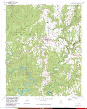
Addison Topo Map Alabama
To zoom in, hover over the map of Addison
USGS Topo Quad 34087b2 - 1:24,000 scale
| Topo Map Name: | Addison |
| USGS Topo Quad ID: | 34087b2 |
| Print Size: | ca. 21 1/4" wide x 27" high |
| Southeast Coordinates: | 34.125° N latitude / 87.125° W longitude |
| Map Center Coordinates: | 34.1875° N latitude / 87.1875° W longitude |
| U.S. State: | AL |
| Filename: | o34087b2.jpg |
| Download Map JPG Image: | Addison topo map 1:24,000 scale |
| Map Type: | Topographic |
| Topo Series: | 7.5´ |
| Map Scale: | 1:24,000 |
| Source of Map Images: | United States Geological Survey (USGS) |
| Alternate Map Versions: |
Addison AL 1969, updated 1973 Download PDF Buy paper map Addison AL 1969, updated 1981 Download PDF Buy paper map Addison AL 1969, updated 1983 Download PDF Buy paper map Addison AL 1969, updated 1983 Download PDF Buy paper map Addison AL 2000, updated 2003 Download PDF Buy paper map Addison AL 2011 Download PDF Buy paper map Addison AL 2014 Download PDF Buy paper map |
| FStopo: | US Forest Service topo Addison is available: Download FStopo PDF Download FStopo TIF |
1:24,000 Topo Quads surrounding Addison
> Back to 34087a1 at 1:100,000 scale
> Back to 34086a1 at 1:250,000 scale
> Back to U.S. Topo Maps home
Addison topo map: Gazetteer
Addison: Bends
Horseshoe Bend elevation 190m 623′Addison: Populated Places
Addison elevation 239m 784′Eagle elevation 250m 820′
Helicon elevation 251m 823′
Inmanfield elevation 257m 843′
New Georgia elevation 244m 800′
Addison: Post Offices
Addison Post Office (historical) elevation 239m 784′Eagle Post Office (historical) elevation 250m 820′
Helicon Post Office (historical) elevation 251m 823′
Addison: Streams
Blevens Creek elevation 176m 577′Boone Creek elevation 189m 620′
Brindley Branch elevation 155m 508′
Burns Branch elevation 157m 515′
Chimney Branch elevation 155m 508′
Clifty Creek elevation 174m 570′
Cow Creek elevation 155m 508′
Glover Creek elevation 157m 515′
Horsepond Branch elevation 195m 639′
Indian Creek elevation 182m 597′
Jones Branch elevation 167m 547′
Little Rock Creek elevation 167m 547′
Long Branch elevation 198m 649′
Mile Creek elevation 156m 511′
Addison digital topo map on disk
Buy this Addison topo map showing relief, roads, GPS coordinates and other geographical features, as a high-resolution digital map file on DVD:


