Hamilton Topo Map Alabama
To zoom in, hover over the map of Hamilton
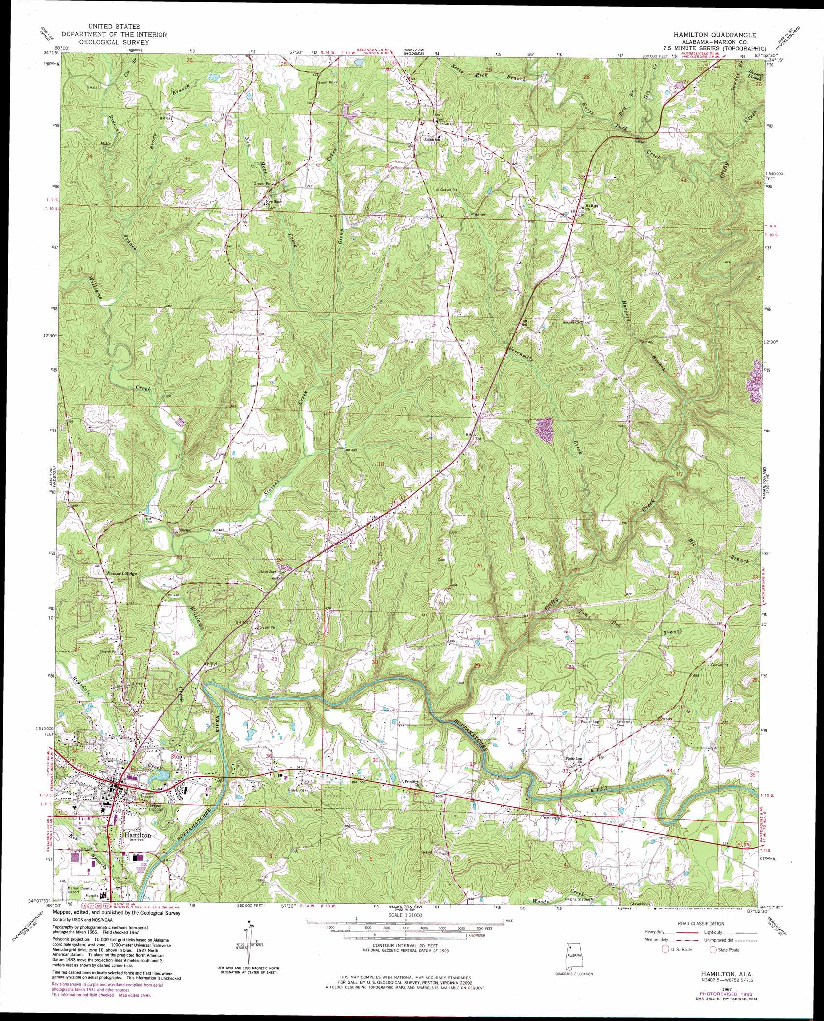
USGS Topo Quad 34087b8 - 1:24,000 scale
| Topo Map Name: | Hamilton |
| USGS Topo Quad ID: | 34087b8 |
| Print Size: | ca. 21 1/4" wide x 27" high |
| Southeast Coordinates: | 34.125° N latitude / 87.875° W longitude |
| Map Center Coordinates: | 34.1875° N latitude / 87.9375° W longitude |
| U.S. State: | AL |
| Filename: | o34087b8.jpg |
| Download Map JPG Image: | Hamilton topo map 1:24,000 scale |
| Map Type: | Topographic |
| Topo Series: | 7.5´ |
| Map Scale: | 1:24,000 |
| Source of Map Images: | United States Geological Survey (USGS) |
| Alternate Map Versions: |
Hamilton AL 1967, updated 1968 Download PDF Buy paper map Hamilton AL 1967, updated 1983 Download PDF Buy paper map Hamilton AL 2011 Download PDF Buy paper map Hamilton AL 2014 Download PDF Buy paper map |
1:24,000 Topo Quads surrounding Hamilton
Red Bay |
Halltown |
Guinn Cross Roads |
Isbell |
Spruce Pine |
Shottsville |
Vina |
Hodges |
Hackleburg |
Phil Campbell |
Bexar |
Weston |
Hamilton |
Hamilton Ne |
Haleyville West |
Detroit |
Henson Springs |
Hamilton Sw |
Brilliant |
Gold Mine |
Sulligent |
Beaverton |
Guin |
Winfield |
Glen Allen |
> Back to 34087a1 at 1:100,000 scale
> Back to 34086a1 at 1:250,000 scale
> Back to U.S. Topo Maps home
Hamilton topo map: Gazetteer
Hamilton: Airports
Marion County Airport elevation 134m 439′Hamilton: Cliffs
State Rock elevation 223m 731′Hamilton: Populated Places
Hamilton elevation 148m 485′Pleasant Ridge elevation 198m 649′
Hamilton: Post Offices
Hamilton Post Office elevation 149m 488′Hamilton: Streams
Big Branch elevation 137m 449′Biggerstaff Branch elevation 152m 498′
Brown Branch elevation 164m 538′
Burnett Branch elevation 185m 606′
Clifty Creek elevation 121m 396′
Cox Branch elevation 192m 629′
Dry Branch elevation 178m 583′
Gin Creek elevation 175m 574′
Glenn Creek elevation 178m 583′
Gowder Branch elevation 175m 574′
Harpers Branch elevation 146m 479′
Key Branch elevation 115m 377′
New Hope Creek elevation 181m 593′
North Fork Creek elevation 164m 538′
Ragsdale Creek elevation 115m 377′
Rideout Branch elevation 153m 501′
Sevenmile Creek elevation 131m 429′
State Rock Branch elevation 195m 639′
Stevens Creek elevation 139m 456′
Toms Den Branch elevation 131m 429′
Williams Creek elevation 117m 383′
Hamilton digital topo map on disk
Buy this Hamilton topo map showing relief, roads, GPS coordinates and other geographical features, as a high-resolution digital map file on DVD: