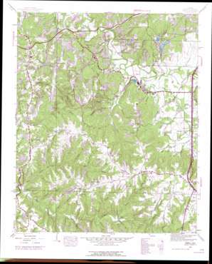
Isbell Topo Map Alabama
To zoom in, hover over the map of Isbell
USGS Topo Quad 34087d7 - 1:24,000 scale
| Topo Map Name: | Isbell |
| USGS Topo Quad ID: | 34087d7 |
| Print Size: | ca. 21 1/4" wide x 27" high |
| Southeast Coordinates: | 34.375° N latitude / 87.75° W longitude |
| Map Center Coordinates: | 34.4375° N latitude / 87.8125° W longitude |
| U.S. State: | AL |
| Filename: | o34087d7.jpg |
| Download Map JPG Image: | Isbell topo map 1:24,000 scale |
| Map Type: | Topographic |
| Topo Series: | 7.5´ |
| Map Scale: | 1:24,000 |
| Source of Map Images: | United States Geological Survey (USGS) |
| Alternate Map Versions: |
Isbell AL 1936 Download PDF Buy paper map Isbell AL 1945, updated 1960 Download PDF Buy paper map Isbell AL 1945, updated 1970 Download PDF Buy paper map Isbell AL 1945, updated 1977 Download PDF Buy paper map Isbell AL 1947 Download PDF Buy paper map Isbell AL 2011 Download PDF Buy paper map Isbell AL 2014 Download PDF Buy paper map |
1:24,000 Topo Quads surrounding Isbell
> Back to 34087a1 at 1:100,000 scale
> Back to 34086a1 at 1:250,000 scale
> Back to U.S. Topo Maps home
Isbell topo map: Gazetteer
Isbell: Lakes
Parrish Pond elevation 238m 780′Rockwood Lake elevation 200m 656′
Isbell: Populated Places
Belgreen elevation 246m 807′Glasgow Corner elevation 279m 915′
Isbell elevation 206m 675′
Rockwood elevation 211m 692′
Isbell: Springs
Rockwood Spring elevation 217m 711′Isbell: Streams
Bare Field Branch elevation 208m 682′Big Branch elevation 210m 688′
Bowen Branch elevation 220m 721′
Butler Branch elevation 219m 718′
Camp Branch elevation 211m 692′
Capeland Branch elevation 202m 662′
Chisholm Creek elevation 191m 626′
Creamos Springs Branch elevation 207m 679′
Desprez Branch elevation 195m 639′
Duncan Branch elevation 196m 643′
Ezzell Branch elevation 194m 636′
Graham Branch elevation 198m 649′
Grissom Branch elevation 204m 669′
Hamilton Branch elevation 202m 662′
Hamilton Creek elevation 193m 633′
Long Branch elevation 186m 610′
Lucas Branch elevation 197m 646′
Mack Branch elevation 198m 649′
Madden Branch elevation 192m 629′
McWright Creek elevation 200m 656′
Mud Creek elevation 195m 639′
Nix Branch elevation 231m 757′
Parrish Branch elevation 194m 636′
Piney Creek elevation 198m 649′
Ray Branch elevation 219m 718′
Robinson Creek elevation 194m 636′
Rocky Branch elevation 201m 659′
Rocky Branch elevation 252m 826′
Sawmill Branch elevation 230m 754′
Shingle Branch elevation 202m 662′
Sol Martin Branch elevation 214m 702′
Steele Branch elevation 218m 715′
Steele Branch elevation 211m 692′
Stone Branch elevation 219m 718′
Strickland Branch elevation 208m 682′
Upper Field Branch elevation 231m 757′
Isbell: Valleys
Martin Hollow elevation 210m 688′Pounders Hollow elevation 201m 659′
Spring Hollow elevation 210m 688′
Isbell digital topo map on disk
Buy this Isbell topo map showing relief, roads, GPS coordinates and other geographical features, as a high-resolution digital map file on DVD:


