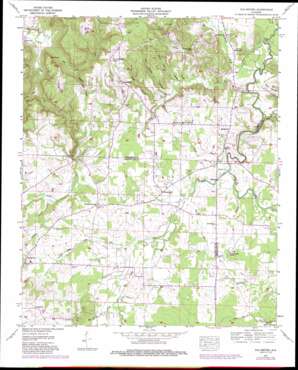
Old Bethel Topo Map Alabama
To zoom in, hover over the map of Old Bethel
USGS Topo Quad 34087e5 - 1:24,000 scale
| Topo Map Name: | Old Bethel |
| USGS Topo Quad ID: | 34087e5 |
| Print Size: | ca. 21 1/4" wide x 27" high |
| Southeast Coordinates: | 34.5° N latitude / 87.5° W longitude |
| Map Center Coordinates: | 34.5625° N latitude / 87.5625° W longitude |
| U.S. State: | AL |
| Filename: | o34087e5.jpg |
| Download Map JPG Image: | Old Bethel topo map 1:24,000 scale |
| Map Type: | Topographic |
| Topo Series: | 7.5´ |
| Map Scale: | 1:24,000 |
| Source of Map Images: | United States Geological Survey (USGS) |
| Alternate Map Versions: |
Old Bethel AL 1936 Download PDF Buy paper map Old Bethel AL 1957, updated 1958 Download PDF Buy paper map Old Bethel AL 1957, updated 1973 Download PDF Buy paper map Old Bethel AL 1957, updated 1989 Download PDF Buy paper map Old Bethel AL 2011 Download PDF Buy paper map Old Bethel AL 2014 Download PDF Buy paper map |
1:24,000 Topo Quads surrounding Old Bethel
> Back to 34087e1 at 1:100,000 scale
> Back to 34086a1 at 1:250,000 scale
> Back to U.S. Topo Maps home
Old Bethel topo map: Gazetteer
Old Bethel: Bridges
Bean Bridge elevation 167m 547′Kirby Bridge (historical) elevation 167m 547′
Old Bethel: Capes
Jack Point elevation 239m 784′Old Bethel: Dams
Vandiver Brothers Lake Dam elevation 171m 561′Old Bethel: Gaps
McCorkles Gap elevation 191m 626′Old Bethel: Populated Places
Avoca (historical) elevation 183m 600′Bethsaida elevation 179m 587′
La Grange elevation 194m 636′
Old Bethel elevation 187m 613′
Pane (historical) elevation 194m 636′
Poplar Creek (historical) elevation 210m 688′
Saints Crossroads elevation 189m 620′
Old Bethel: Post Offices
Abbey Post Office (historical) elevation 184m 603′Pane Post Office (historical) elevation 194m 636′
Old Bethel: Reservoirs
Vandiver Brothers Lake elevation 171m 561′Old Bethel: Streams
Bull Skull Creek elevation 146m 479′Cabin Branch elevation 146m 479′
Foxtrap Creek elevation 149m 488′
Hollow Field Branch elevation 173m 567′
Lick Branch elevation 174m 570′
Little Mud Creek elevation 177m 580′
Masterson Creek elevation 166m 544′
McAfee Creek elevation 168m 551′
McBride Branch elevation 152m 498′
Mud Creek elevation 173m 567′
Mulwee Branch elevation 172m 564′
Poplar Creek elevation 168m 551′
Rock Creek elevation 173m 567′
Smith Creek elevation 182m 597′
Watson Spring Branch elevation 173m 567′
Whitlock Branch elevation 177m 580′
Old Bethel: Summits
Collins Mountain elevation 208m 682′Old Bethel: Valleys
Doss Hollow elevation 177m 580′Gin House Hollow elevation 175m 574′
King Hollow elevation 170m 557′
Stillhouse Hollow elevation 168m 551′
Old Bethel digital topo map on disk
Buy this Old Bethel topo map showing relief, roads, GPS coordinates and other geographical features, as a high-resolution digital map file on DVD:


