Turon Topo Map Mississippi
To zoom in, hover over the map of Turon
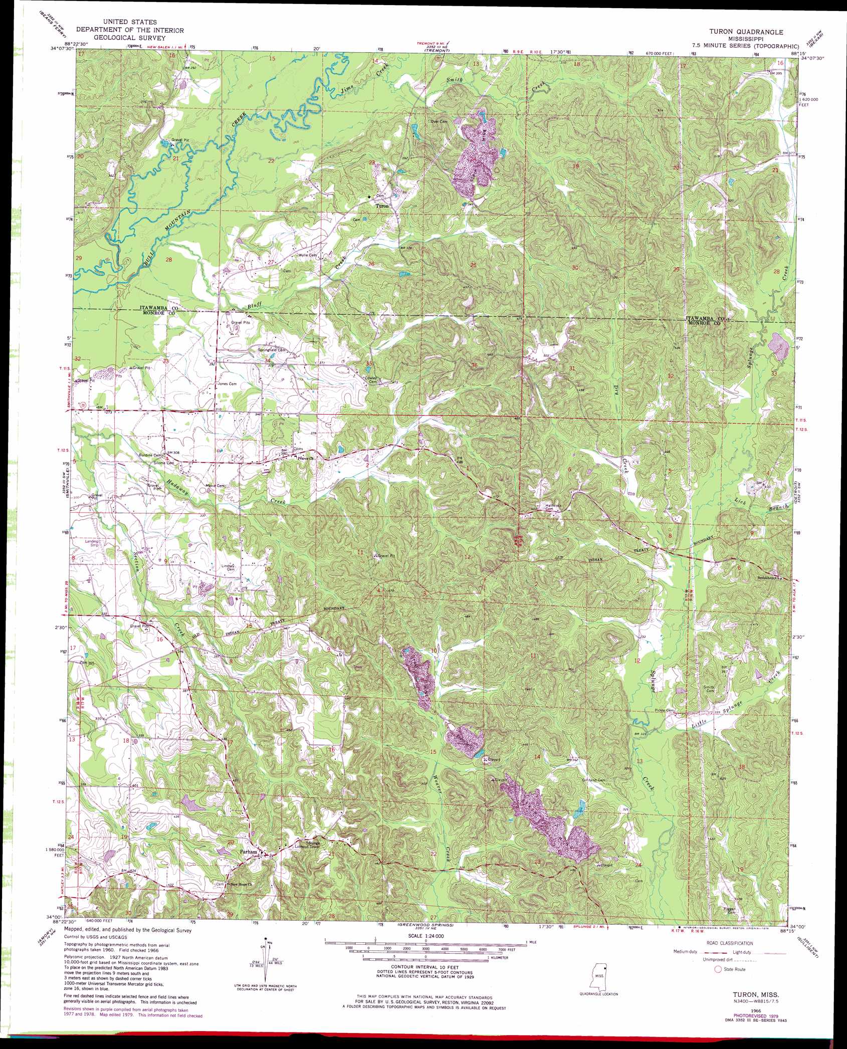
USGS Topo Quad 34088a3 - 1:24,000 scale
| Topo Map Name: | Turon |
| USGS Topo Quad ID: | 34088a3 |
| Print Size: | ca. 21 1/4" wide x 27" high |
| Southeast Coordinates: | 34° N latitude / 88.25° W longitude |
| Map Center Coordinates: | 34.0625° N latitude / 88.3125° W longitude |
| U.S. State: | MS |
| Filename: | o34088a3.jpg |
| Download Map JPG Image: | Turon topo map 1:24,000 scale |
| Map Type: | Topographic |
| Topo Series: | 7.5´ |
| Map Scale: | 1:24,000 |
| Source of Map Images: | United States Geological Survey (USGS) |
| Alternate Map Versions: |
Turon MS 1966, updated 1967 Download PDF Buy paper map Turon MS 1966, updated 1979 Download PDF Buy paper map Turon MS 2012 Download PDF Buy paper map Turon MS 2015 Download PDF Buy paper map |
1:24,000 Topo Quads surrounding Turon
Mooreville |
Fulton |
Fulton Se |
Shottsville |
Vina |
Evergreen |
Beans Ferry |
Tremont |
Bexar |
Weston |
Nettleton |
Smithville |
Turon |
Detroit |
Henson Springs |
Wren |
Amory |
Greenwood Springs |
Sulligent |
Beaverton |
Aberdeen |
Amory Sw |
Amory Se |
Sulligent Sw |
Vernon |
> Back to 34088a1 at 1:100,000 scale
> Back to 34088a1 at 1:250,000 scale
> Back to U.S. Topo Maps home
Turon topo map: Gazetteer
Turon: Airports
Rye Field elevation 94m 308′Turon: Dams
Monroe Sporting Club Lake Dam elevation 113m 370′W A Gideon Lake Dam elevation 103m 337′
Turon: Populated Places
Bristow elevation 114m 374′Parham elevation 150m 492′
Riggins elevation 149m 488′
Turon elevation 116m 380′
Turon: Streams
Bluff Creek elevation 78m 255′Dry Creek elevation 101m 331′
Jims Creek elevation 80m 262′
Lick Branch elevation 101m 331′
Little Splunge Creek elevation 97m 318′
Smith Creek elevation 80m 262′
Turon digital topo map on disk
Buy this Turon topo map showing relief, roads, GPS coordinates and other geographical features, as a high-resolution digital map file on DVD: