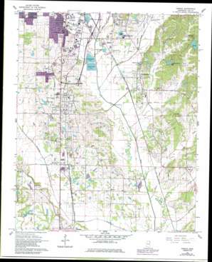
Verona Topo Map Mississippi
To zoom in, hover over the map of Verona
USGS Topo Quad 34088b6 - 1:24,000 scale
| Topo Map Name: | Verona |
| USGS Topo Quad ID: | 34088b6 |
| Print Size: | ca. 21 1/4" wide x 27" high |
| Southeast Coordinates: | 34.125° N latitude / 88.625° W longitude |
| Map Center Coordinates: | 34.1875° N latitude / 88.6875° W longitude |
| U.S. State: | MS |
| Filename: | o34088b6.jpg |
| Download Map JPG Image: | Verona topo map 1:24,000 scale |
| Map Type: | Topographic |
| Topo Series: | 7.5´ |
| Map Scale: | 1:24,000 |
| Source of Map Images: | United States Geological Survey (USGS) |
| Alternate Map Versions: |
Verona MS 1966, updated 1967 Download PDF Buy paper map Verona MS 1966, updated 1979 Download PDF Buy paper map Verona MS 1966, updated 1986 Download PDF Buy paper map Verona MS 2012 Download PDF Buy paper map Verona MS 2015 Download PDF Buy paper map |
1:24,000 Topo Quads surrounding Verona
> Back to 34088a1 at 1:100,000 scale
> Back to 34088a1 at 1:250,000 scale
> Back to U.S. Topo Maps home
Verona topo map: Gazetteer
Verona: Dams
Charles Bailey Lake Dam elevation 109m 357′Club Lake Dam elevation 79m 259′
J B Armstrong Lake Dam elevation 76m 249′
Kennedy Lake Dam elevation 77m 252′
Lakewood Lake Dam elevation 99m 324′
Ruff Estate Dam elevation 104m 341′
Sewage Disposal Pond Number 1 Dam elevation 90m 295′
Sewage Disposal Pond Number 2 Dam elevation 89m 291′
Tombigbee State Park Lake Dam elevation 100m 328′
Verona: Lakes
Borden Lake elevation 79m 259′Longs Lake elevation 86m 282′
Verona: Parks
Tupelo National Fish Hatchery elevation 79m 259′Verona: Populated Places
Brewer elevation 85m 278′Lakewood Park elevation 97m 318′
Lee Acres elevation 91m 298′
Oak Grove Park elevation 79m 259′
Old Union elevation 95m 311′
Plantersville elevation 94m 308′
Union elevation 89m 291′
Verona elevation 98m 321′
Verona Heights elevation 98m 321′
Verona: Reservoirs
Barley Lake elevation 97m 318′Club Lake elevation 84m 275′
Lakewood Park Lake elevation 91m 298′
Verona: Streams
Carmichael Creek elevation 69m 226′Garrett Creek elevation 69m 226′
Kings Creek elevation 74m 242′
Leeper Creek elevation 70m 229′
Little Garrett Creek elevation 76m 249′
Louisa Creek elevation 73m 239′
Mud Creek elevation 78m 255′
Smith Creek elevation 71m 232′
South Tulip Creek elevation 79m 259′
Tulip Creek elevation 73m 239′
Verona digital topo map on disk
Buy this Verona topo map showing relief, roads, GPS coordinates and other geographical features, as a high-resolution digital map file on DVD:


