Fulton Topo Map Mississippi
To zoom in, hover over the map of Fulton
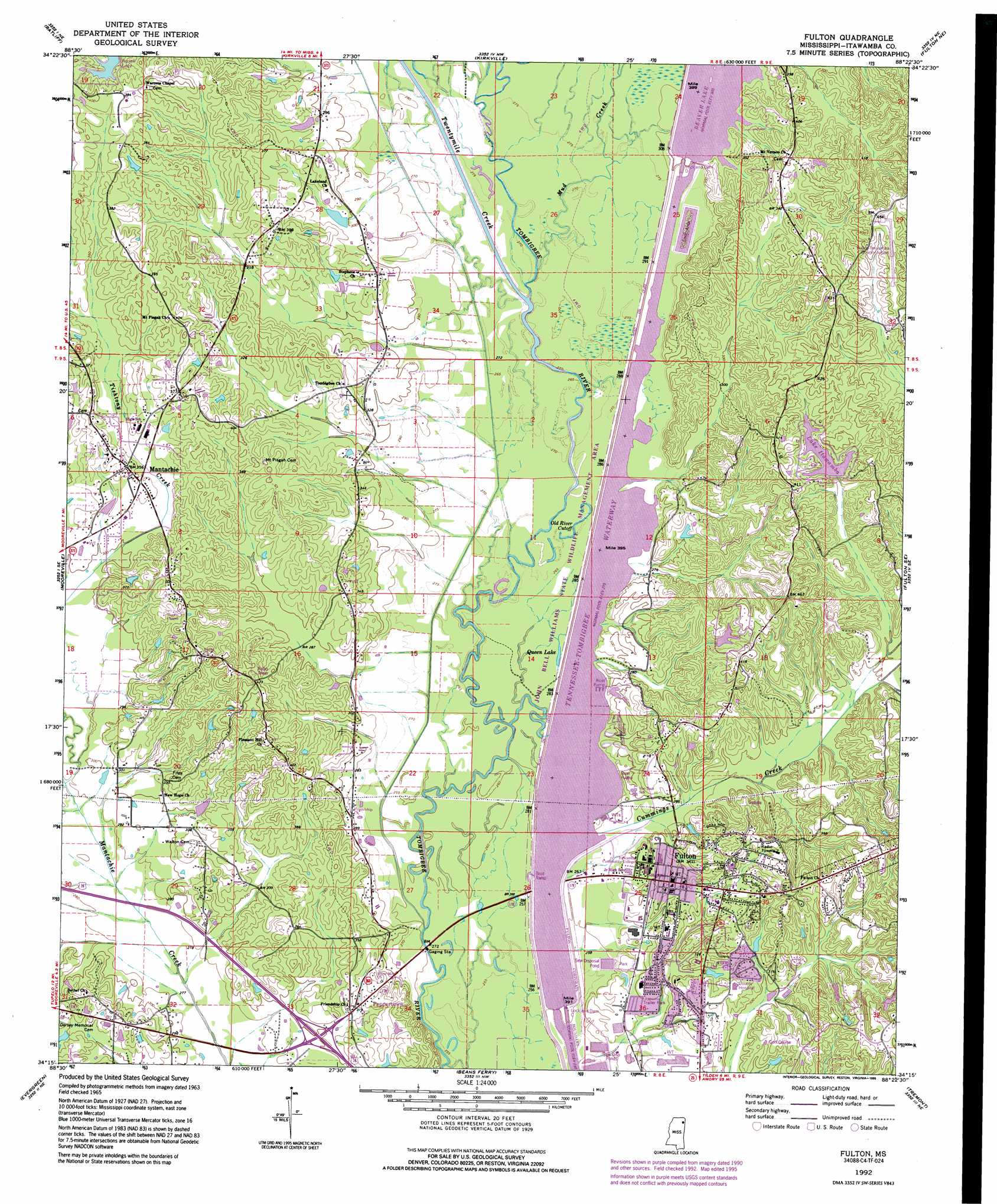
USGS Topo Quad 34088c4 - 1:24,000 scale
| Topo Map Name: | Fulton |
| USGS Topo Quad ID: | 34088c4 |
| Print Size: | ca. 21 1/4" wide x 27" high |
| Southeast Coordinates: | 34.25° N latitude / 88.375° W longitude |
| Map Center Coordinates: | 34.3125° N latitude / 88.4375° W longitude |
| U.S. State: | MS |
| Filename: | o34088c4.jpg |
| Download Map JPG Image: | Fulton topo map 1:24,000 scale |
| Map Type: | Topographic |
| Topo Series: | 7.5´ |
| Map Scale: | 1:24,000 |
| Source of Map Images: | United States Geological Survey (USGS) |
| Alternate Map Versions: |
Fulton MS 1965, updated 1966 Download PDF Buy paper map Fulton MS 1965, updated 1976 Download PDF Buy paper map Fulton MS 1965, updated 1979 Download PDF Buy paper map Fulton MS 1992, updated 1995 Download PDF Buy paper map Fulton MS 2012 Download PDF Buy paper map Fulton MS 2015 Download PDF Buy paper map |
1:24,000 Topo Quads surrounding Fulton
Baldwyn |
Wheeler |
Marietta |
Paden Se |
Belmont |
Guntown |
Ratliff |
Kirkville |
Fulton Ne |
Red Bay |
Tupelo |
Mooreville |
Fulton |
Fulton Se |
Shottsville |
Verona |
Evergreen |
Beans Ferry |
Tremont |
Bexar |
Shannon |
Nettleton |
Smithville |
Turon |
Detroit |
> Back to 34088a1 at 1:100,000 scale
> Back to 34088a1 at 1:250,000 scale
> Back to U.S. Topo Maps home
Fulton topo map: Gazetteer
Fulton: Airports
Fulton-Itawamba County Airport elevation 134m 439′Fulton: Dams
Buck Riley Lake Dam elevation 105m 344′Graham Lake Dam elevation 91m 298′
Lake Itawamba Dam elevation 110m 360′
Pearce Lake Dam elevation 96m 314′
Scenic Hills Club Lake Dam elevation 104m 341′
Wilber Stephens Pond Dam elevation 92m 301′
Fulton: Lakes
Old River Cutoff elevation 81m 265′Queen Lake elevation 81m 265′
Fulton: Parks
Fulton Recreation Area elevation 92m 301′Fulton: Populated Places
Fulton elevation 104m 341′Mantachie elevation 105m 344′
West Fulton elevation 89m 291′
Fulton: Reservoirs
Lake Itawamba elevation 104m 341′Pool C elevation 79m 259′
Fulton: Streams
Bullger Creek elevation 85m 278′Cummings Creek elevation 78m 255′
Mud Creek elevation 82m 269′
Twentymile Creek elevation 81m 265′
Fulton digital topo map on disk
Buy this Fulton topo map showing relief, roads, GPS coordinates and other geographical features, as a high-resolution digital map file on DVD: