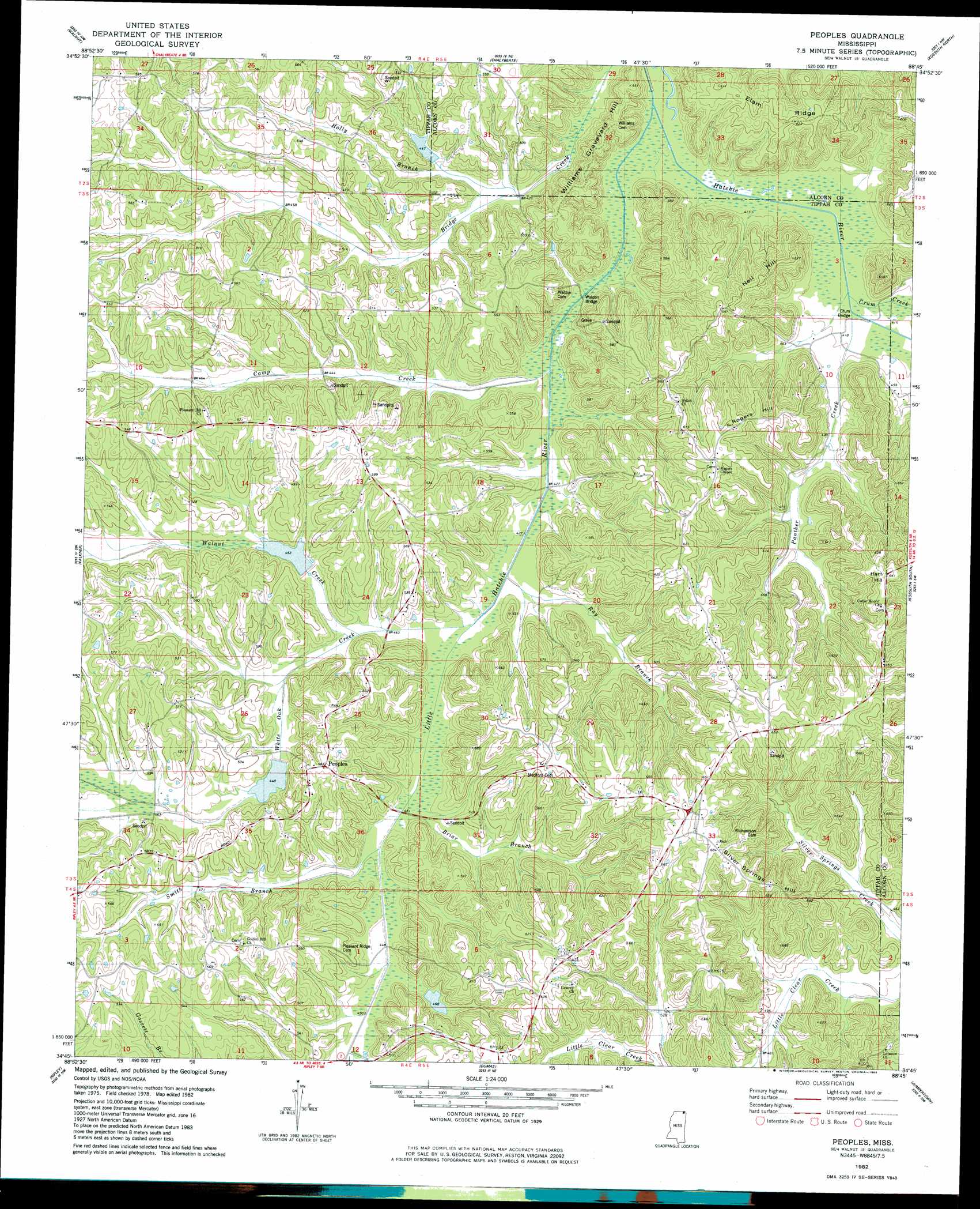
Peoples Topo Map Mississippi
To zoom in, hover over the map of Peoples
USGS Topo Quad 34088g7 - 1:24,000 scale
| Topo Map Name: | Peoples |
| USGS Topo Quad ID: | 34088g7 |
| Print Size: | ca. 21 1/4" wide x 27" high |
| Southeast Coordinates: | 34.75° N latitude / 88.75° W longitude |
| Map Center Coordinates: | 34.8125° N latitude / 88.8125° W longitude |
| U.S. State: | MS |
| Filename: | o34088g7.jpg |
| Download Map JPG Image: | Peoples topo map 1:24,000 scale |
| Map Type: | Topographic |
| Topo Series: | 7.5´ |
| Map Scale: | 1:24,000 |
| Source of Map Images: | United States Geological Survey (USGS) |
| Alternate Map Versions: |
Peoples MS 1982, updated 1983 Download PDF Buy paper map Peoples MS 2012 Download PDF Buy paper map Peoples MS 2015 Download PDF Buy paper map |
1:24,000 Topo Quads surrounding Peoples
Saulsbury |
Middleton |
Pocahontas |
Chewalla |
Guys |
Camp Hill |
Walnut |
Chalybeate |
Kossuth North |
Corinth |
Whitten Town |
Falkner |
Peoples |
Kossuth South |
Rienzi |
Blue Mountain |
Ripley |
Dumas |
Jumpertown |
Booneville |
Myrtle |
Keownville |
Pleasant Ridge |
Baldwyn |
Wheeler |
> Back to 34088e1 at 1:100,000 scale
> Back to 34088a1 at 1:250,000 scale
> Back to U.S. Topo Maps home
Peoples topo map: Gazetteer
Peoples: Bridges
Crum Bridge elevation 123m 403′Waldon Bridge elevation 128m 419′
Peoples: Dams
Crum Lake Dam elevation 140m 459′Jocks Lake Dam elevation 159m 521′
Jones Lake Dam elevation 158m 518′
West Hatchie Structure 37 Dam elevation 135m 442′
West Hatchie Structure 38 Dam elevation 145m 475′
Peoples: Populated Places
Silver Springs elevation 208m 682′Peoples: Streams
Briar Branch elevation 129m 423′Camp Creek elevation 128m 419′
Crum Creek elevation 122m 400′
Holly Branch elevation 129m 423′
Little Hatchie River elevation 122m 400′
Neely Branch elevation 135m 442′
Panther Creek elevation 123m 403′
Ray Branch elevation 128m 419′
Smith Branch elevation 129m 423′
Walnut Creek elevation 131m 429′
White Oak Creek elevation 128m 419′
Peoples: Summits
Ham Hill elevation 178m 583′Neil Hill elevation 173m 567′
Rogers Hill elevation 193m 633′
Silver Springs Hill elevation 203m 666′
Williams Graveyard Hill elevation 156m 511′
Peoples: Valleys
White Oak Bottom elevation 129m 423′Peoples digital topo map on disk
Buy this Peoples topo map showing relief, roads, GPS coordinates and other geographical features, as a high-resolution digital map file on DVD: