Pine Valley Topo Map Mississippi
To zoom in, hover over the map of Pine Valley
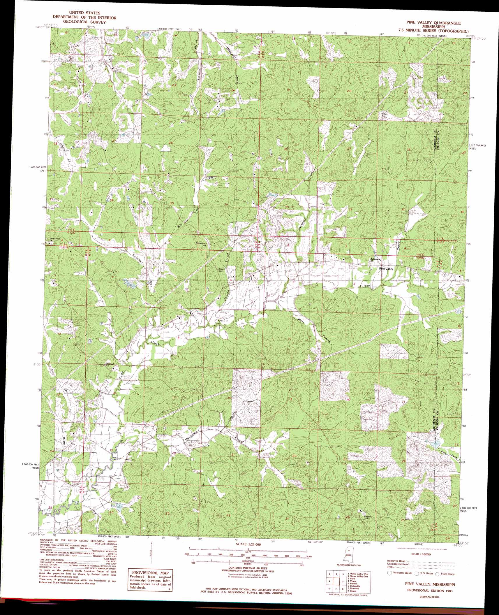
USGS Topo Quad 34089a5 - 1:24,000 scale
| Topo Map Name: | Pine Valley |
| USGS Topo Quad ID: | 34089a5 |
| Print Size: | ca. 21 1/4" wide x 27" high |
| Southeast Coordinates: | 34° N latitude / 89.5° W longitude |
| Map Center Coordinates: | 34.0625° N latitude / 89.5625° W longitude |
| U.S. State: | MS |
| Filename: | o34089a5.jpg |
| Download Map JPG Image: | Pine Valley topo map 1:24,000 scale |
| Map Type: | Topographic |
| Topo Series: | 7.5´ |
| Map Scale: | 1:24,000 |
| Source of Map Images: | United States Geological Survey (USGS) |
| Alternate Map Versions: |
Pine Valley MS 1983, updated 1983 Download PDF Buy paper map Pine Valley MS 2012 Download PDF Buy paper map Pine Valley MS 2015 Download PDF Buy paper map |
1:24,000 Topo Quads surrounding Pine Valley
Sardis Se |
Splinter |
Oxford South |
Yocona |
Denmark |
Shuford |
Water Valley West |
Water Valley East |
Paris |
Tula |
Coker Lake |
Velma |
Pine Valley |
Banner |
Sarepta |
Scobey |
Coffeeville |
Benwood |
Skuna |
Bruce |
Grenada |
Kincaid |
Gore Springs |
Big Creek |
Calhoun City |
> Back to 34089a1 at 1:100,000 scale
> Back to 34088a1 at 1:250,000 scale
> Back to U.S. Topo Maps home
Pine Valley topo map: Gazetteer
Pine Valley: Dams
Turkey Creek Structure Y-20-51 Dam elevation 106m 347′Turkey Creek Structure Y-20-57 Dam elevation 103m 337′
Pine Valley: Populated Places
Pine Valley elevation 101m 331′Pine Valley: Streams
Browers Branch elevation 88m 288′Coleman Creek elevation 86m 282′
Hurricane Creek elevation 80m 262′
Jew Branch elevation 76m 249′
Mill Pond Branch elevation 91m 298′
Saunders Creek elevation 93m 305′
Simpson Branch elevation 89m 291′
Ware Branch elevation 92m 301′
Pine Valley digital topo map on disk
Buy this Pine Valley topo map showing relief, roads, GPS coordinates and other geographical features, as a high-resolution digital map file on DVD: