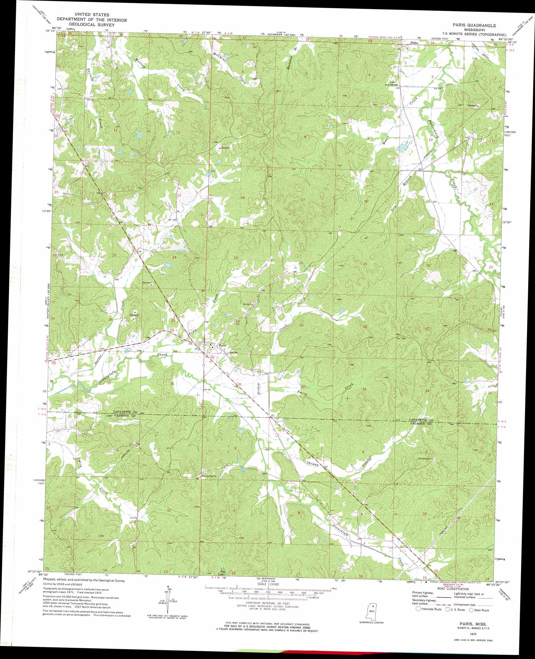
Paris Topo Map Mississippi
To zoom in, hover over the map of Paris
USGS Topo Quad 34089b4 - 1:24,000 scale
| Topo Map Name: | Paris |
| USGS Topo Quad ID: | 34089b4 |
| Print Size: | ca. 21 1/4" wide x 27" high |
| Southeast Coordinates: | 34.125° N latitude / 89.375° W longitude |
| Map Center Coordinates: | 34.1875° N latitude / 89.4375° W longitude |
| U.S. State: | MS |
| Filename: | o34089b4.jpg |
| Download Map JPG Image: | Paris topo map 1:24,000 scale |
| Map Type: | Topographic |
| Topo Series: | 7.5´ |
| Map Scale: | 1:24,000 |
| Source of Map Images: | United States Geological Survey (USGS) |
| Alternate Map Versions: |
Paris MS 1972, updated 1974 Download PDF Buy paper map Paris MS 2012 Download PDF Buy paper map Paris MS 2015 Download PDF Buy paper map |
1:24,000 Topo Quads surrounding Paris
Coles Point |
Oxford North |
Bagley Lake |
Puskus Lake |
Etta |
Splinter |
Oxford South |
Yocona |
Denmark |
Thaxton |
Water Valley West |
Water Valley East |
Paris |
Tula |
Randolph |
Velma |
Pine Valley |
Banner |
Sarepta |
Robbs |
Coffeeville |
Benwood |
Skuna |
Bruce |
Vardaman |
> Back to 34089a1 at 1:100,000 scale
> Back to 34088a1 at 1:250,000 scale
> Back to U.S. Topo Maps home
Paris topo map: Gazetteer
Paris: Dams
Harwell Pond Dam elevation 104m 341′Murray Creek Y-13a-4 Dam elevation 131m 429′
Paris: Populated Places
Delay elevation 110m 360′Paris elevation 113m 370′
Paris: Streams
Dickey Creek elevation 110m 360′Dry Branch elevation 101m 331′
Moore Creek elevation 98m 321′
Shippy Creek elevation 111m 364′
Smith Creek elevation 107m 351′
Town Creek elevation 104m 341′
Paris digital topo map on disk
Buy this Paris topo map showing relief, roads, GPS coordinates and other geographical features, as a high-resolution digital map file on DVD: