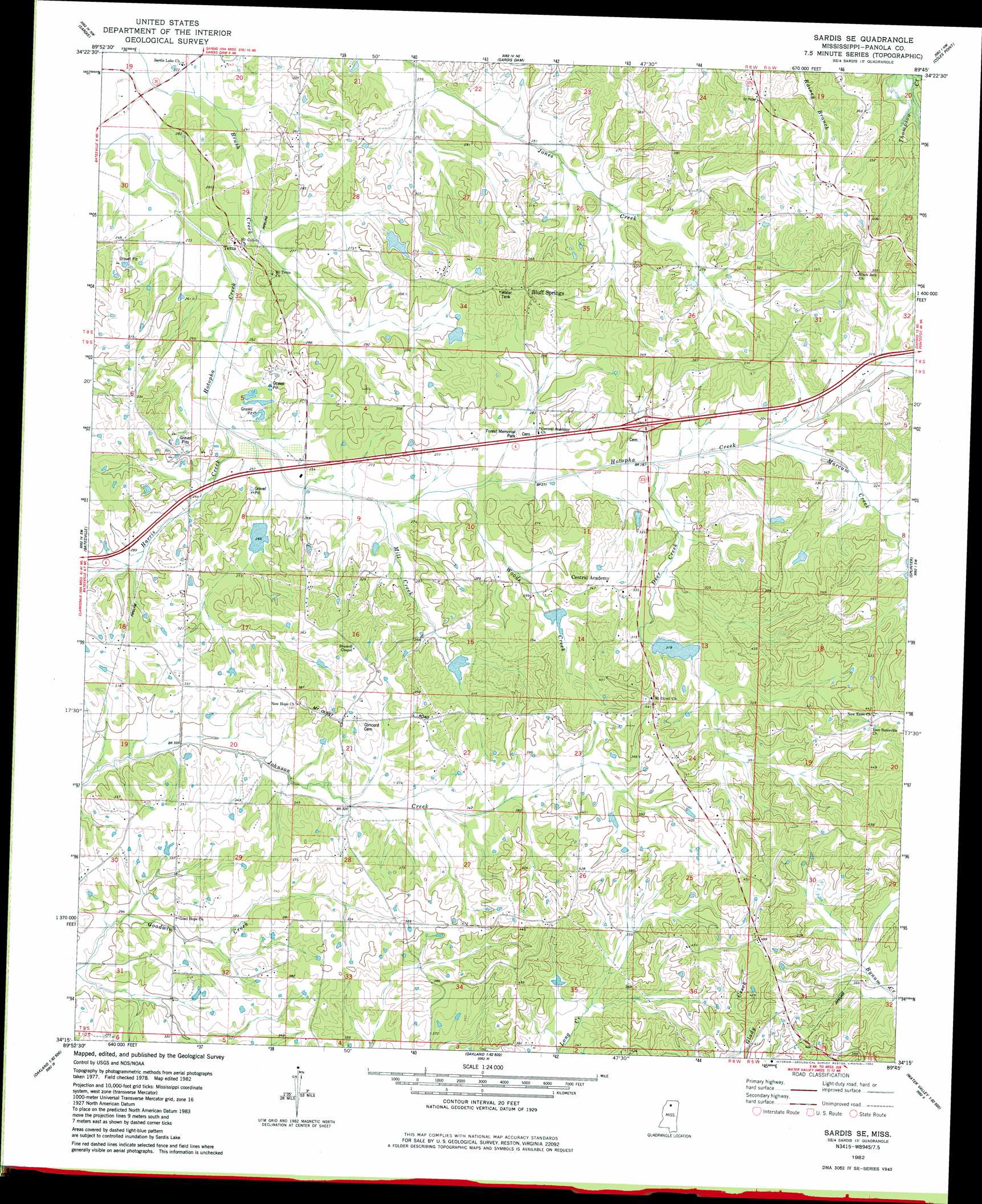
Sardis Se Topo Map Mississippi
To zoom in, hover over the map of Sardis Se
USGS Topo Quad 34089c7 - 1:24,000 scale
| Topo Map Name: | Sardis Se |
| USGS Topo Quad ID: | 34089c7 |
| Print Size: | ca. 21 1/4" wide x 27" high |
| Southeast Coordinates: | 34.25° N latitude / 89.75° W longitude |
| Map Center Coordinates: | 34.3125° N latitude / 89.8125° W longitude |
| U.S. State: | MS |
| Filename: | o34089c7.jpg |
| Download Map JPG Image: | Sardis Se topo map 1:24,000 scale |
| Map Type: | Topographic |
| Topo Series: | 7.5´ |
| Map Scale: | 1:24,000 |
| Source of Map Images: | United States Geological Survey (USGS) |
| Alternate Map Versions: |
Sardis SE MS 1982, updated 1982 Download PDF Buy paper map Sardis SE MS 2012 Download PDF Buy paper map Sardis SE MS 2015 Download PDF Buy paper map |
1:24,000 Topo Quads surrounding Sardis Se
Longtown |
Senatobia |
Looxahoma |
Tyro |
Laws Hill |
Pleasant Grove |
Sardis |
Sardis Dam |
Coles Point |
Oxford North |
Asa |
Batesville |
Sardis Se |
Splinter |
Oxford South |
Tocowa |
Courtland |
Shuford |
Water Valley West |
Water Valley East |
Charleston |
Oakland |
Coker Lake |
Velma |
Pine Valley |
> Back to 34089a1 at 1:100,000 scale
> Back to 34088a1 at 1:250,000 scale
> Back to U.S. Topo Maps home
Sardis Se topo map: Gazetteer
Sardis Se: Dams
Beland Petree Pond Dam elevation 104m 341′Hotopha Creek Watershed Y-10a-47 Dam elevation 91m 298′
Hotopha Creek Watershed Y-10a-47a Dam elevation 95m 311′
Hotopha Creek Watershed Y-10a-52 Dam elevation 104m 341′
Hotopha Creek Watershed Y-10a-62 Dam elevation 91m 298′
Hotopha Creek Y-10a-43 Dam elevation 79m 259′
Hotopha Creek Y-10a-66 Dam elevation 97m 318′
John E Dunlap Pond Dam elevation 91m 298′
Mississippi No Name 219 Dam elevation 94m 308′
Sardis Se: Populated Places
Bluff Springs elevation 122m 400′Central Academy elevation 104m 341′
Mount Olivet elevation 134m 439′
Terza elevation 92m 301′
Sardis Se: Streams
Deer Creek elevation 75m 246′Harris Creek elevation 71m 232′
Inman Creek elevation 83m 272′
Marcum Creek elevation 76m 249′
Sardis Se digital topo map on disk
Buy this Sardis Se topo map showing relief, roads, GPS coordinates and other geographical features, as a high-resolution digital map file on DVD: