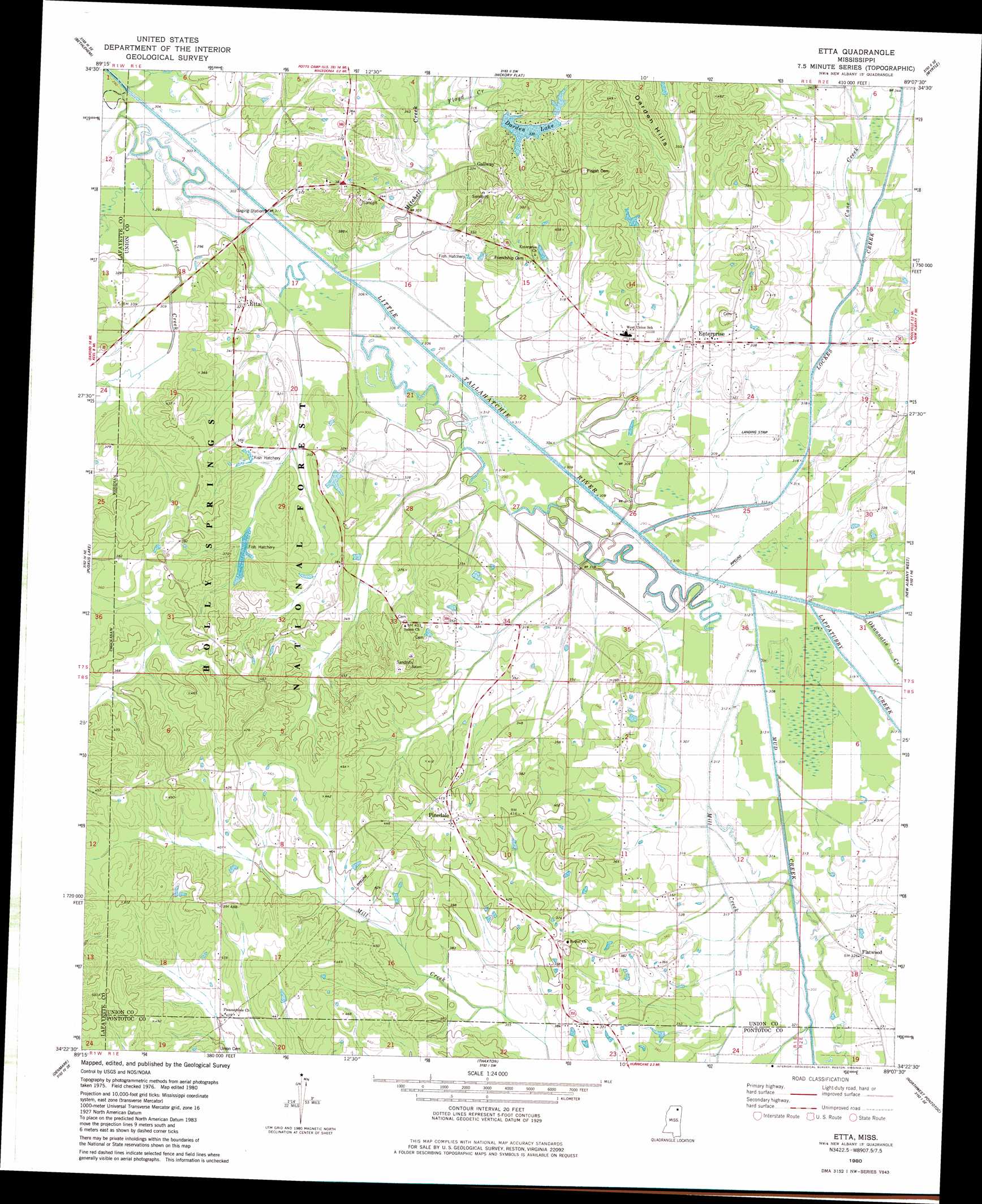
Etta Topo Map Mississippi
To zoom in, hover over the map of Etta
USGS Topo Quad 34089d2 - 1:24,000 scale
| Topo Map Name: | Etta |
| USGS Topo Quad ID: | 34089d2 |
| Print Size: | ca. 21 1/4" wide x 27" high |
| Southeast Coordinates: | 34.375° N latitude / 89.125° W longitude |
| Map Center Coordinates: | 34.4375° N latitude / 89.1875° W longitude |
| U.S. State: | MS |
| Filename: | o34089d2.jpg |
| Download Map JPG Image: | Etta topo map 1:24,000 scale |
| Map Type: | Topographic |
| Topo Series: | 7.5´ |
| Map Scale: | 1:24,000 |
| Source of Map Images: | United States Geological Survey (USGS) |
| Alternate Map Versions: |
Etta MS 1980, updated 1981 Download PDF Buy paper map Etta MS 2000, updated 2003 Download PDF Buy paper map Etta MS 2012 Download PDF Buy paper map Etta MS 2015 Download PDF Buy paper map |
| FStopo: | US Forest Service topo Etta is available: Download FStopo PDF Download FStopo TIF |
1:24,000 Topo Quads surrounding Etta
Waterford |
Potts Camp |
Chilli Creek |
Blue Mountain |
Ripley |
Malone |
Bethlehem |
Hickory Flat |
Myrtle |
Keownville |
Bagley Lake |
Puskus Lake |
Etta |
New Albany West |
New Albany East |
Yocona |
Denmark |
Thaxton |
Northwest Pontotoc |
Northeast Pontotoc |
Paris |
Tula |
Randolph |
Southwest Pontotoc |
Southeast Pontotoc |
> Back to 34089a1 at 1:100,000 scale
> Back to 34088a1 at 1:250,000 scale
> Back to U.S. Topo Maps home
Etta topo map: Gazetteer
Etta: Airports
Union County Landing Strip elevation 95m 311′Etta: Crossings
Rocky Ford (historical) elevation 91m 298′Etta: Dams
Darden Lake Dam elevation 100m 328′Robbins Lake Dam elevation 105m 344′
Etta: Populated Places
Enterprise elevation 102m 334′Etta elevation 98m 321′
Flatwood elevation 102m 334′
Gallway elevation 100m 328′
Pinedale elevation 132m 433′
Etta: Reservoirs
Darden Lake elevation 95m 311′Etta: Streams
Fice Creek elevation 90m 295′Floyd Creek elevation 95m 311′
Lappatubby Creek elevation 94m 308′
Lockes Creek elevation 94m 308′
Mill Creek elevation 97m 318′
Mitchell Creek elevation 89m 291′
Mud Creek elevation 94m 308′
Okannatie Creek elevation 90m 295′
Etta digital topo map on disk
Buy this Etta topo map showing relief, roads, GPS coordinates and other geographical features, as a high-resolution digital map file on DVD: