Coles Point Topo Map Mississippi
To zoom in, hover over the map of Coles Point
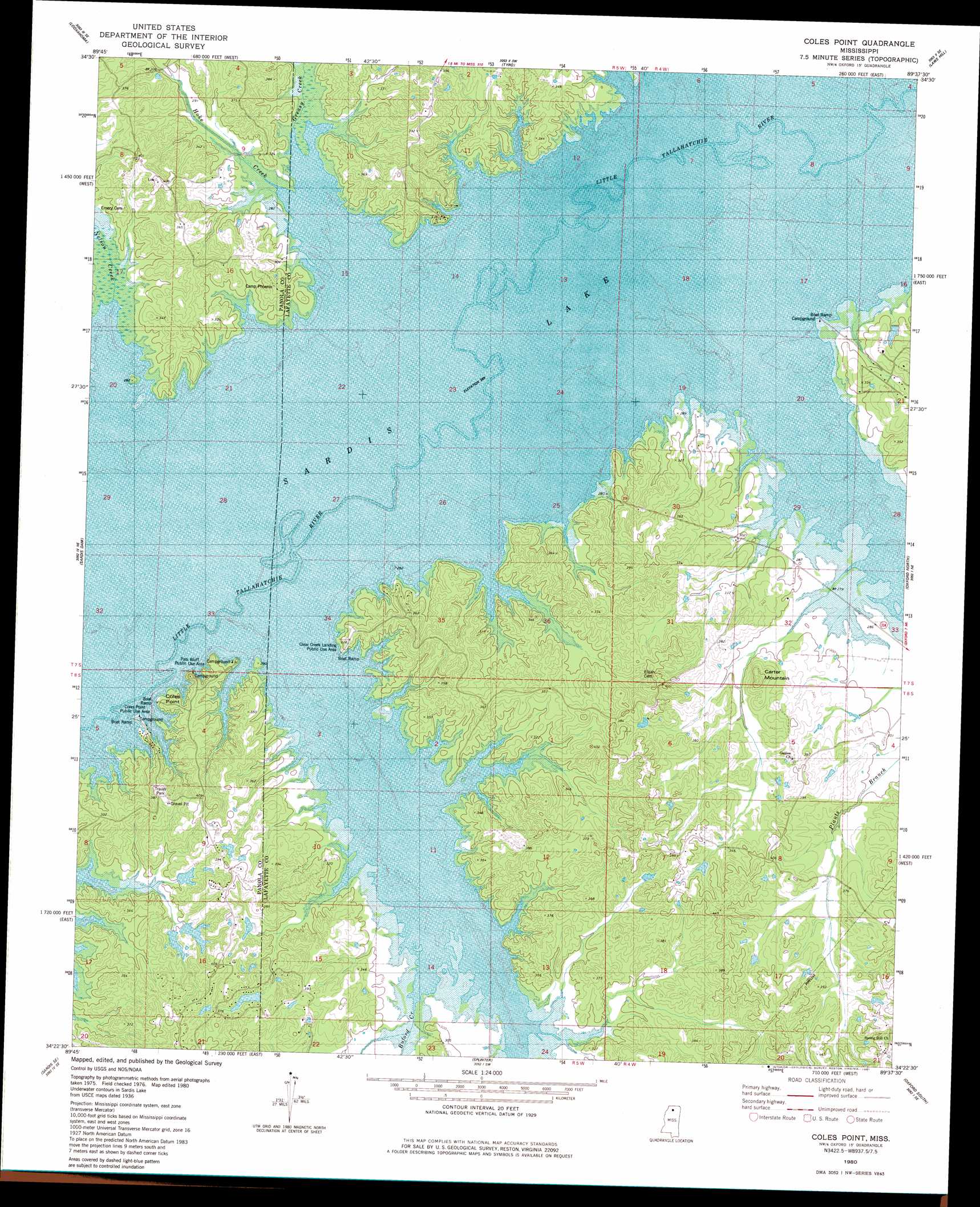
USGS Topo Quad 34089d6 - 1:24,000 scale
| Topo Map Name: | Coles Point |
| USGS Topo Quad ID: | 34089d6 |
| Print Size: | ca. 21 1/4" wide x 27" high |
| Southeast Coordinates: | 34.375° N latitude / 89.625° W longitude |
| Map Center Coordinates: | 34.4375° N latitude / 89.6875° W longitude |
| U.S. State: | MS |
| Filename: | o34089d6.jpg |
| Download Map JPG Image: | Coles Point topo map 1:24,000 scale |
| Map Type: | Topographic |
| Topo Series: | 7.5´ |
| Map Scale: | 1:24,000 |
| Source of Map Images: | United States Geological Survey (USGS) |
| Alternate Map Versions: |
Coles Point MS 1980, updated 1981 Download PDF Buy paper map Coles Point MS 2012 Download PDF Buy paper map Coles Point MS 2015 Download PDF Buy paper map |
1:24,000 Topo Quads surrounding Coles Point
Coldwater |
Independence |
Wyatte |
Marianna |
Waterford |
Senatobia |
Looxahoma |
Tyro |
Laws Hill |
Malone |
Sardis |
Sardis Dam |
Coles Point |
Oxford North |
Bagley Lake |
Batesville |
Sardis Se |
Splinter |
Oxford South |
Yocona |
Courtland |
Shuford |
Water Valley West |
Water Valley East |
Paris |
> Back to 34089a1 at 1:100,000 scale
> Back to 34088a1 at 1:250,000 scale
> Back to U.S. Topo Maps home
Coles Point topo map: Gazetteer
Coles Point: Bridges
Iron Bridge (historical) elevation 81m 265′Coles Point: Capes
Coles Point elevation 93m 305′Coles Point: Crossings
Coils Ferry (historical) elevation 81m 265′Toby Tubby Ferry (historical) elevation 81m 265′
Coles Point: Dams
Dunlap Pond Dam elevation 118m 387′Pine Lake Dam elevation 109m 357′
Talbert Pond Dam elevation 119m 390′
Coles Point: Parks
Clear Creek Landing Public Use Area elevation 98m 321′Coles Point Public Use Area elevation 86m 282′
Coontown Crossing Public Use Area elevation 82m 269′
Deacon Ridge Public Use Area elevation 91m 298′
Pats Bluff Public Use Area elevation 101m 331′
Coles Point: Streams
Buford Creek elevation 81m 265′Clear Creek elevation 81m 265′
Greasy Creek elevation 81m 265′
Hoke Creek elevation 81m 265′
Lott Branch elevation 81m 265′
Toby Tubby Creek elevation 81m 265′
Coles Point: Summits
Carter Mountain elevation 123m 403′Coles Point digital topo map on disk
Buy this Coles Point topo map showing relief, roads, GPS coordinates and other geographical features, as a high-resolution digital map file on DVD: