Laws Hill Topo Map Mississippi
To zoom in, hover over the map of Laws Hill
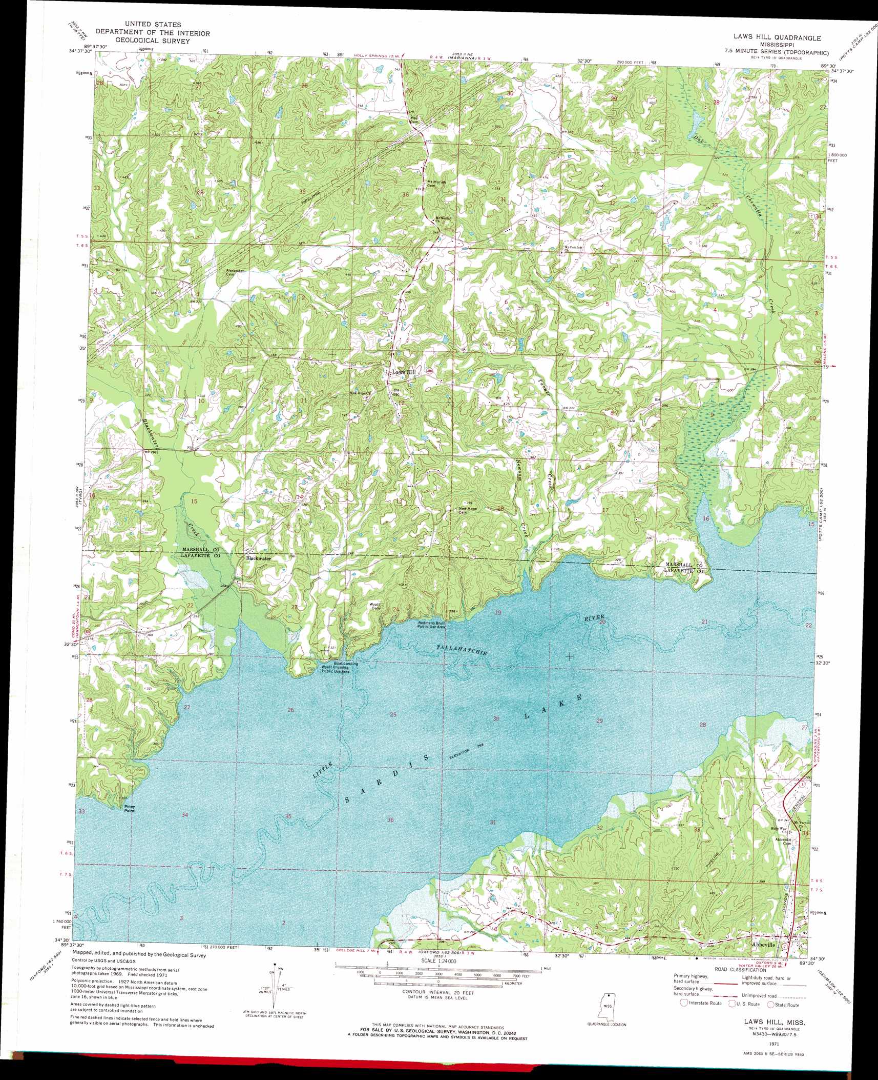
USGS Topo Quad 34089e5 - 1:24,000 scale
| Topo Map Name: | Laws Hill |
| USGS Topo Quad ID: | 34089e5 |
| Print Size: | ca. 21 1/4" wide x 27" high |
| Southeast Coordinates: | 34.5° N latitude / 89.5° W longitude |
| Map Center Coordinates: | 34.5625° N latitude / 89.5625° W longitude |
| U.S. State: | MS |
| Filename: | o34089e5.jpg |
| Download Map JPG Image: | Laws Hill topo map 1:24,000 scale |
| Map Type: | Topographic |
| Topo Series: | 7.5´ |
| Map Scale: | 1:24,000 |
| Source of Map Images: | United States Geological Survey (USGS) |
| Alternate Map Versions: |
Laws Hill MS 1971, updated 1973 Download PDF Buy paper map Laws Hill MS 1971, updated 1973 Download PDF Buy paper map Laws Hill MS 2012 Download PDF Buy paper map Laws Hill MS 2015 Download PDF Buy paper map |
1:24,000 Topo Quads surrounding Laws Hill
Lewisburg |
Byhalia |
Red Banks |
Holly Springs |
Holly Springs Se |
Independence |
Wyatte |
Marianna |
Waterford |
Potts Camp |
Looxahoma |
Tyro |
Laws Hill |
Malone |
Bethlehem |
Sardis Dam |
Coles Point |
Oxford North |
Bagley Lake |
Puskus Lake |
Sardis Se |
Splinter |
Oxford South |
Yocona |
Denmark |
> Back to 34089e1 at 1:100,000 scale
> Back to 34088a1 at 1:250,000 scale
> Back to U.S. Topo Maps home
Laws Hill topo map: Gazetteer
Laws Hill: Bridges
Wyatt Bridge (historical) elevation 81m 265′Laws Hill: Capes
Piney Point elevation 81m 265′Laws Hill: Crossings
Dunnovants Ferry (historical) elevation 81m 265′Laws Hill: Dams
Pigeon Roost Watershed Y-5-124 Dam elevation 163m 534′Laws Hill: Lakes
Graham Lake (historical) elevation 81m 265′Laws Hill: Parks
Redmans Bluff Public Use Area elevation 82m 269′Wyatt Crossing Public Use Area elevation 81m 265′
Laws Hill: Populated Places
Abbeville elevation 112m 367′Blackwater elevation 98m 321′
Laws Hill elevation 171m 561′
Laws Hill: Streams
Blackwater Creek elevation 81m 265′Newsom Creek elevation 83m 272′
Oak Chewalla Creek elevation 81m 265′
Turner Creek elevation 82m 269′
Laws Hill digital topo map on disk
Buy this Laws Hill topo map showing relief, roads, GPS coordinates and other geographical features, as a high-resolution digital map file on DVD: