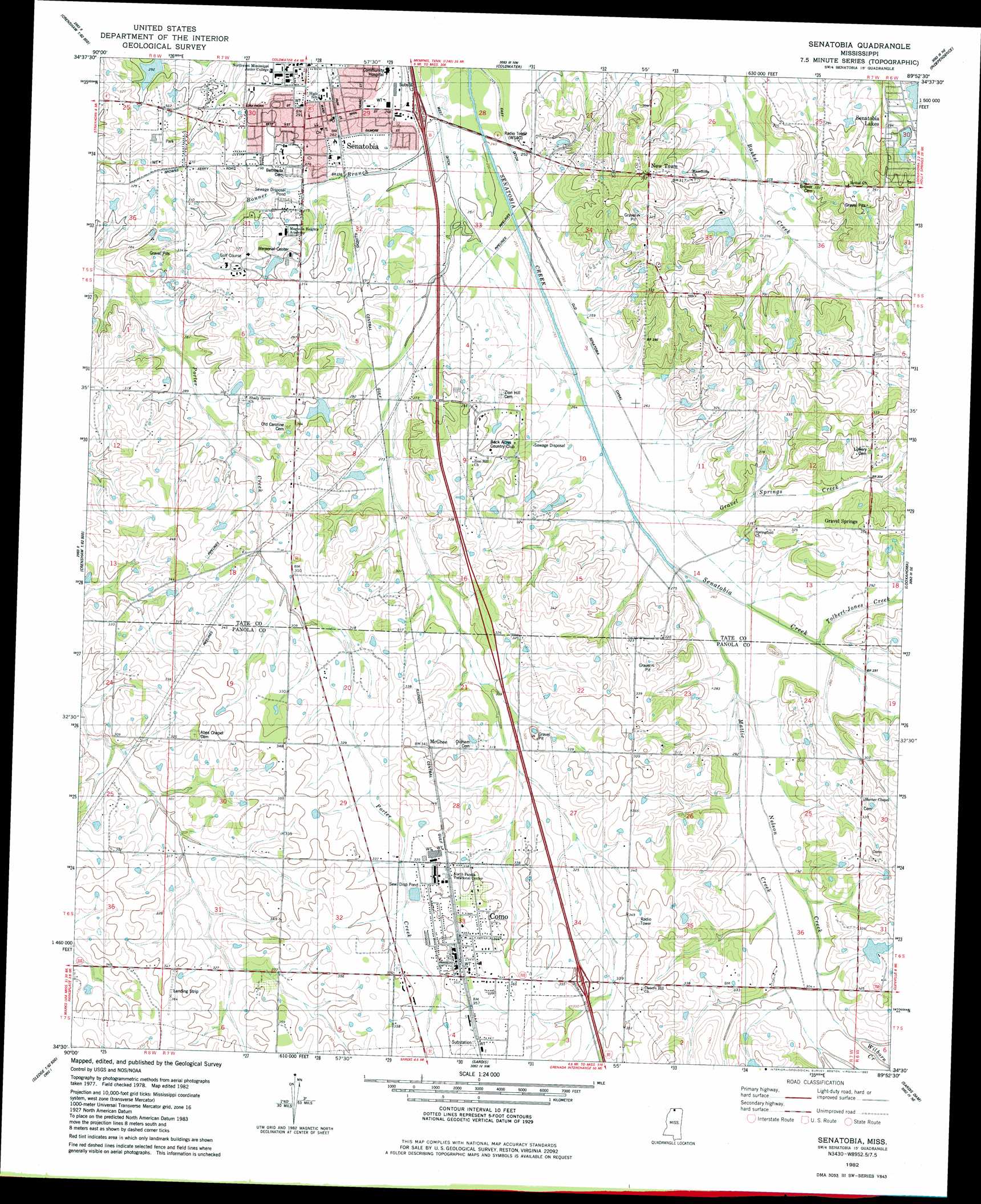
Senatobia Topo Map Mississippi
To zoom in, hover over the map of Senatobia
USGS Topo Quad 34089e8 - 1:24,000 scale
| Topo Map Name: | Senatobia |
| USGS Topo Quad ID: | 34089e8 |
| Print Size: | ca. 21 1/4" wide x 27" high |
| Southeast Coordinates: | 34.5° N latitude / 89.875° W longitude |
| Map Center Coordinates: | 34.5625° N latitude / 89.9375° W longitude |
| U.S. State: | MS |
| Filename: | o34089e8.jpg |
| Download Map JPG Image: | Senatobia topo map 1:24,000 scale |
| Map Type: | Topographic |
| Topo Series: | 7.5´ |
| Map Scale: | 1:24,000 |
| Source of Map Images: | United States Geological Survey (USGS) |
| Alternate Map Versions: |
Senatobia SW MS 1975, updated 1976 Download PDF Buy paper map Senatobia MS 1982, updated 1982 Download PDF Buy paper map Senatobia MS 2012 Download PDF Buy paper map Senatobia MS 2015 Download PDF Buy paper map |
1:24,000 Topo Quads surrounding Senatobia
Banks |
Frees Corners |
Hernando |
Lewisburg |
Byhalia |
Arkabutla West |
Arkabutla East |
Coldwater |
Independence |
Wyatte |
Crenshaw North |
Longtown |
Senatobia |
Looxahoma |
Tyro |
Crenshaw South |
Pleasant Grove |
Sardis |
Sardis Dam |
Coles Point |
Curtis Station |
Asa |
Batesville |
Sardis Se |
Splinter |
> Back to 34089e1 at 1:100,000 scale
> Back to 34088a1 at 1:250,000 scale
> Back to U.S. Topo Maps home
Senatobia topo map: Gazetteer
Senatobia: Canals
Old Senatobia Canal elevation 79m 259′West Ditch elevation 75m 246′
Senatobia: Crossings
Interchange 257 elevation 108m 354′Interchange 265 elevation 79m 259′
Senatobia: Dams
Elmer Massey Pond Dam elevation 106m 347′I C Keefer Pond Dam elevation 86m 282′
I C Keefer Pond Dam elevation 88m 288′
Miriam Orr Pond Dam elevation 100m 328′
Paul Baddour Pond Dam elevation 83m 272′
Senatobia: Populated Places
Como elevation 109m 357′McGhee elevation 106m 347′
New Town elevation 105m 344′
Senatobia elevation 88m 288′
Senatobia Lakes elevation 89m 291′
Senatobia: Streams
Gravel Springs Creek elevation 81m 265′Mattic Creek elevation 83m 272′
Nelson Creek elevation 81m 265′
Tolbert-Jones Creek elevation 83m 272′
Wilborn Creek elevation 92m 301′
Senatobia digital topo map on disk
Buy this Senatobia topo map showing relief, roads, GPS coordinates and other geographical features, as a high-resolution digital map file on DVD: