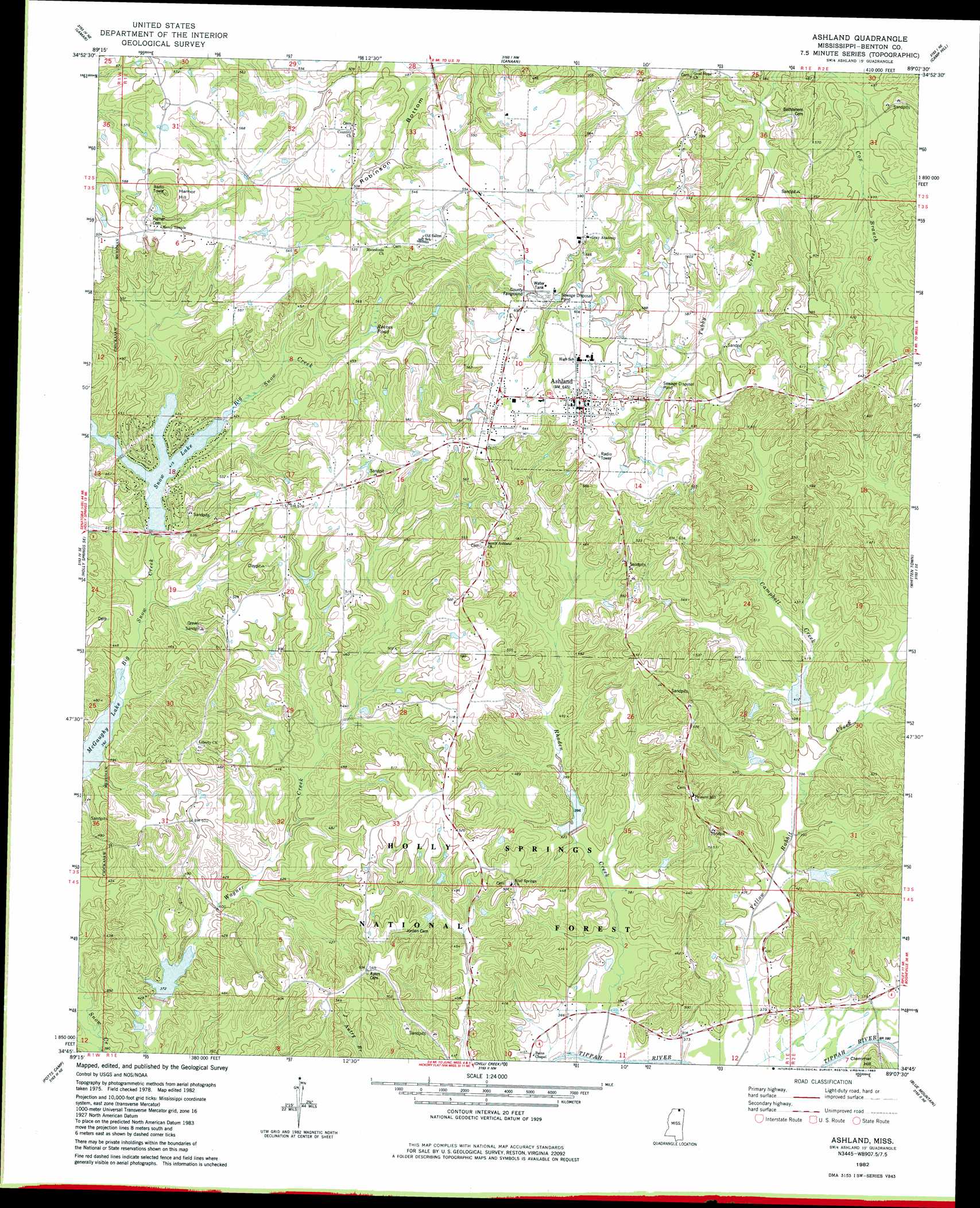
Ashland Topo Map Mississippi
To zoom in, hover over the map of Ashland
USGS Topo Quad 34089g2 - 1:24,000 scale
| Topo Map Name: | Ashland |
| USGS Topo Quad ID: | 34089g2 |
| Print Size: | ca. 21 1/4" wide x 27" high |
| Southeast Coordinates: | 34.75° N latitude / 89.125° W longitude |
| Map Center Coordinates: | 34.8125° N latitude / 89.1875° W longitude |
| U.S. State: | MS |
| Filename: | o34089g2.jpg |
| Download Map JPG Image: | Ashland topo map 1:24,000 scale |
| Map Type: | Topographic |
| Topo Series: | 7.5´ |
| Map Scale: | 1:24,000 |
| Source of Map Images: | United States Geological Survey (USGS) |
| Alternate Map Versions: |
Ashland MS 1982, updated 1983 Download PDF Buy paper map Ashland MS 2000, updated 2003 Download PDF Buy paper map Ashland MS 2012 Download PDF Buy paper map Ashland MS 2015 Download PDF Buy paper map |
| FStopo: | US Forest Service topo Ashland is available: Download FStopo PDF Download FStopo TIF |
1:24,000 Topo Quads surrounding Ashland
Moscow |
Moscow Se |
Grand Junction |
Saulsbury |
Middleton |
Slayden |
Lamar |
Canaan |
Camp Hill |
Walnut |
Holly Springs |
Holly Springs Se |
Ashland |
Whitten Town |
Falkner |
Waterford |
Potts Camp |
Chilli Creek |
Blue Mountain |
Ripley |
Malone |
Bethlehem |
Hickory Flat |
Myrtle |
Keownville |
> Back to 34089e1 at 1:100,000 scale
> Back to 34088a1 at 1:250,000 scale
> Back to U.S. Topo Maps home
Ashland topo map: Gazetteer
Ashland: Dams
Big Snow Lake Dam elevation 127m 416′LT 7-11 Dam elevation 118m 387′
LT 7-5 Dam elevation 127m 416′
May Lake Dam elevation 116m 380′
Paseur Lake Dam elevation 134m 439′
Pippin Lake Dam elevation 151m 495′
Ashland: Lakes
Reaves Pond elevation 137m 449′Ashland: Populated Places
Ashland elevation 196m 643′Snow Lake Shores elevation 123m 403′
Ashland: Reservoirs
Bluff Springs Lake elevation 119m 390′LT 7-11 Pleasant Hill Lake elevation 118m 387′
Pleasant Hill Lake elevation 125m 410′
Snow Lake elevation 123m 403′
Wagner Lake elevation 122m 400′
Ashland: Streams
Campbell Creek elevation 120m 393′Rhoden Creek elevation 108m 354′
Stillhouse Branch elevation 122m 400′
Ashland: Summits
Hamer Hill elevation 214m 702′Harper Hill elevation 213m 698′
Ashland digital topo map on disk
Buy this Ashland topo map showing relief, roads, GPS coordinates and other geographical features, as a high-resolution digital map file on DVD: