Holly Springs Topo Map Mississippi
To zoom in, hover over the map of Holly Springs
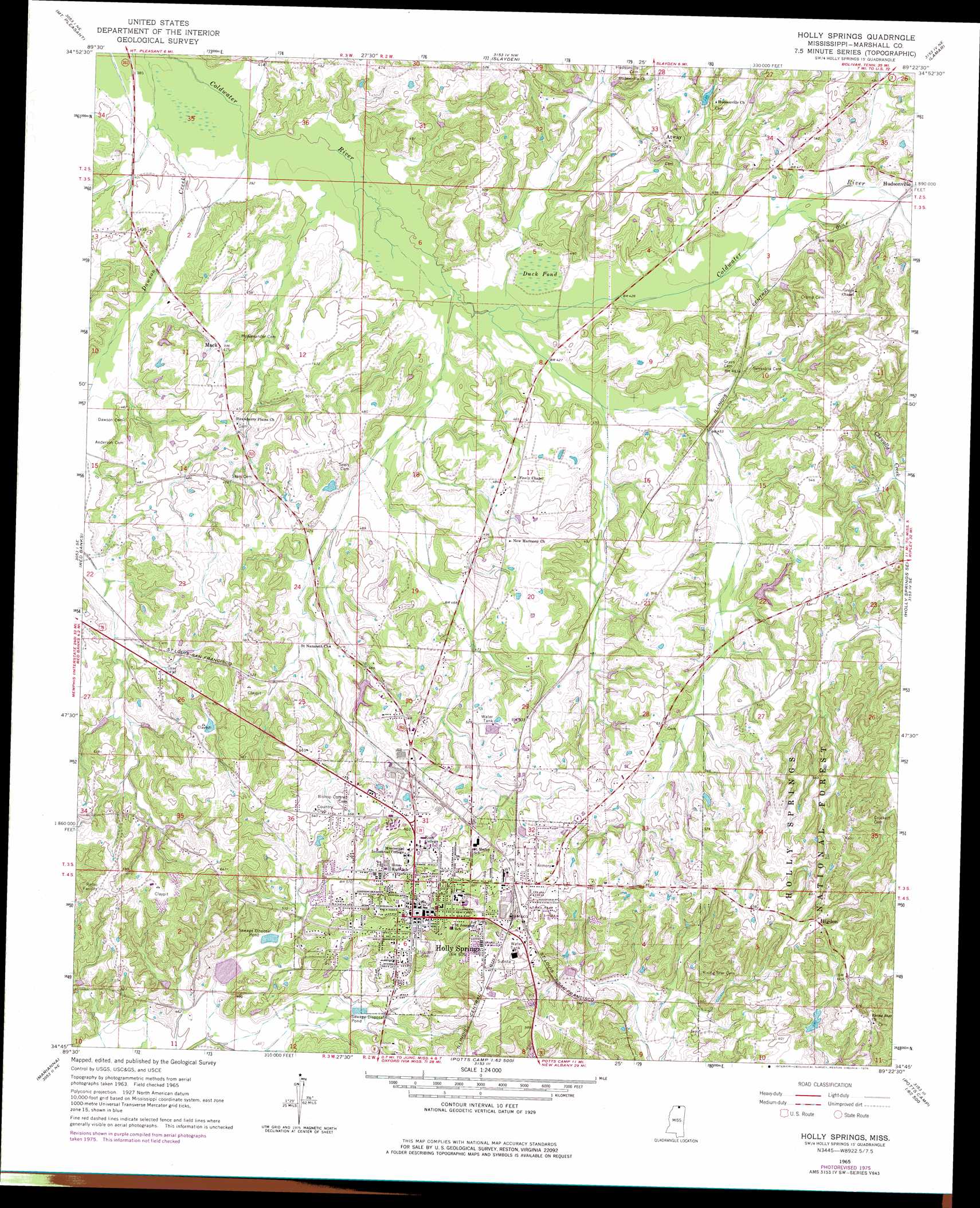
USGS Topo Quad 34089g4 - 1:24,000 scale
| Topo Map Name: | Holly Springs |
| USGS Topo Quad ID: | 34089g4 |
| Print Size: | ca. 21 1/4" wide x 27" high |
| Southeast Coordinates: | 34.75° N latitude / 89.375° W longitude |
| Map Center Coordinates: | 34.8125° N latitude / 89.4375° W longitude |
| U.S. State: | MS |
| Filename: | o34089g4.jpg |
| Download Map JPG Image: | Holly Springs topo map 1:24,000 scale |
| Map Type: | Topographic |
| Topo Series: | 7.5´ |
| Map Scale: | 1:24,000 |
| Source of Map Images: | United States Geological Survey (USGS) |
| Alternate Map Versions: |
Holly Springs MS 1965, updated 1966 Download PDF Buy paper map Holly Springs MS 1965, updated 1976 Download PDF Buy paper map Holly Springs MS 2000, updated 2003 Download PDF Buy paper map Holly Springs MS 2012 Download PDF Buy paper map Holly Springs MS 2015 Download PDF Buy paper map |
| FStopo: | US Forest Service topo Holly Springs is available: Download FStopo PDF Download FStopo TIF |
1:24,000 Topo Quads surrounding Holly Springs
Collierville |
Rossville |
Moscow |
Moscow Se |
Grand Junction |
Byhalia Nw |
Mount Pleasant |
Slayden |
Lamar |
Canaan |
Byhalia |
Red Banks |
Holly Springs |
Holly Springs Se |
Ashland |
Wyatte |
Marianna |
Waterford |
Potts Camp |
Chilli Creek |
Tyro |
Laws Hill |
Malone |
Bethlehem |
Hickory Flat |
> Back to 34089e1 at 1:100,000 scale
> Back to 34088a1 at 1:250,000 scale
> Back to U.S. Topo Maps home
Holly Springs topo map: Gazetteer
Holly Springs: Dams
Collins Lake Dam elevation 157m 515′Duck Pond Dam elevation 127m 416′
Mississippi No Name 183 Dam elevation 169m 554′
Peel Lake Dam elevation 151m 495′
Sunbeam Lake Dam elevation 156m 511′
Holly Springs: Forests
Holly Springs Ranger District elevation 167m 547′Holly Springs: Populated Places
Atway elevation 155m 508′Higdon elevation 198m 649′
Holly Springs elevation 183m 600′
Hudsonville elevation 148m 485′
Mack elevation 146m 479′
Holly Springs: Post Offices
Holly Springs Post Office elevation 183m 600′Holly Springs: Swamps
Duck Pond elevation 126m 413′Holly Springs digital topo map on disk
Buy this Holly Springs topo map showing relief, roads, GPS coordinates and other geographical features, as a high-resolution digital map file on DVD: