Duncan Topo Map Mississippi
To zoom in, hover over the map of Duncan
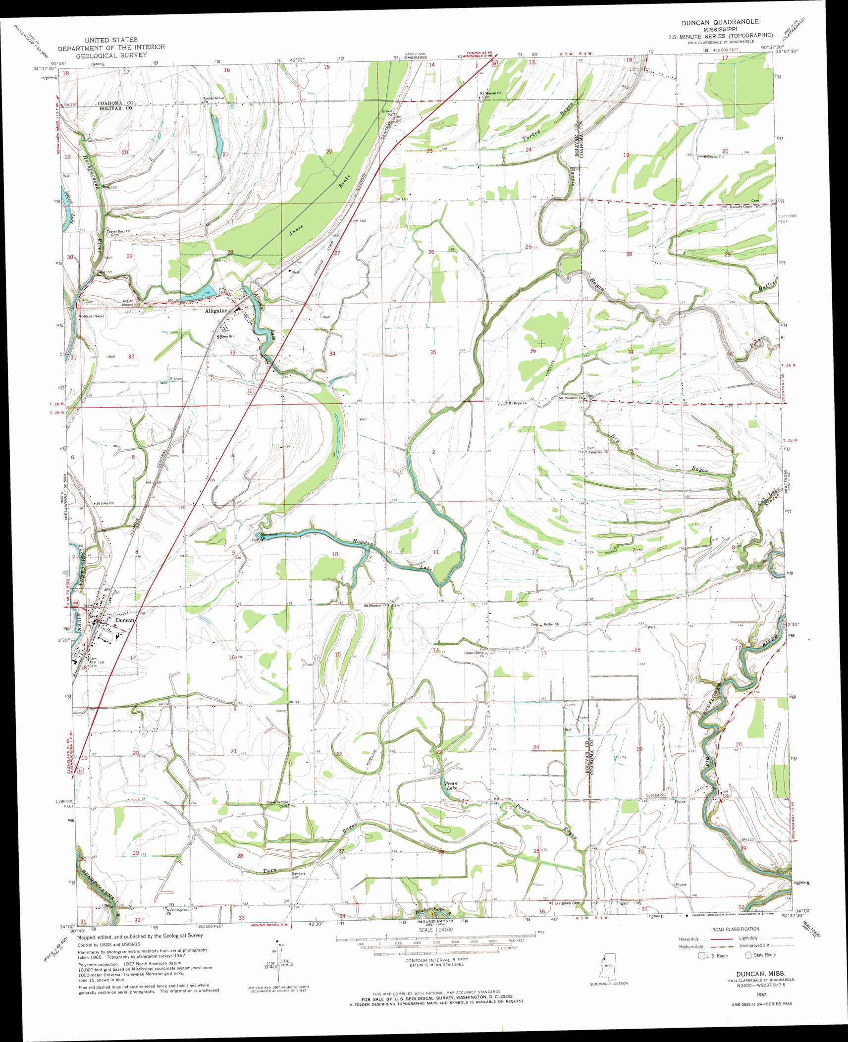
USGS Topo Quad 34090a6 - 1:24,000 scale
| Topo Map Name: | Duncan |
| USGS Topo Quad ID: | 34090a6 |
| Print Size: | ca. 21 1/4" wide x 27" high |
| Southeast Coordinates: | 34° N latitude / 90.625° W longitude |
| Map Center Coordinates: | 34.0625° N latitude / 90.6875° W longitude |
| U.S. State: | MS |
| Filename: | o34090a6.jpg |
| Download Map JPG Image: | Duncan topo map 1:24,000 scale |
| Map Type: | Topographic |
| Topo Series: | 7.5´ |
| Map Scale: | 1:24,000 |
| Source of Map Images: | United States Geological Survey (USGS) |
| Alternate Map Versions: |
Duncan MS 1967, updated 1968 Download PDF Buy paper map Duncan MS 1967, updated 1986 Download PDF Buy paper map Duncan MS 2012 Download PDF Buy paper map Duncan MS 2015 Download PDF Buy paper map |
1:24,000 Topo Quads surrounding Duncan
Lambrook |
Elaine |
Friars Point |
Coahoma |
Jonestown |
Mellwood |
Rena Lara |
Sherard |
Clarksdale |
Sabino |
Laconia |
Round Lake |
Duncan |
Mattson |
Tutwiler |
Gunnison |
Shelby |
Mound Bayou |
Baltzer |
Rome |
Beulah |
Pace |
Merigold |
Drew |
Brooks |
> Back to 34090a1 at 1:100,000 scale
> Back to 34090a1 at 1:250,000 scale
> Back to U.S. Topo Maps home
Duncan topo map: Gazetteer
Duncan: Airports
Glidewell Flying Service Airport elevation 50m 164′Duncan: Dams
Alford Butler Lake Dam elevation 43m 141′Duncan: Lakes
Alligator Lake elevation 42m 137′Emory Pond (historical) elevation 47m 154′
Howden Lake elevation 44m 144′
Pecan Lake elevation 44m 144′
Duncan: Populated Places
Africa (historical) elevation 47m 154′Alligator elevation 49m 160′
Duncan elevation 49m 160′
Duncan: Streams
Alligator Bayou elevation 46m 150′Bobo Outlet elevation 43m 141′
Cub Lake Slough elevation 41m 134′
Dry Bayou elevation 39m 127′
Turkey Bayou elevation 44m 144′
Turn Bayou elevation 41m 134′
Yellow Bayou elevation 42m 137′
Duncan digital topo map on disk
Buy this Duncan topo map showing relief, roads, GPS coordinates and other geographical features, as a high-resolution digital map file on DVD: