Tocowa Topo Map Mississippi
To zoom in, hover over the map of Tocowa
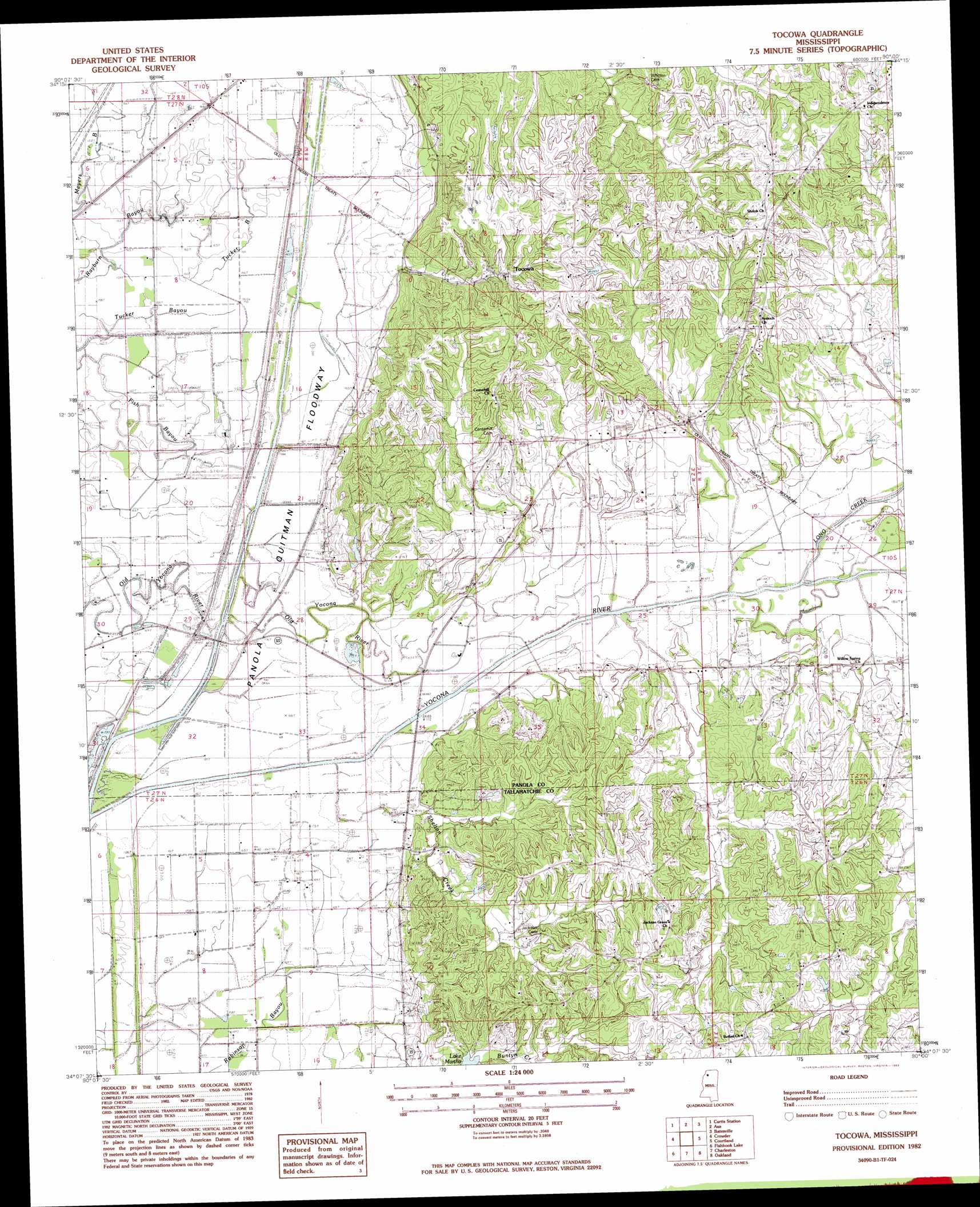
USGS Topo Quad 34090b1 - 1:24,000 scale
| Topo Map Name: | Tocowa |
| USGS Topo Quad ID: | 34090b1 |
| Print Size: | ca. 21 1/4" wide x 27" high |
| Southeast Coordinates: | 34.125° N latitude / 90° W longitude |
| Map Center Coordinates: | 34.1875° N latitude / 90.0625° W longitude |
| U.S. State: | MS |
| Filename: | o34090b1.jpg |
| Download Map JPG Image: | Tocowa topo map 1:24,000 scale |
| Map Type: | Topographic |
| Topo Series: | 7.5´ |
| Map Scale: | 1:24,000 |
| Source of Map Images: | United States Geological Survey (USGS) |
| Alternate Map Versions: |
Tocowa MS 1982, updated 1983 Download PDF Buy paper map Tocowa MS 2012 Download PDF Buy paper map Tocowa MS 2015 Download PDF Buy paper map |
1:24,000 Topo Quads surrounding Tocowa
Falcon |
Crenshaw South |
Pleasant Grove |
Sardis |
Sardis Dam |
Marks |
Curtis Station |
Asa |
Batesville |
Sardis Se |
Lambert |
Crowder |
Tocowa |
Courtland |
Shuford |
Vance |
Fishhook Lake |
Charleston |
Oakland |
Coker Lake |
Webb |
Tippo |
Paynes |
Tillatoba |
Scobey |
> Back to 34090a1 at 1:100,000 scale
> Back to 34090a1 at 1:250,000 scale
> Back to U.S. Topo Maps home
Tocowa topo map: Gazetteer
Tocowa: Guts
Rayburn Bayou elevation 49m 160′Tocowa: Lakes
Sutton Lake elevation 49m 160′Tocowa: Populated Places
Tocowa elevation 72m 236′Tocowa: Streams
Buntyn Creek elevation 70m 229′Peters Creek elevation 54m 177′
Shelton Creek elevation 52m 170′
Yocona River elevation 48m 157′
Tocowa digital topo map on disk
Buy this Tocowa topo map showing relief, roads, GPS coordinates and other geographical features, as a high-resolution digital map file on DVD: