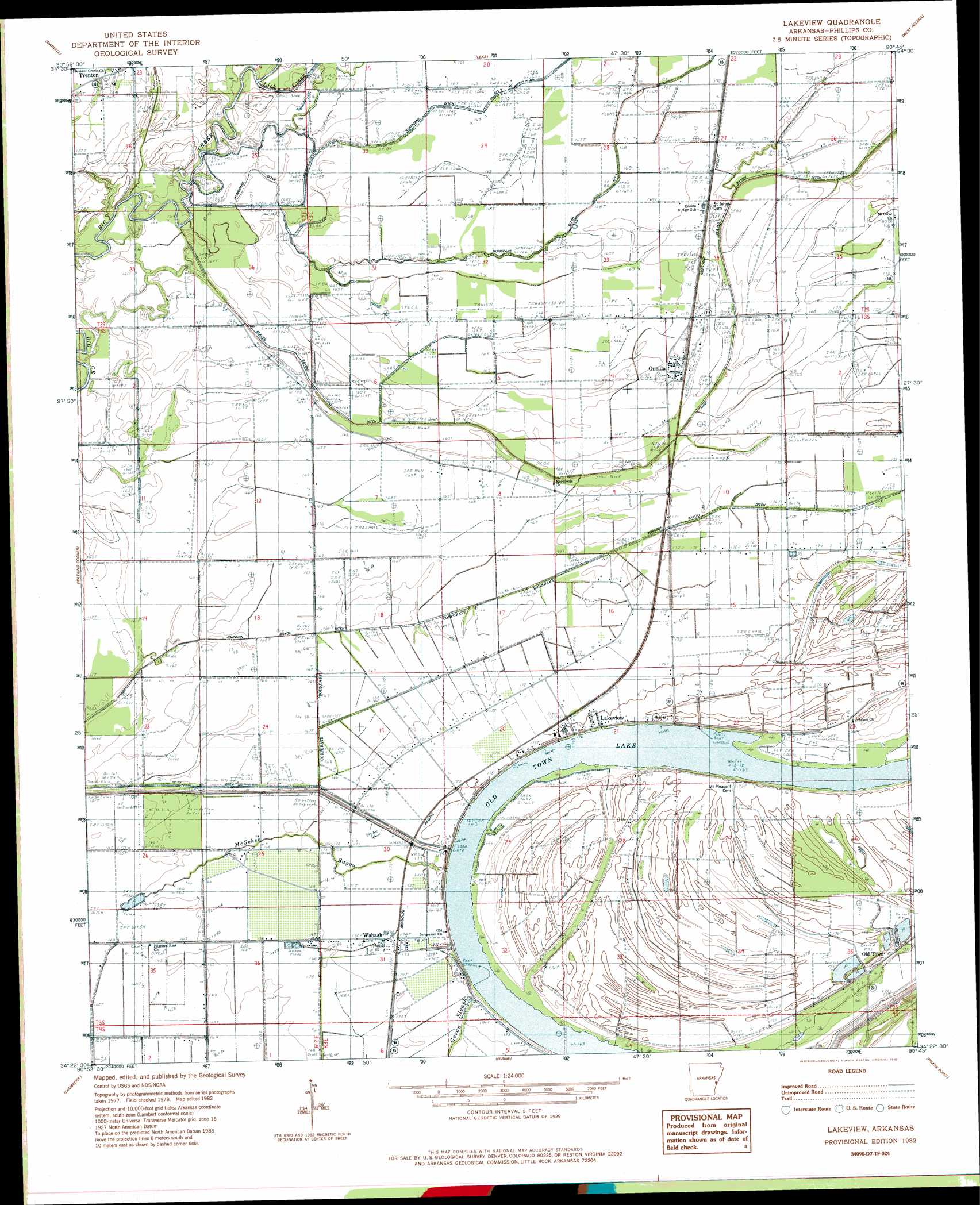
Lakeview Topo Map Arkansas
To zoom in, hover over the map of Lakeview
USGS Topo Quad 34090d7 - 1:24,000 scale
| Topo Map Name: | Lakeview |
| USGS Topo Quad ID: | 34090d7 |
| Print Size: | ca. 21 1/4" wide x 27" high |
| Southeast Coordinates: | 34.375° N latitude / 90.75° W longitude |
| Map Center Coordinates: | 34.4375° N latitude / 90.8125° W longitude |
| U.S. State: | AR |
| Filename: | o34090d7.jpg |
| Download Map JPG Image: | Lakeview topo map 1:24,000 scale |
| Map Type: | Topographic |
| Topo Series: | 7.5´ |
| Map Scale: | 1:24,000 |
| Source of Map Images: | United States Geological Survey (USGS) |
| Alternate Map Versions: |
Lakeview AR 1982, updated 1982 Download PDF Buy paper map Lakeview AR 2011 Download PDF Buy paper map Lakeview AR 2014 Download PDF Buy paper map |
1:24,000 Topo Quads surrounding Lakeview
Monroe |
Aubrey |
Rondo |
Lagrange |
Stubbs Island |
Pine City |
Marvell |
Lexa |
West Helena |
Helena |
Turner |
Watkins Corner |
Lakeview |
Friars Point Nw |
Moon Lake |
Indian Bay Se |
Lambrook |
Elaine |
Friars Point |
Coahoma |
Henrico Ne |
Mellwood |
Rena Lara |
Sherard |
Clarksdale |
> Back to 34090a1 at 1:100,000 scale
> Back to 34090a1 at 1:250,000 scale
> Back to U.S. Topo Maps home
Lakeview topo map: Gazetteer
Lakeview: Canals
Beaver Bayou Ditch elevation 51m 167′Johnson Bayou Ditch elevation 50m 164′
Lakeview: Guts
McGehee Bayou elevation 51m 167′Lakeview: Lakes
Old Town Lake elevation 51m 167′Lakeview: Populated Places
Hugo (historical) elevation 53m 173′Lakeview elevation 53m 173′
Old Town elevation 54m 177′
Oneida elevation 53m 173′
Pilgrims Rest elevation 50m 164′
Trenton elevation 57m 187′
Wabash elevation 53m 173′
Lakeview: Post Offices
Oneida Post Office elevation 53m 173′Wabash Post Office elevation 52m 170′
Lakeview: Streams
Lick Creek elevation 51m 167′Lakeview digital topo map on disk
Buy this Lakeview topo map showing relief, roads, GPS coordinates and other geographical features, as a high-resolution digital map file on DVD: