Lexa Topo Map Arkansas
To zoom in, hover over the map of Lexa
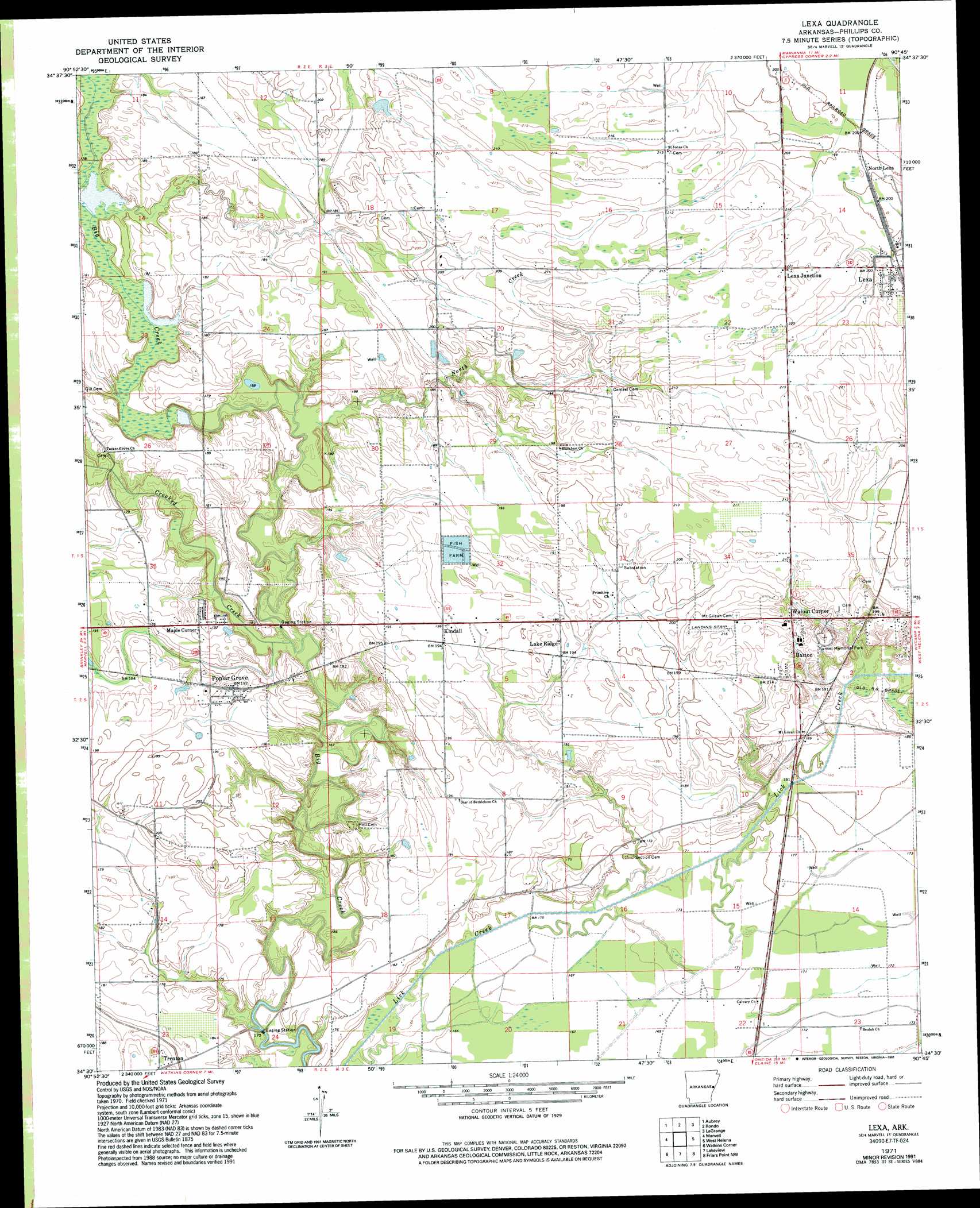
USGS Topo Quad 34090e7 - 1:24,000 scale
| Topo Map Name: | Lexa |
| USGS Topo Quad ID: | 34090e7 |
| Print Size: | ca. 21 1/4" wide x 27" high |
| Southeast Coordinates: | 34.5° N latitude / 90.75° W longitude |
| Map Center Coordinates: | 34.5625° N latitude / 90.8125° W longitude |
| U.S. State: | AR |
| Filename: | o34090e7.jpg |
| Download Map JPG Image: | Lexa topo map 1:24,000 scale |
| Map Type: | Topographic |
| Topo Series: | 7.5´ |
| Map Scale: | 1:24,000 |
| Source of Map Images: | United States Geological Survey (USGS) |
| Alternate Map Versions: |
Lexa AR 1971, updated 1973 Download PDF Buy paper map Lexa AR 1971, updated 1991 Download PDF Buy paper map Lexa AR 2011 Download PDF Buy paper map Lexa AR 2014 Download PDF Buy paper map |
1:24,000 Topo Quads surrounding Lexa
Garrett Grove |
Moro |
Marianna |
Soudan |
Brickeys |
Monroe |
Aubrey |
Rondo |
Lagrange |
Stubbs Island |
Pine City |
Marvell |
Lexa |
West Helena |
Helena |
Turner |
Watkins Corner |
Lakeview |
Friars Point Nw |
Moon Lake |
Indian Bay Se |
Lambrook |
Elaine |
Friars Point |
Coahoma |
> Back to 34090e1 at 1:100,000 scale
> Back to 34090a1 at 1:250,000 scale
> Back to U.S. Topo Maps home
Lexa topo map: Gazetteer
Lexa: Populated Places
Barton elevation 65m 213′Blackfoot elevation 66m 216′
Harbis (historical) elevation 52m 170′
Kindall elevation 60m 196′
Lake Ridge elevation 60m 196′
Lexa elevation 66m 216′
Lexa Junction elevation 68m 223′
Maple Corner elevation 58m 190′
North Creek (historical) elevation 60m 196′
North Lexa elevation 63m 206′
Poplar Grove elevation 59m 193′
Walnut Corner elevation 65m 213′
Lexa: Streams
Crooked Creek elevation 52m 170′North Creek elevation 52m 170′
Lexa digital topo map on disk
Buy this Lexa topo map showing relief, roads, GPS coordinates and other geographical features, as a high-resolution digital map file on DVD: