Rondo Topo Map Arkansas
To zoom in, hover over the map of Rondo
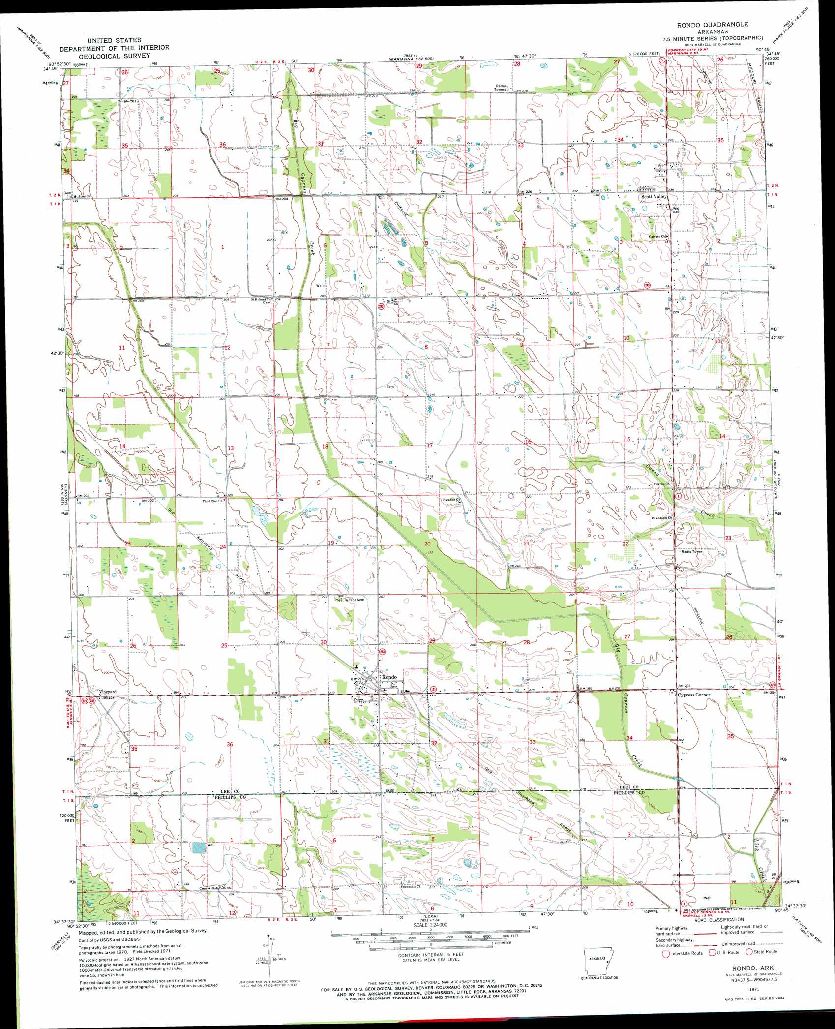
USGS Topo Quad 34090f7 - 1:24,000 scale
| Topo Map Name: | Rondo |
| USGS Topo Quad ID: | 34090f7 |
| Print Size: | ca. 21 1/4" wide x 27" high |
| Southeast Coordinates: | 34.625° N latitude / 90.75° W longitude |
| Map Center Coordinates: | 34.6875° N latitude / 90.8125° W longitude |
| U.S. State: | AR |
| Filename: | o34090f7.jpg |
| Download Map JPG Image: | Rondo topo map 1:24,000 scale |
| Map Type: | Topographic |
| Topo Series: | 7.5´ |
| Map Scale: | 1:24,000 |
| Source of Map Images: | United States Geological Survey (USGS) |
| Alternate Map Versions: |
Rondo AR 1971, updated 1973 Download PDF Buy paper map Rondo AR 2011 Download PDF Buy paper map Rondo AR 2014 Download PDF Buy paper map |
1:24,000 Topo Quads surrounding Rondo
Wheatley |
Palestine |
Haynes |
Dansby |
Mud Lake |
Garrett Grove |
Moro |
Marianna |
Soudan |
Brickeys |
Monroe |
Aubrey |
Rondo |
Lagrange |
Stubbs Island |
Pine City |
Marvell |
Lexa |
West Helena |
Helena |
Turner |
Watkins Corner |
Lakeview |
Friars Point Nw |
Moon Lake |
> Back to 34090e1 at 1:100,000 scale
> Back to 34090a1 at 1:250,000 scale
> Back to U.S. Topo Maps home
Rondo topo map: Gazetteer
Rondo: Populated Places
Chappelle (historical) elevation 62m 203′Cypress Corner elevation 61m 200′
Edgewood elevation 66m 216′
Rondo elevation 65m 213′
Scott Valley elevation 72m 236′
Tyner (historical) elevation 60m 196′
Vineyard elevation 58m 190′
Rondo: Streams
Big Cypress Creek elevation 58m 190′Rondo digital topo map on disk
Buy this Rondo topo map showing relief, roads, GPS coordinates and other geographical features, as a high-resolution digital map file on DVD: