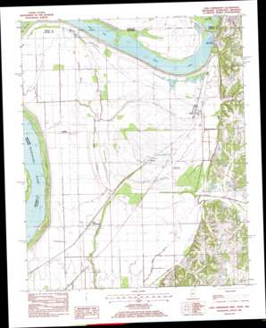
Lake Cormorant Topo Map Mississippi
To zoom in, hover over the map of Lake Cormorant
USGS Topo Quad 34090h2 - 1:24,000 scale
| Topo Map Name: | Lake Cormorant |
| USGS Topo Quad ID: | 34090h2 |
| Print Size: | ca. 21 1/4" wide x 27" high |
| Southeast Coordinates: | 34.875° N latitude / 90.125° W longitude |
| Map Center Coordinates: | 34.9375° N latitude / 90.1875° W longitude |
| U.S. States: | MS, AR, TN |
| Filename: | o34090h2.jpg |
| Download Map JPG Image: | Lake Cormorant topo map 1:24,000 scale |
| Map Type: | Topographic |
| Topo Series: | 7.5´ |
| Map Scale: | 1:24,000 |
| Source of Map Images: | United States Geological Survey (USGS) |
| Alternate Map Versions: |
Lake Cormorant MS 1908, updated 1961 Download PDF Buy paper map Lake Cormorant MS 1982, updated 1982 Download PDF Buy paper map Lake Cormorant MS 1982, updated 1982 Download PDF Buy paper map Lake Cormorant MS 2011 Download PDF Buy paper map Lake Cormorant MS 2012 Download PDF Buy paper map Lake Cormorant MS 2015 Download PDF Buy paper map |
1:24,000 Topo Quads surrounding Lake Cormorant
> Back to 34090e1 at 1:100,000 scale
> Back to 34090a1 at 1:250,000 scale
> Back to U.S. Topo Maps home
Lake Cormorant topo map: Gazetteer
Lake Cormorant: Bends
Horn Lake Cutoff elevation 61m 200′Lake Cormorant: Guts
Dead Negro Slough elevation 59m 193′Norfolk Bayou elevation 62m 203′
Lake Cormorant: Islands
Dooleys Island elevation 62m 203′Lake Cormorant: Lakes
Horn Lake elevation 58m 190′Lake Cormorant elevation 57m 187′
Mud Lake elevation 58m 190′
Mud Lake elevation 59m 193′
Norfolk Lake elevation 60m 196′
Lake Cormorant: Populated Places
Blue Goose (historical) elevation 64m 209′Glover elevation 64m 209′
Lake Cormorant elevation 63m 206′
Lake View elevation 69m 226′
Norfolk elevation 64m 209′
Southhaven elevation 87m 285′
Walls elevation 64m 209′
Lake Cormorant: Post Offices
Walls Post Office elevation 64m 209′Lake Cormorant: Streams
Jackson Creek elevation 62m 203′Johnson Creek elevation 60m 196′
Lake Cormorant digital topo map on disk
Buy this Lake Cormorant topo map showing relief, roads, GPS coordinates and other geographical features, as a high-resolution digital map file on DVD:


