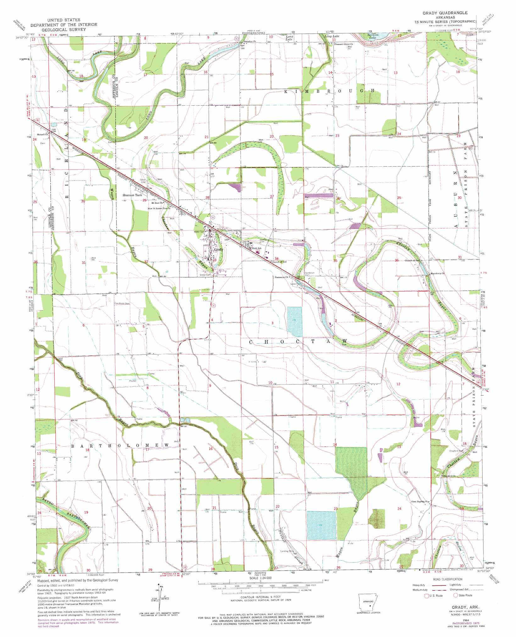
Grady Topo Map Arkansas
To zoom in, hover over the map of Grady
USGS Topo Quad 34091a6 - 1:24,000 scale
| Topo Map Name: | Grady |
| USGS Topo Quad ID: | 34091a6 |
| Print Size: | ca. 21 1/4" wide x 27" high |
| Southeast Coordinates: | 34° N latitude / 91.625° W longitude |
| Map Center Coordinates: | 34.0625° N latitude / 91.6875° W longitude |
| U.S. State: | AR |
| Filename: | o34091a6.jpg |
| Download Map JPG Image: | Grady topo map 1:24,000 scale |
| Map Type: | Topographic |
| Topo Series: | 7.5´ |
| Map Scale: | 1:24,000 |
| Source of Map Images: | United States Geological Survey (USGS) |
| Alternate Map Versions: |
Grady AR 1964, updated 1965 Download PDF Buy paper map Grady AR 1964, updated 1976 Download PDF Buy paper map Grady AR 2011 Download PDF Buy paper map Grady AR 2014 Download PDF Buy paper map |
1:24,000 Topo Quads surrounding Grady
Rob Roy |
Altheimer |
Humphrey Sw |
Lodge Corner |
De Witt Sw |
Ladd |
Moscow |
Cornerstone |
Reydell |
One Horse Store |
Pinebergen |
Tarry |
Grady |
Cades |
Gillett |
Glendale |
Star City |
Avery |
Gould |
Dumas |
Cornerville |
Relfs Bluff |
Tyro |
Gourd |
Winchester |
> Back to 34091a1 at 1:100,000 scale
> Back to 34090a1 at 1:250,000 scale
> Back to U.S. Topo Maps home
Grady topo map: Gazetteer
Grady: Airports
Matthews Field (historical) elevation 51m 167′Grady: Guts
Long Lake elevation 57m 187′Grady: Populated Places
Dolton (historical) elevation 56m 183′Four Groves (historical) elevation 54m 177′
Grady elevation 55m 180′
Sarassa elevation 54m 177′
Shannon Tank elevation 56m 183′
Silt (historical) elevation 54m 177′
Woodville elevation 54m 177′
Grady digital topo map on disk
Buy this Grady topo map showing relief, roads, GPS coordinates and other geographical features, as a high-resolution digital map file on DVD: