One Horse Store Topo Map Arkansas
To zoom in, hover over the map of One Horse Store
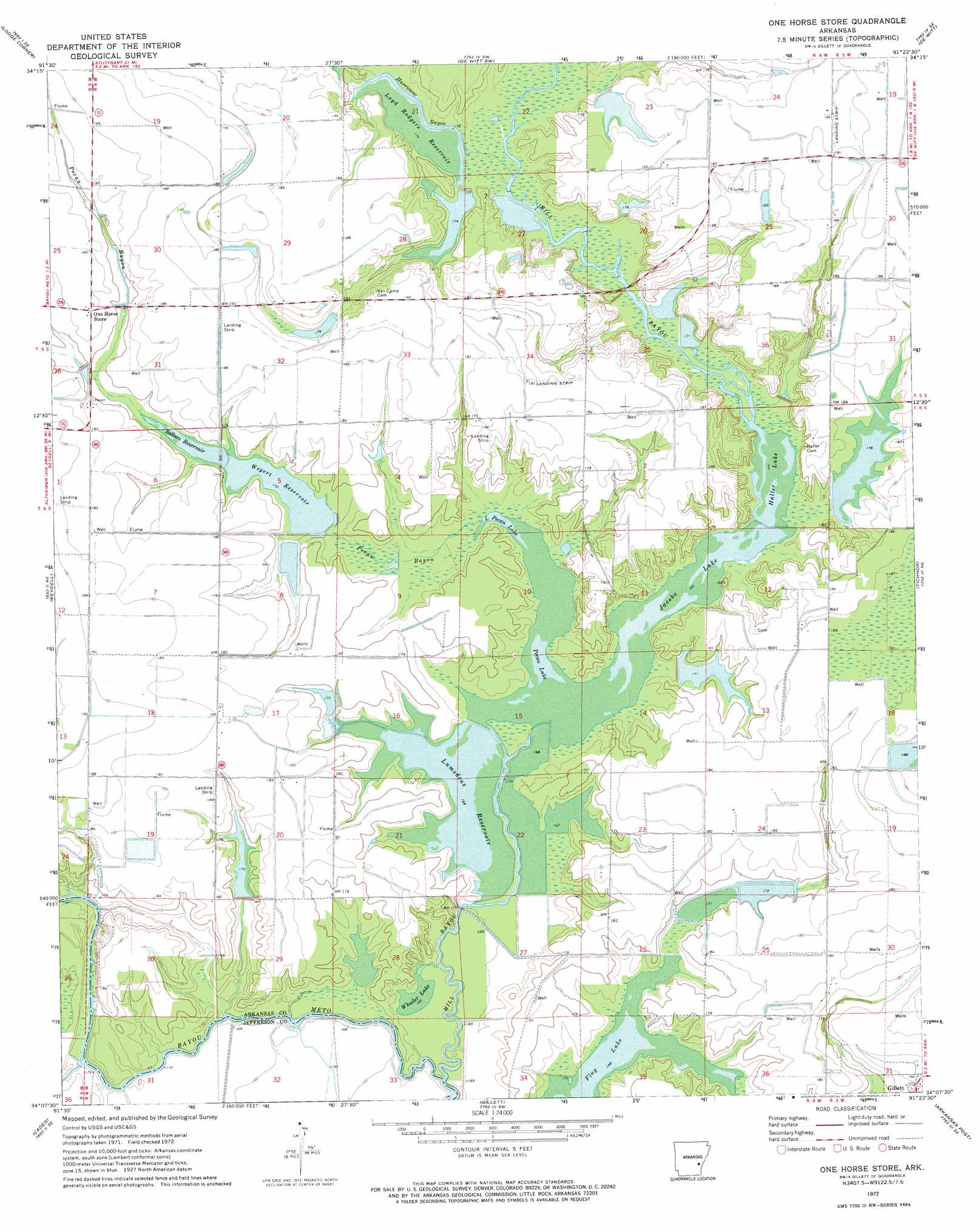
USGS Topo Quad 34091b4 - 1:24,000 scale
| Topo Map Name: | One Horse Store |
| USGS Topo Quad ID: | 34091b4 |
| Print Size: | ca. 21 1/4" wide x 27" high |
| Southeast Coordinates: | 34.125° N latitude / 91.375° W longitude |
| Map Center Coordinates: | 34.1875° N latitude / 91.4375° W longitude |
| U.S. State: | AR |
| Filename: | o34091b4.jpg |
| Download Map JPG Image: | One Horse Store topo map 1:24,000 scale |
| Map Type: | Topographic |
| Topo Series: | 7.5´ |
| Map Scale: | 1:24,000 |
| Source of Map Images: | United States Geological Survey (USGS) |
| Alternate Map Versions: |
One Horse Store AR 1972, updated 1974 Download PDF Buy paper map One Horse Store AR 2011 Download PDF Buy paper map One Horse Store AR 2014 Download PDF Buy paper map |
1:24,000 Topo Quads surrounding One Horse Store
Humphrey |
Stuttgart South |
Almyra |
De Witt Ne |
Crocketts Bluff |
Humphrey Sw |
Lodge Corner |
De Witt Sw |
De Witt |
Ethel |
Cornerstone |
Reydell |
One Horse Store |
Tichnor |
Weber |
Grady |
Cades |
Gillett |
Arkansas Post |
Henrico Sw |
Avery |
Gould |
Dumas |
Watson |
Yancopin |
> Back to 34091a1 at 1:100,000 scale
> Back to 34090a1 at 1:250,000 scale
> Back to U.S. Topo Maps home
One Horse Store topo map: Gazetteer
One Horse Store: Dams
Chaney Lake Dam elevation 58m 190′Lake Wilson Dam elevation 54m 177′
Lumsden Lake Dam elevation 55m 180′
Lumsdens Reservoir Dam elevation 53m 173′
McKinley Reservoir Dam elevation 52m 170′
Rodgers Lake Number One Dam elevation 59m 193′
Rodgers Lake Number Two Dam elevation 54m 177′
Wegert Reservoir Dam elevation 50m 164′
One Horse Store: Lakes
Flag Lake elevation 50m 164′Little Pecan Lake elevation 49m 160′
Wheeler Lake elevation 52m 170′
One Horse Store: Reservoirs
Chaney Lake elevation 58m 190′Haller Lake elevation 50m 164′
Jacobs Lake elevation 52m 170′
Lake Wilson elevation 54m 177′
Loyd Rodgers Reservoir elevation 53m 173′
Lumsden Lake elevation 55m 180′
Lumsdens Reservoir elevation 53m 173′
McKinley Reservoir elevation 52m 170′
Pecan Lake elevation 54m 177′
Rodgers Lake Number One elevation 59m 193′
Rodgers Lake Number Two elevation 54m 177′
Sollars Reservoir elevation 51m 167′
Wegert Reservoir elevation 50m 164′
One Horse Store: Streams
Hurricane Bayou elevation 53m 173′Mill Bayou elevation 50m 164′
Pecan Bayou elevation 49m 160′
One Horse Store digital topo map on disk
Buy this One Horse Store topo map showing relief, roads, GPS coordinates and other geographical features, as a high-resolution digital map file on DVD: