England Topo Map Arkansas
To zoom in, hover over the map of England
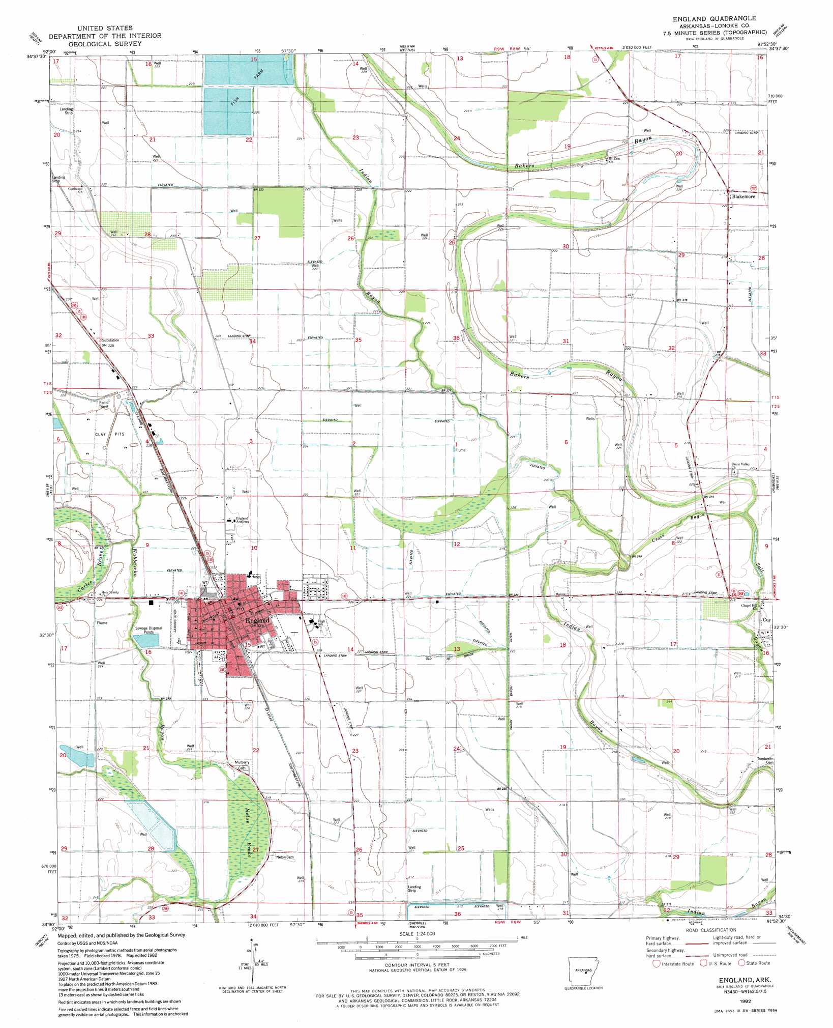
USGS Topo Quad 34091e8 - 1:24,000 scale
| Topo Map Name: | England |
| USGS Topo Quad ID: | 34091e8 |
| Print Size: | ca. 21 1/4" wide x 27" high |
| Southeast Coordinates: | 34.5° N latitude / 91.875° W longitude |
| Map Center Coordinates: | 34.5625° N latitude / 91.9375° W longitude |
| U.S. State: | AR |
| Filename: | o34091e8.jpg |
| Download Map JPG Image: | England topo map 1:24,000 scale |
| Map Type: | Topographic |
| Topo Series: | 7.5´ |
| Map Scale: | 1:24,000 |
| Source of Map Images: | United States Geological Survey (USGS) |
| Alternate Map Versions: |
England SW AR 1975, updated 1977 Download PDF Buy paper map England AR 1982, updated 1982 Download PDF Buy paper map England AR 2011 Download PDF Buy paper map England AR 2014 Download PDF Buy paper map |
1:24,000 Topo Quads surrounding England
Mcalmont |
Jacksonville |
Lonoke |
Pocket Prarie |
Carlisle |
Sweet Home |
Scott |
Pettus |
Culler |
Parkers Corner |
Woodson |
Keo |
England |
Humnoke |
Geridge |
Redfield |
Wright |
Sherrill |
Gethsemane |
Humphrey |
Hardin |
White Hall |
Rob Roy |
Altheimer |
Humphrey Sw |
> Back to 34091e1 at 1:100,000 scale
> Back to 34090a1 at 1:250,000 scale
> Back to U.S. Topo Maps home
England topo map: Gazetteer
England: Airports
Capps Airport elevation 68m 223′England Flying Service Airport elevation 70m 229′
England: Canals
Indian Bayou Ditch elevation 66m 216′England: Guts
Cross Bayou elevation 67m 219′England: Lakes
Salt Lake elevation 65m 213′England: Populated Places
Blakemore elevation 68m 223′Boyd (historical) elevation 68m 223′
England elevation 72m 236′
England: Post Offices
England Post Office elevation 72m 236′England: Swamps
Carlee Brake elevation 70m 229′Nelon Brake elevation 66m 216′
England digital topo map on disk
Buy this England topo map showing relief, roads, GPS coordinates and other geographical features, as a high-resolution digital map file on DVD: