Slovak Topo Map Arkansas
To zoom in, hover over the map of Slovak
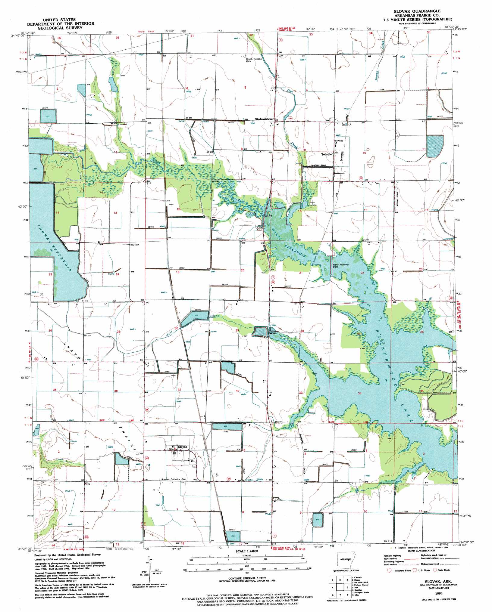
USGS Topo Quad 34091f5 - 1:24,000 scale
| Topo Map Name: | Slovak |
| USGS Topo Quad ID: | 34091f5 |
| Print Size: | ca. 21 1/4" wide x 27" high |
| Southeast Coordinates: | 34.625° N latitude / 91.5° W longitude |
| Map Center Coordinates: | 34.6875° N latitude / 91.5625° W longitude |
| U.S. State: | AR |
| Filename: | o34091f5.jpg |
| Download Map JPG Image: | Slovak topo map 1:24,000 scale |
| Map Type: | Topographic |
| Topo Series: | 7.5´ |
| Map Scale: | 1:24,000 |
| Source of Map Images: | United States Geological Survey (USGS) |
| Alternate Map Versions: |
Slovak AR 1969, updated 1971 Download PDF Buy paper map Slovak AR 1994, updated 1994 Download PDF Buy paper map Slovak AR 2011 Download PDF Buy paper map Slovak AR 2014 Download PDF Buy paper map |
1:24,000 Topo Quads surrounding Slovak
Wattensaw |
Hickory Plains |
Des Arc West |
Des Arc East |
De Valls Bluff Ne |
Pocket Prarie |
Carlisle |
Hazen |
De Valls Bluff |
De Valls Bluff Se |
Culler |
Parkers Corner |
Slovak |
Roe |
Clarendon |
Humnoke |
Geridge |
Stuttgart North |
Ulm |
Aberdeen |
Gethsemane |
Humphrey |
Stuttgart South |
Almyra |
De Witt Ne |
> Back to 34091e1 at 1:100,000 scale
> Back to 34090a1 at 1:250,000 scale
> Back to U.S. Topo Maps home
Slovak topo map: Gazetteer
Slovak: Dams
Hartz Reservoir Dam elevation 64m 209′Slovak: Populated Places
Balle (historical) elevation 65m 213′La Grue (historical) elevation 66m 216′
Nahay (historical) elevation 67m 219′
Siedenstricker elevation 65m 213′
Slovak elevation 66m 216′
Slovaktown (historical) elevation 69m 226′
Spear (historical) elevation 65m 213′
Tollville elevation 65m 213′
Veits (historical) elevation 64m 209′
Slovak: Reservoirs
Hartz Reservoir elevation 64m 209′Thomas Reservoir Number 2 elevation 66m 216′
Slovak: Streams
Oak Creek elevation 64m 209′Wolf Island Slash elevation 62m 203′
Slovak digital topo map on disk
Buy this Slovak topo map showing relief, roads, GPS coordinates and other geographical features, as a high-resolution digital map file on DVD: