Malvern South Topo Map Arkansas
To zoom in, hover over the map of Malvern South
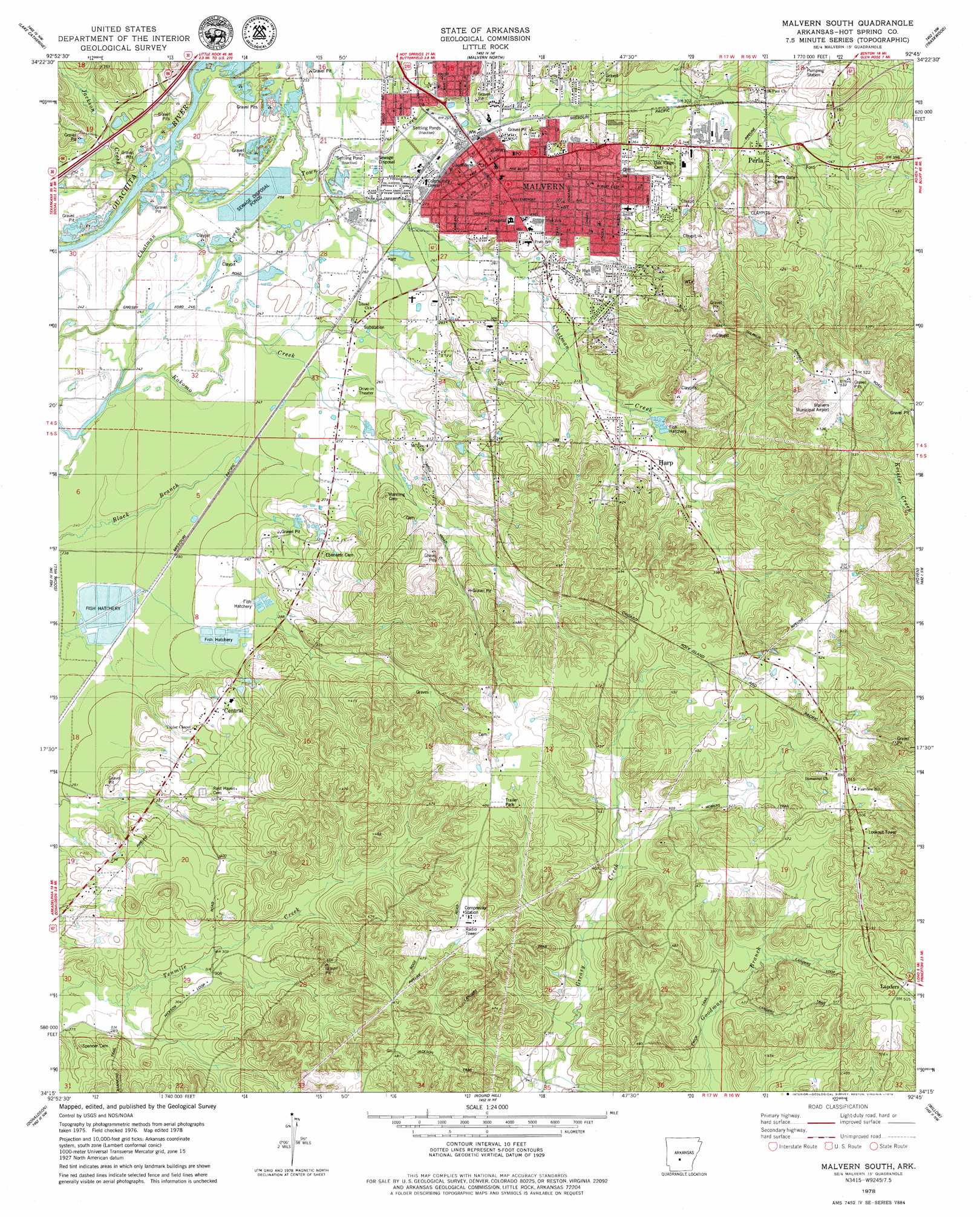
USGS Topo Quad 34092c7 - 1:24,000 scale
| Topo Map Name: | Malvern South |
| USGS Topo Quad ID: | 34092c7 |
| Print Size: | ca. 21 1/4" wide x 27" high |
| Southeast Coordinates: | 34.25° N latitude / 92.75° W longitude |
| Map Center Coordinates: | 34.3125° N latitude / 92.8125° W longitude |
| U.S. State: | AR |
| Filename: | o34092c7.jpg |
| Download Map JPG Image: | Malvern South topo map 1:24,000 scale |
| Map Type: | Topographic |
| Topo Series: | 7.5´ |
| Map Scale: | 1:24,000 |
| Source of Map Images: | United States Geological Survey (USGS) |
| Alternate Map Versions: |
Malvern South AR 1978, updated 1979 Download PDF Buy paper map Malvern South AR 2000, updated 2002 Download PDF Buy paper map Malvern South AR 2011 Download PDF Buy paper map Malvern South AR 2014 Download PDF Buy paper map |
1:24,000 Topo Quads surrounding Malvern South
Hot Springs North |
Fountain Lake |
Lonsdale |
Haskell |
Benton |
Hot Springs South |
Lake Catherine |
Malvern North |
Traskwood |
Tull |
De Roche |
Social Hill |
Malvern South |
Poyen |
Prattsville |
Caddo Valley |
Donaldson |
Round Hill |
Willow |
Leola |
Arkadelphia |
Dalark |
Manning |
Tulip |
Carthage |
> Back to 34092a1 at 1:100,000 scale
> Back to 34092a1 at 1:250,000 scale
> Back to U.S. Topo Maps home
Malvern South topo map: Gazetteer
Malvern South: Airports
Hot Spring County Memorial Hospital Heliport elevation 107m 351′Malvern Municipal Airport elevation 164m 538′
Malvern South: Parks
Centennial Park elevation 91m 298′Malvern South: Populated Places
Abco elevation 78m 255′Central elevation 93m 305′
Durian (historical) elevation 155m 508′
Elmore (historical) elevation 92m 301′
Fleming (historical) elevation 123m 403′
Harp elevation 107m 351′
Landers elevation 155m 508′
Malvern elevation 95m 311′
Perla elevation 101m 331′
Twin Oak (historical) elevation 117m 383′
Walco (historical) elevation 99m 324′
Malvern South: Post Offices
Malvern Post Office elevation 98m 321′Malvern South: Streams
Beauchamp Creek elevation 78m 255′Jackson Creek elevation 68m 223′
Town Creek elevation 73m 239′
Malvern South digital topo map on disk
Buy this Malvern South topo map showing relief, roads, GPS coordinates and other geographical features, as a high-resolution digital map file on DVD: