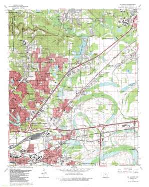
Mcalmont Topo Map Arkansas
To zoom in, hover over the map of Mcalmont
USGS Topo Quad 34092g2 - 1:24,000 scale
| Topo Map Name: | Mcalmont |
| USGS Topo Quad ID: | 34092g2 |
| Print Size: | ca. 21 1/4" wide x 27" high |
| Southeast Coordinates: | 34.75° N latitude / 92.125° W longitude |
| Map Center Coordinates: | 34.8125° N latitude / 92.1875° W longitude |
| U.S. State: | AR |
| Filename: | o34092g2.jpg |
| Download Map JPG Image: | Mcalmont topo map 1:24,000 scale |
| Map Type: | Topographic |
| Topo Series: | 7.5´ |
| Map Scale: | 1:24,000 |
| Source of Map Images: | United States Geological Survey (USGS) |
| Alternate Map Versions: |
Mc Almont AR 1935 Download PDF Buy paper map Mc Almont AR 1954, updated 1957 Download PDF Buy paper map Mc Almont AR 1961, updated 1962 Download PDF Buy paper map Mc Almont AR 1961, updated 1971 Download PDF Buy paper map Mc Almont AR 1961, updated 1976 Download PDF Buy paper map Mc Almont AR 1975, updated 1976 Download PDF Buy paper map Mc Almont AR 1986, updated 1988 Download PDF Buy paper map Mc Almont AR 1986, updated 1997 Download PDF Buy paper map Mc Almont AR 1994, updated 2000 Download PDF Buy paper map McAlmont AR 2011 Download PDF Buy paper map McAlmont AR 2014 Download PDF Buy paper map |
1:24,000 Topo Quads surrounding Mcalmont
> Back to 34092e1 at 1:100,000 scale
> Back to 34092a1 at 1:250,000 scale
> Back to U.S. Topo Maps home
Mcalmont topo map: Gazetteer
Mcalmont: Airports
Robert Chris McIntosh Airport elevation 73m 239′Mcalmont: Bends
Stark Bend elevation 77m 252′Mcalmont: Bridges
Waterside Street Bridge elevation 79m 259′Mcalmont: Crossings
Dark Hollow Interchange elevation 89m 291′Interchange 10 elevation 78m 255′
Interchange 11 elevation 76m 249′
Interchange 154 elevation 83m 272′
Interchange 155 elevation 87m 285′
Interchange 157 elevation 74m 242′
Interchange 159 elevation 88m 288′
Interchange 161 elevation 77m 252′
Mcalmont: Dams
Beal Lake Dam elevation 76m 249′Dupree Lake Dam elevation 75m 246′
Harris Lake Dam elevation 75m 246′
Indianhead Lake Dam elevation 77m 252′
Lake Cherrywood Dam elevation 78m 255′
Lakewood Lake Number One Dam elevation 82m 269′
Lakewood Lake Number Two Dam elevation 88m 288′
Little Indian Lake Number One Dam elevation 120m 393′
Little Indian Lake Number Two Dam elevation 128m 419′
McConnell Lake Dam elevation 75m 246′
Mcalmont: Flats
Brushy Island elevation 81m 265′Dark Hollow elevation 77m 252′
Mcalmont: Guts
Ink Bayou elevation 73m 239′Mcalmont: Lakes
Peeler Lake elevation 74m 242′Trammel Lake elevation 74m 242′
Mcalmont: Parks
Conley Park elevation 78m 255′Dupree Park elevation 76m 249′
Henson Park elevation 83m 272′
North Shore Park elevation 75m 246′
Optimist Park elevation 157m 515′
Reuther Park elevation 85m 278′
Rose City Park elevation 77m 252′
Mcalmont: Populated Places
Autumnbrook elevation 97m 318′Booker elevation 83m 272′
Dixie elevation 77m 252′
Eureka Garden elevation 75m 246′
Fairman elevation 79m 259′
Galloway elevation 77m 252′
Gravel Ridge elevation 78m 255′
Indian Head Lake Estates elevation 79m 259′
Lakewood elevation 105m 344′
Lansbrook elevation 77m 252′
McAlmont elevation 80m 262′
Niemeyer (historical) elevation 78m 255′
North Hills Manor elevation 86m 282′
Pecan Grove elevation 76m 249′
Protho Junction elevation 76m 249′
Rixey elevation 75m 246′
Rose City elevation 76m 249′
Sherwood elevation 99m 324′
Silver Creek elevation 86m 282′
Sylvan Hills elevation 120m 393′
Timber Creek elevation 109m 357′
Valentine elevation 73m 239′
Western Acres elevation 93m 305′
Mcalmont: Post Offices
Rose City Post Office elevation 74m 242′Mcalmont: Reservoirs
Beal Lake elevation 76m 249′Dupree Lake elevation 75m 246′
Harris Lake elevation 75m 246′
Indianhead Lake elevation 77m 252′
Lake Cherrywood elevation 78m 255′
Lake Number One elevation 88m 288′
Lake Number Three elevation 105m 344′
Lake Number Two elevation 95m 311′
Lakewood Lake Number One elevation 82m 269′
Lakewood Lake Number Two elevation 88m 288′
Little Indian Lake Number One elevation 120m 393′
Little Indian Lake Number Two elevation 128m 419′
Matthews Lake elevation 75m 246′
Watkins Pond elevation 83m 272′
Mcalmont: Streams
Brushy Island Creek elevation 72m 236′Duncan Creek elevation 74m 242′
Fivemile Creek elevation 73m 239′
Gap Creek elevation 74m 242′
Kellogg Creek elevation 73m 239′
Miles Creek elevation 76m 249′
Rocky Branch elevation 73m 239′
Spring Creek elevation 90m 295′
Woodruff Creek elevation 71m 232′
Mcalmont: Summits
Franklin Hill elevation 100m 328′Red Hill elevation 126m 413′
Mcalmont: Swamps
Faulkner Lake elevation 73m 239′Fears Lake elevation 75m 246′
Mcalmont digital topo map on disk
Buy this Mcalmont topo map showing relief, roads, GPS coordinates and other geographical features, as a high-resolution digital map file on DVD:


