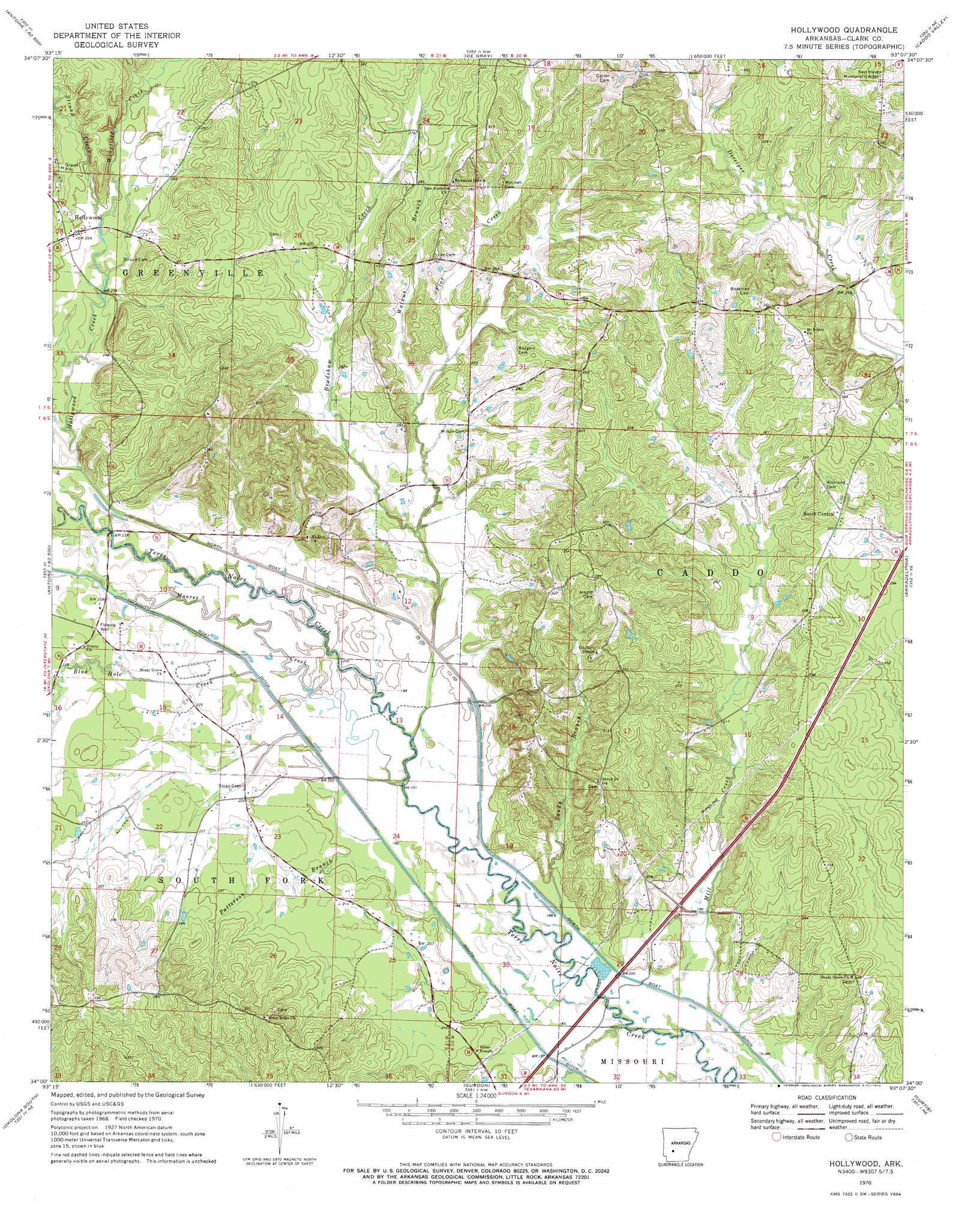
Hollywood Topo Map Arkansas
To zoom in, hover over the map of Hollywood
USGS Topo Quad 34093a2 - 1:24,000 scale
| Topo Map Name: | Hollywood |
| USGS Topo Quad ID: | 34093a2 |
| Print Size: | ca. 21 1/4" wide x 27" high |
| Southeast Coordinates: | 34° N latitude / 93.125° W longitude |
| Map Center Coordinates: | 34.0625° N latitude / 93.1875° W longitude |
| U.S. State: | AR |
| Filename: | o34093a2.jpg |
| Download Map JPG Image: | Hollywood topo map 1:24,000 scale |
| Map Type: | Topographic |
| Topo Series: | 7.5´ |
| Map Scale: | 1:24,000 |
| Source of Map Images: | United States Geological Survey (USGS) |
| Alternate Map Versions: |
Hollywood AR 1970, updated 1972 Download PDF Buy paper map Hollywood AR 2011 Download PDF Buy paper map Hollywood AR 2014 Download PDF Buy paper map |
1:24,000 Topo Quads surrounding Hollywood
Amity |
Point Cedar |
Bismark |
De Roche |
Social Hill |
Chalybeate Mountain West |
Chalybeate Mountain East |
De Gray |
Caddo Valley |
Donaldson |
Antoine |
Okolona North |
Hollywood |
Arkadelphia |
Dalark |
Piney Grove |
Okolona South |
Gurdon |
Curtis |
Sparkman Nw |
Prescott West |
Prescott East |
Whelen Springs |
Reader |
Tates Bluff |
> Back to 34093a1 at 1:100,000 scale
> Back to 34092a1 at 1:250,000 scale
> Back to U.S. Topo Maps home
Hollywood topo map: Gazetteer
Hollywood: Canals
South Boat Ditch elevation 59m 193′Hollywood: Populated Places
Hollywood elevation 77m 252′Hollywood: Streams
Blue Hole Creek elevation 60m 196′Bradshaw Creek elevation 61m 200′
Flat Creek elevation 62m 203′
Hollywood Creek elevation 61m 200′
Mill Creek elevation 54m 177′
Moores Creek elevation 57m 187′
Patterson Branch elevation 59m 193′
Sandy Branch elevation 55m 180′
South Fork Terre Noire Creek elevation 57m 187′
Stroud Creek elevation 73m 239′
Walnut Branch elevation 65m 213′
Wingfield Creek elevation 70m 229′
Hollywood digital topo map on disk
Buy this Hollywood topo map showing relief, roads, GPS coordinates and other geographical features, as a high-resolution digital map file on DVD: