Okolona North Topo Map Arkansas
To zoom in, hover over the map of Okolona North
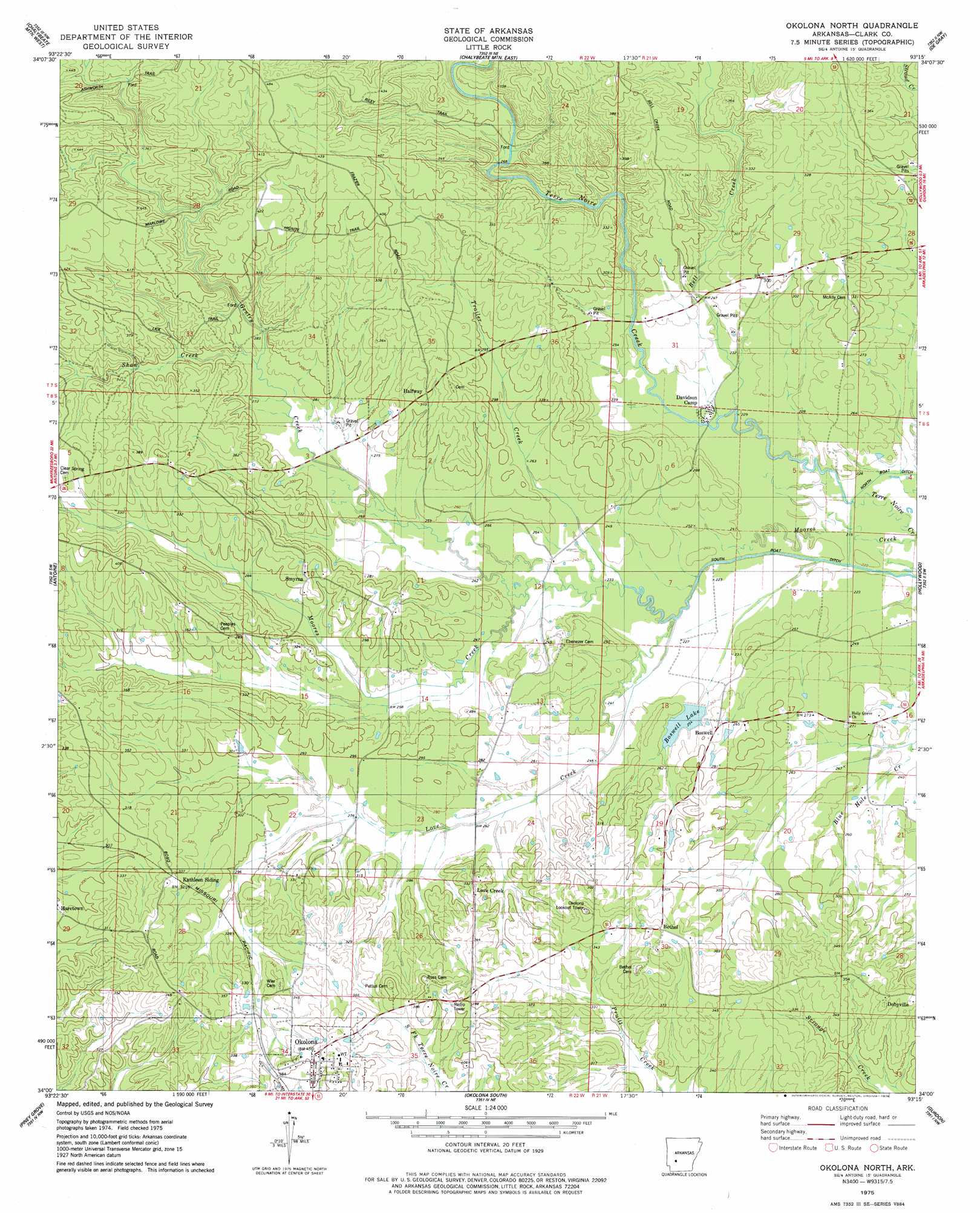
USGS Topo Quad 34093a3 - 1:24,000 scale
| Topo Map Name: | Okolona North |
| USGS Topo Quad ID: | 34093a3 |
| Print Size: | ca. 21 1/4" wide x 27" high |
| Southeast Coordinates: | 34° N latitude / 93.25° W longitude |
| Map Center Coordinates: | 34.0625° N latitude / 93.3125° W longitude |
| U.S. State: | AR |
| Filename: | o34093a3.jpg |
| Download Map JPG Image: | Okolona North topo map 1:24,000 scale |
| Map Type: | Topographic |
| Topo Series: | 7.5´ |
| Map Scale: | 1:24,000 |
| Source of Map Images: | United States Geological Survey (USGS) |
| Alternate Map Versions: |
Okolona North AR 1975, updated 1978 Download PDF Buy paper map Okolona North AR 2011 Download PDF Buy paper map Okolona North AR 2014 Download PDF Buy paper map |
1:24,000 Topo Quads surrounding Okolona North
Glenwood |
Amity |
Point Cedar |
Bismark |
De Roche |
Murfreesboro Ne |
Chalybeate Mountain West |
Chalybeate Mountain East |
De Gray |
Caddo Valley |
Delight |
Antoine |
Okolona North |
Hollywood |
Arkadelphia |
Pisgah |
Piney Grove |
Okolona South |
Gurdon |
Curtis |
Blevins |
Prescott West |
Prescott East |
Whelen Springs |
Reader |
> Back to 34093a1 at 1:100,000 scale
> Back to 34092a1 at 1:250,000 scale
> Back to U.S. Topo Maps home
Okolona North topo map: Gazetteer
Okolona North: Dams
Boswell Lake Dam elevation 79m 259′Okolona North: Populated Places
Bethel elevation 119m 390′Boswell elevation 87m 285′
Dobyville elevation 111m 364′
Halfway elevation 102m 334′
Haretown elevation 102m 334′
Love Creek elevation 104m 341′
Smyrna elevation 98m 321′
Okolona North: Reservoirs
Boswell Lake elevation 79m 259′Okolona North: Streams
Bell Creek elevation 72m 236′Gentry Creek elevation 68m 223′
Love Creek elevation 74m 242′
Shaw Creek elevation 106m 347′
Trailer Creek elevation 75m 246′
Okolona North digital topo map on disk
Buy this Okolona North topo map showing relief, roads, GPS coordinates and other geographical features, as a high-resolution digital map file on DVD: