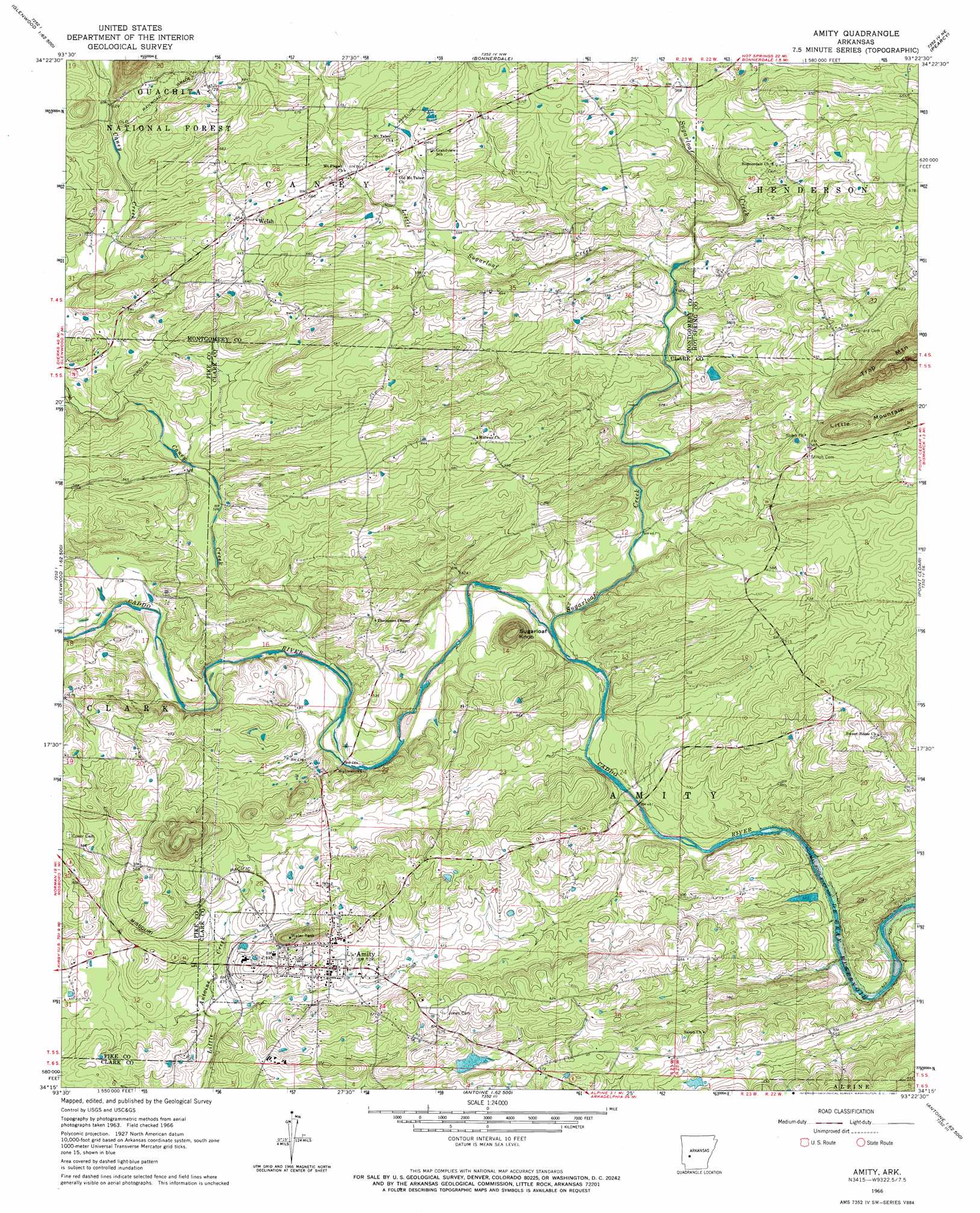
Amity Topo Map Arkansas
To zoom in, hover over the map of Amity
USGS Topo Quad 34093c4 - 1:24,000 scale
| Topo Map Name: | Amity |
| USGS Topo Quad ID: | 34093c4 |
| Print Size: | ca. 21 1/4" wide x 27" high |
| Southeast Coordinates: | 34.25° N latitude / 93.375° W longitude |
| Map Center Coordinates: | 34.3125° N latitude / 93.4375° W longitude |
| U.S. State: | AR |
| Filename: | o34093c4.jpg |
| Download Map JPG Image: | Amity topo map 1:24,000 scale |
| Map Type: | Topographic |
| Topo Series: | 7.5´ |
| Map Scale: | 1:24,000 |
| Source of Map Images: | United States Geological Survey (USGS) |
| Alternate Map Versions: |
Amity AR 1966, updated 1967 Download PDF Buy paper map Amity AR 2011 Download PDF Buy paper map Amity AR 2014 Download PDF Buy paper map |
| FStopo: | US Forest Service topo Amity is available: Download FStopo PDF Download FStopo TIF |
1:24,000 Topo Quads surrounding Amity
Mount Ida |
Reed Mountain |
Mcgraw Mountain |
Crystal Springs |
Mountain Pine |
Norman |
Caddo Gap |
Bonnerdale |
Pearcy |
Hempwallace |
Lodi |
Glenwood |
Amity |
Point Cedar |
Bismark |
Narrows Dam |
Murfreesboro Ne |
Chalybeate Mountain West |
Chalybeate Mountain East |
De Gray |
Murfreesboro |
Delight |
Antoine |
Okolona North |
Hollywood |
> Back to 34093a1 at 1:100,000 scale
> Back to 34092a1 at 1:250,000 scale
> Back to U.S. Topo Maps home
Amity topo map: Gazetteer
Amity: Dams
Kirksey Reservoir Dam elevation 155m 508′Amity: Populated Places
Amity elevation 156m 511′Elm (historical) elevation 181m 593′
Welsh elevation 200m 656′
Amity: Reservoirs
Kirksey Reservoir elevation 155m 508′Amity: Ridges
Little Mountain elevation 233m 764′Amity: Streams
Caney Creek elevation 145m 475′Little Sugarloaf Creek elevation 154m 505′
Sugarloaf Creek elevation 137m 449′
Amity: Summits
Sugarloaf Knob elevation 215m 705′Amity digital topo map on disk
Buy this Amity topo map showing relief, roads, GPS coordinates and other geographical features, as a high-resolution digital map file on DVD: