Lodi Topo Map Arkansas
To zoom in, hover over the map of Lodi
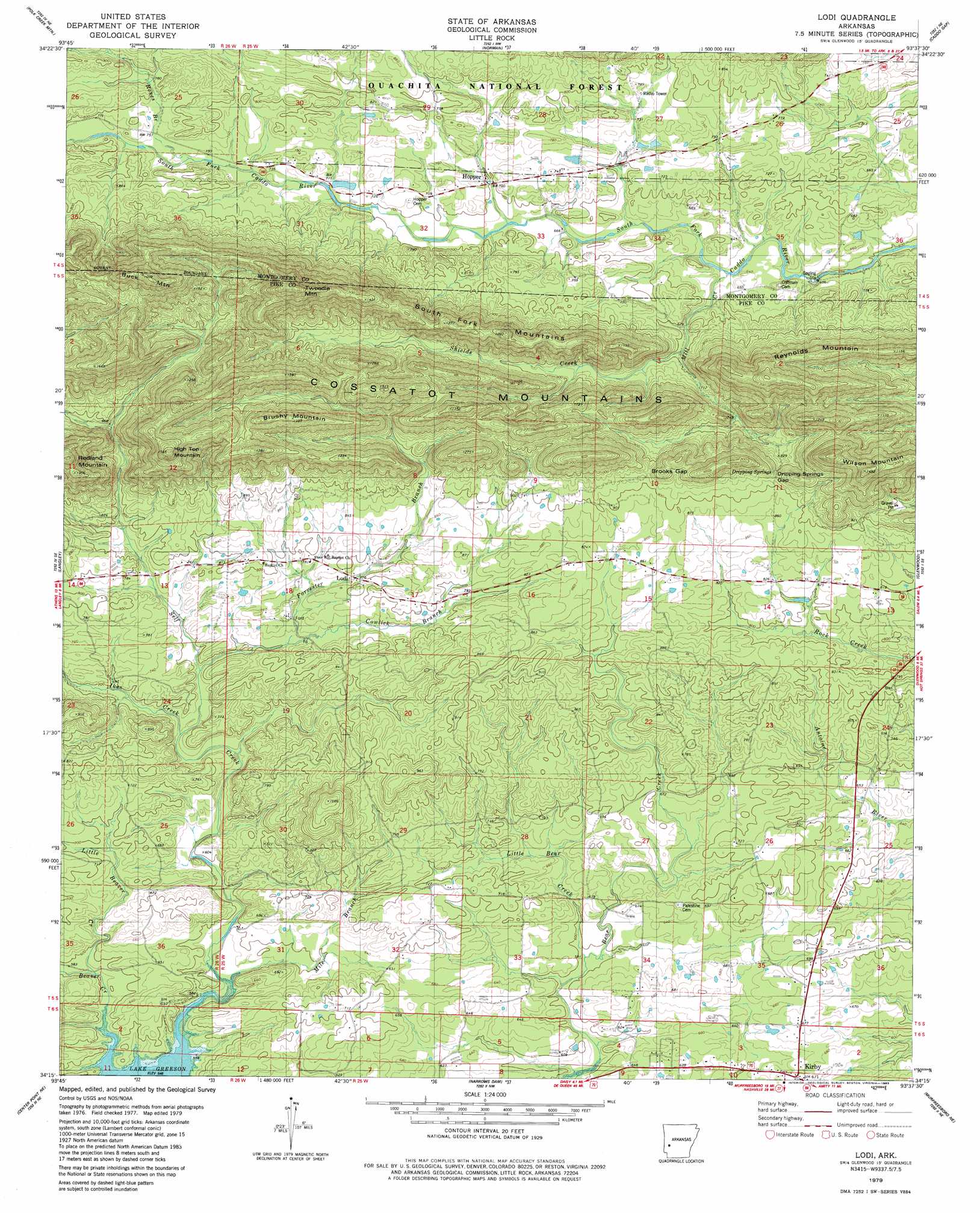
USGS Topo Quad 34093c6 - 1:24,000 scale
| Topo Map Name: | Lodi |
| USGS Topo Quad ID: | 34093c6 |
| Print Size: | ca. 21 1/4" wide x 27" high |
| Southeast Coordinates: | 34.25° N latitude / 93.625° W longitude |
| Map Center Coordinates: | 34.3125° N latitude / 93.6875° W longitude |
| U.S. State: | AR |
| Filename: | o34093c6.jpg |
| Download Map JPG Image: | Lodi topo map 1:24,000 scale |
| Map Type: | Topographic |
| Topo Series: | 7.5´ |
| Map Scale: | 1:24,000 |
| Source of Map Images: | United States Geological Survey (USGS) |
| Alternate Map Versions: |
Lodi AR 1979, updated 1983 Download PDF Buy paper map Lodi AR 2011 Download PDF Buy paper map Lodi AR 2014 Download PDF Buy paper map |
| FStopo: | US Forest Service topo Lodi is available: Download FStopo PDF Download FStopo TIF |
1:24,000 Topo Quads surrounding Lodi
Pine Ridge |
Oden |
Mount Ida |
Reed Mountain |
Mcgraw Mountain |
Big Fork |
Polk Creek Mountain |
Norman |
Caddo Gap |
Bonnerdale |
Athens |
Langley |
Lodi |
Glenwood |
Amity |
Newhope |
Center Point Ne |
Narrows Dam |
Murfreesboro Ne |
Chalybeate Mountain West |
Center Point |
Nathan |
Murfreesboro |
Delight |
Antoine |
> Back to 34093a1 at 1:100,000 scale
> Back to 34092a1 at 1:250,000 scale
> Back to U.S. Topo Maps home
Lodi topo map: Gazetteer
Lodi: Gaps
Brooks Gap elevation 291m 954′Dripping Springs Gap elevation 295m 967′
Lodi: Populated Places
Cooper (historical) elevation 176m 577′Dunlap (historical) elevation 231m 757′
Hopper elevation 215m 705′
Kirby elevation 206m 675′
Lodi elevation 236m 774′
Zebulon (historical) elevation 252m 826′
Lodi: Ridges
South Fork Mountains elevation 385m 1263′Lodi: Springs
Dripping Springs elevation 295m 967′Lodi: Streams
Beaver Creek elevation 164m 538′Cowlick Branch elevation 218m 715′
Forrester Branch elevation 212m 695′
Ikes Creek elevation 196m 643′
Little Bear Creek elevation 180m 590′
Little Beaver Creek elevation 173m 567′
Mile Branch elevation 169m 554′
Mill Creek elevation 192m 629′
Reeves Branch elevation 225m 738′
Self Creek elevation 167m 547′
Shields Creek elevation 214m 702′
Lodi: Summits
Brushy Mountain elevation 411m 1348′Buck Mountain elevation 488m 1601′
High Top Mountain elevation 436m 1430′
Tweedle Mountain elevation 506m 1660′
Wilson Mountain elevation 442m 1450′
Lodi digital topo map on disk
Buy this Lodi topo map showing relief, roads, GPS coordinates and other geographical features, as a high-resolution digital map file on DVD: