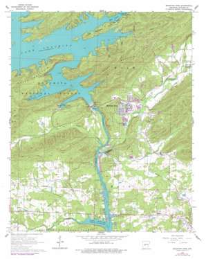
Mountain Pine Topo Map Arkansas
To zoom in, hover over the map of Mountain Pine
USGS Topo Quad 34093e2 - 1:24,000 scale
| Topo Map Name: | Mountain Pine |
| USGS Topo Quad ID: | 34093e2 |
| Print Size: | ca. 21 1/4" wide x 27" high |
| Southeast Coordinates: | 34.5° N latitude / 93.125° W longitude |
| Map Center Coordinates: | 34.5625° N latitude / 93.1875° W longitude |
| U.S. State: | AR |
| Filename: | o34093e2.jpg |
| Download Map JPG Image: | Mountain Pine topo map 1:24,000 scale |
| Map Type: | Topographic |
| Topo Series: | 7.5´ |
| Map Scale: | 1:24,000 |
| Source of Map Images: | United States Geological Survey (USGS) |
| Alternate Map Versions: |
Mountain Pine AR 1966, updated 1967 Download PDF Buy paper map Mountain Pine AR 1966, updated 1977 Download PDF Buy paper map Mountain Pine AR 2011 Download PDF Buy paper map Mountain Pine AR 2014 Download PDF Buy paper map |
| FStopo: | US Forest Service topo Mountain Pine is available: Download FStopo PDF Download FStopo TIF |
1:24,000 Topo Quads surrounding Mountain Pine
> Back to 34093e1 at 1:100,000 scale
> Back to 34092a1 at 1:250,000 scale
> Back to U.S. Topo Maps home
Mountain Pine topo map: Gazetteer
Mountain Pine: Dams
Blakely Mountain Dam elevation 163m 534′Mountain Pine: Parks
Lake Ouachita State Park elevation 218m 715′Spillway Public Use Area elevation 186m 610′
Mountain Pine: Populated Places
Hawes elevation 150m 492′Mountain Pine elevation 146m 479′
Piney elevation 126m 413′
Royal elevation 149m 488′
Mountain Pine: Reservoirs
Lake Ouachita elevation 181m 593′Mountain Pine: Ridges
Blakely Mountain elevation 345m 1131′Mountain Pine: Streams
Bear Creek elevation 177m 580′Bear Creek elevation 136m 446′
Cearley Creek elevation 130m 426′
Clear Creek elevation 122m 400′
Crudington Creek elevation 121m 396′
Glazypeau Creek elevation 122m 400′
Little Glazypeau Creek elevation 154m 505′
Mill Creek elevation 173m 567′
Owl Creek elevation 121m 396′
Rabbit Creek elevation 148m 485′
Steep Shoals Creek elevation 172m 564′
Mountain Pine: Summits
Brady Mountain elevation 203m 666′Mountain Pine digital topo map on disk
Buy this Mountain Pine topo map showing relief, roads, GPS coordinates and other geographical features, as a high-resolution digital map file on DVD:


