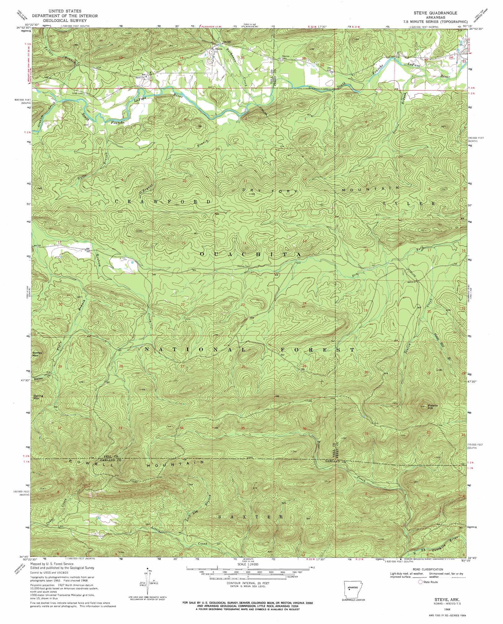
Steve Topo Map Arkansas
To zoom in, hover over the map of Steve
USGS Topo Quad 34093g3 - 1:24,000 scale
| Topo Map Name: | Steve |
| USGS Topo Quad ID: | 34093g3 |
| Print Size: | ca. 21 1/4" wide x 27" high |
| Southeast Coordinates: | 34.75° N latitude / 93.25° W longitude |
| Map Center Coordinates: | 34.8125° N latitude / 93.3125° W longitude |
| U.S. State: | AR |
| Filename: | o34093g3.jpg |
| Download Map JPG Image: | Steve topo map 1:24,000 scale |
| Map Type: | Topographic |
| Topo Series: | 7.5´ |
| Map Scale: | 1:24,000 |
| Source of Map Images: | United States Geological Survey (USGS) |
| Alternate Map Versions: |
Steve AR 1968, updated 1970 Download PDF Buy paper map Steve AR 2011 Download PDF Buy paper map Steve AR 2014 Download PDF Buy paper map |
| FStopo: | US Forest Service topo Steve is available: Download FStopo PDF Download FStopo TIF |
1:24,000 Topo Quads surrounding Steve
Havana |
Danville |
Danville Mountain |
Ola |
Casa |
Bluffton |
Rover |
Plainview |
Nimrod Dam |
Nimrod |
Chula Mountain |
Onyx |
Steve |
Nimrod Sw |
Nimrod Se |
Story |
Fannie |
Avant |
Hamilton |
Jessieville |
Reed Mountain |
Mcgraw Mountain |
Crystal Springs |
Mountain Pine |
Hot Springs North |
> Back to 34093e1 at 1:100,000 scale
> Back to 34092a1 at 1:250,000 scale
> Back to U.S. Topo Maps home
Steve topo map: Gazetteer
Steve: Populated Places
Steve elevation 210m 688′Steve: Ridges
Dry Fork Mountain elevation 298m 977′Steve: Streams
Bear Creek elevation 232m 761′Buchanan Creek elevation 188m 616′
Graham Creek elevation 204m 669′
Hutto Branch elevation 198m 649′
Keener Creek elevation 276m 905′
Lick Log Branch elevation 265m 869′
Loston Branch elevation 178m 583′
O'Bryant Branch elevation 200m 656′
Potato Hill Branch elevation 239m 784′
Seaton Creek elevation 215m 705′
Turner Branch elevation 203m 666′
Steve: Summits
Potato Hill elevation 473m 1551′Powell Mountain elevation 547m 1794′
Steve digital topo map on disk
Buy this Steve topo map showing relief, roads, GPS coordinates and other geographical features, as a high-resolution digital map file on DVD: