Onyx Topo Map Arkansas
To zoom in, hover over the map of Onyx
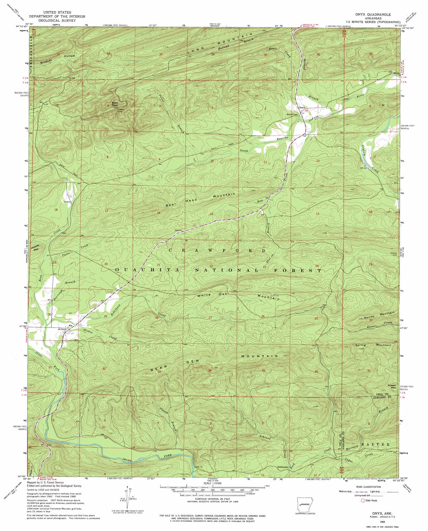
USGS Topo Quad 34093g4 - 1:24,000 scale
| Topo Map Name: | Onyx |
| USGS Topo Quad ID: | 34093g4 |
| Print Size: | ca. 21 1/4" wide x 27" high |
| Southeast Coordinates: | 34.75° N latitude / 93.375° W longitude |
| Map Center Coordinates: | 34.8125° N latitude / 93.4375° W longitude |
| U.S. State: | AR |
| Filename: | o34093g4.jpg |
| Download Map JPG Image: | Onyx topo map 1:24,000 scale |
| Map Type: | Topographic |
| Topo Series: | 7.5´ |
| Map Scale: | 1:24,000 |
| Source of Map Images: | United States Geological Survey (USGS) |
| Alternate Map Versions: |
Onyx AR 1968, updated 1970 Download PDF Buy paper map Onyx AR 1968, updated 1977 Download PDF Buy paper map Onyx AR 2011 Download PDF Buy paper map Onyx AR 2014 Download PDF Buy paper map |
| FStopo: | US Forest Service topo Onyx is available: Download FStopo PDF Download FStopo TIF |
1:24,000 Topo Quads surrounding Onyx
Blue Mountain Dam |
Havana |
Danville |
Danville Mountain |
Ola |
Gravelly |
Bluffton |
Rover |
Plainview |
Nimrod Dam |
Little Texas |
Chula Mountain |
Onyx |
Steve |
Nimrod Sw |
Sims |
Story |
Fannie |
Avant |
Hamilton |
Mount Ida |
Reed Mountain |
Mcgraw Mountain |
Crystal Springs |
Mountain Pine |
> Back to 34093e1 at 1:100,000 scale
> Back to 34092a1 at 1:250,000 scale
> Back to U.S. Topo Maps home
Onyx topo map: Gazetteer
Onyx: Populated Places
Aly elevation 259m 849′Onyx elevation 225m 738′
Stillwater elevation 236m 774′
Onyx: Ridges
White Oak Mountain elevation 352m 1154′Onyx: Streams
Ashland Creek elevation 233m 764′Cedar Creek elevation 245m 803′
Clenny Branch elevation 237m 777′
Durrough Branch elevation 258m 846′
Ennis Creek elevation 238m 780′
Haw Creek elevation 218m 715′
Holland Branch elevation 215m 705′
Moccasin Branch elevation 244m 800′
Negro Branch elevation 225m 738′
Potter Branch elevation 247m 810′
Purse Creek elevation 265m 869′
Reed Creek elevation 251m 823′
Robertson Creek elevation 252m 826′
Shut-in Branch elevation 236m 774′
Stokes Creek elevation 249m 816′
Onyx: Summits
Allen Peak elevation 456m 1496′Bear Den Mountain elevation 431m 1414′
Bear Head Mountain elevation 374m 1227′
Powell Mountain elevation 414m 1358′
Spring Mountain elevation 409m 1341′
Worley Mountain elevation 385m 1263′
Onyx digital topo map on disk
Buy this Onyx topo map showing relief, roads, GPS coordinates and other geographical features, as a high-resolution digital map file on DVD: