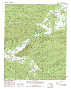
Harvey Topo Map Arkansas
To zoom in, hover over the map of Harvey
USGS Topo Quad 34093g7 - 1:24,000 scale
| Topo Map Name: | Harvey |
| USGS Topo Quad ID: | 34093g7 |
| Print Size: | ca. 21 1/4" wide x 27" high |
| Southeast Coordinates: | 34.75° N latitude / 93.75° W longitude |
| Map Center Coordinates: | 34.8125° N latitude / 93.8125° W longitude |
| U.S. State: | AR |
| Filename: | o34093g7.jpg |
| Download Map JPG Image: | Harvey topo map 1:24,000 scale |
| Map Type: | Topographic |
| Topo Series: | 7.5´ |
| Map Scale: | 1:24,000 |
| Source of Map Images: | United States Geological Survey (USGS) |
| Alternate Map Versions: |
Harvey AR 1985, updated 1986 Download PDF Buy paper map Harvey AR 2011 Download PDF Buy paper map Harvey AR 2014 Download PDF Buy paper map |
| FStopo: | US Forest Service topo Harvey is available: Download FStopo PDF Download FStopo TIF |
1:24,000 Topo Quads surrounding Harvey
> Back to 34093e1 at 1:100,000 scale
> Back to 34092a1 at 1:250,000 scale
> Back to U.S. Topo Maps home
Harvey topo map: Gazetteer
Harvey: Bends
Papa Bend elevation 155m 508′Harvey: Flats
Post Oak Flat elevation 272m 892′Harvey: Guts
Beaver Slough elevation 158m 518′Harvey: Populated Places
Cedar Creek elevation 168m 551′Forester elevation 206m 675′
Harvey elevation 186m 610′
Nebraska (historical) elevation 161m 528′
Harvey: Post Offices
Harvey Post Office elevation 199m 652′Harvey: Ridges
Abbot Mountain elevation 366m 1200′Bogus Ridge elevation 249m 816′
Hickory Ridge elevation 329m 1079′
Hurricane Ridge elevation 279m 915′
John Sanders Ridge elevation 285m 935′
Pond Ridge elevation 368m 1207′
Red Buck Ridge elevation 307m 1007′
Road Ridge elevation 266m 872′
Harvey: Streams
Allen Creek elevation 206m 675′Big Cedar Creek elevation 160m 524′
Brush Creek elevation 161m 528′
Camp Buck Creek elevation 251m 823′
Cow Creek elevation 201m 659′
Hughes Branch elevation 160m 524′
Kelly Creek elevation 145m 475′
Little Joe Creek elevation 188m 616′
Little Nickleson Branch elevation 191m 626′
Nickleson Branch elevation 187m 613′
North Prong Brush Creek elevation 173m 567′
Ringer Branch elevation 201m 659′
Rocky Branch elevation 192m 629′
Rocky Creek elevation 168m 551′
Rough Shack Creek elevation 223m 731′
Shack Creek elevation 215m 705′
Sulphur Creek elevation 146m 479′
Uncle Bud Creek elevation 170m 557′
West Fork Big Cedar Creek elevation 187m 613′
Windy Branch elevation 187m 613′
Harvey: Summits
Holly Mountain elevation 348m 1141′Round Mountain elevation 341m 1118′
Round Mountain elevation 384m 1259′
Harvey: Valleys
Bates Hollow elevation 155m 508′McCafferty Hollow elevation 219m 718′
Owens Hollow elevation 199m 652′
Red Buck Hollow elevation 227m 744′
Stillhouse Hollow elevation 161m 528′
White Oak Hollow elevation 159m 521′
Harvey digital topo map on disk
Buy this Harvey topo map showing relief, roads, GPS coordinates and other geographical features, as a high-resolution digital map file on DVD:


