Nimrod Topo Map Arkansas
To zoom in, hover over the map of Nimrod
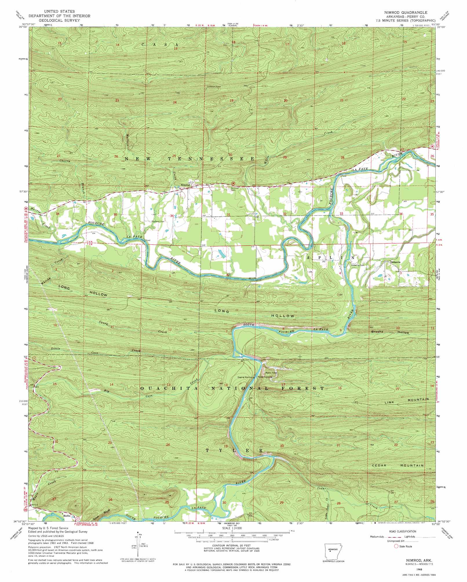
USGS Topo Quad 34093h1 - 1:24,000 scale
| Topo Map Name: | Nimrod |
| USGS Topo Quad ID: | 34093h1 |
| Print Size: | ca. 21 1/4" wide x 27" high |
| Southeast Coordinates: | 34.875° N latitude / 93° W longitude |
| Map Center Coordinates: | 34.9375° N latitude / 93.0625° W longitude |
| U.S. State: | AR |
| Filename: | o34093h1.jpg |
| Download Map JPG Image: | Nimrod topo map 1:24,000 scale |
| Map Type: | Topographic |
| Topo Series: | 7.5´ |
| Map Scale: | 1:24,000 |
| Source of Map Images: | United States Geological Survey (USGS) |
| Alternate Map Versions: |
Nimrod AR 1968, updated 1970 Download PDF Buy paper map Nimrod AR 1968, updated 1977 Download PDF Buy paper map Nimrod AR 2011 Download PDF Buy paper map Nimrod AR 2014 Download PDF Buy paper map |
| FStopo: | US Forest Service topo Nimrod is available: Download FStopo PDF Download FStopo TIF |
1:24,000 Topo Quads surrounding Nimrod
Chickalah Mountain East |
Dardanelle |
Holla Bend |
Atkins |
Morrilton West |
Danville Mountain |
Ola |
Casa |
Adona |
Perryville |
Plainview |
Nimrod Dam |
Nimrod |
Aplin |
Thornburg |
Steve |
Nimrod Sw |
Nimrod Se |
Paron Sw |
Paron |
Avant |
Hamilton |
Jessieville |
Goosepond Moutain |
Lonsdale Ne |
> Back to 34093e1 at 1:100,000 scale
> Back to 34092a1 at 1:250,000 scale
> Back to U.S. Topo Maps home
Nimrod topo map: Gazetteer
Nimrod: Cliffs
Goat Bluff elevation 151m 495′Nimrod: Crossings
Cherry Ford elevation 88m 288′Flynn Ford elevation 87m 285′
Gill Ford elevation 88m 288′
Rocky Crossing elevation 117m 383′
Rocky Ford elevation 110m 360′
Nimrod: Populated Places
Deberrie elevation 99m 324′Nimrod elevation 118m 387′
Nimrod: Streams
Big Cove Creek elevation 114m 374′Caney Creek elevation 110m 360′
Cedar Creek elevation 149m 488′
Cherry Branch elevation 89m 291′
Harris Creek elevation 95m 311′
Little Cedar Creek elevation 146m 479′
Little Cove Creek elevation 121m 396′
Magie Creek elevation 146m 479′
South Fourche LaFave River elevation 87m 285′
Wallace Creek elevation 90m 295′
Whisky Creek elevation 94m 308′
White Creek elevation 92m 301′
Wright Branch elevation 136m 446′
Nimrod: Valleys
Brushy Hollow elevation 102m 334′Long Hollow elevation 94m 308′
Spring Hollow elevation 111m 364′
Nimrod digital topo map on disk
Buy this Nimrod topo map showing relief, roads, GPS coordinates and other geographical features, as a high-resolution digital map file on DVD: