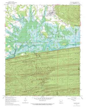
Plainview Topo Map Arkansas
To zoom in, hover over the map of Plainview
USGS Topo Quad 34093h3 - 1:24,000 scale
| Topo Map Name: | Plainview |
| USGS Topo Quad ID: | 34093h3 |
| Print Size: | ca. 21 1/4" wide x 27" high |
| Southeast Coordinates: | 34.875° N latitude / 93.25° W longitude |
| Map Center Coordinates: | 34.9375° N latitude / 93.3125° W longitude |
| U.S. State: | AR |
| Filename: | o34093h3.jpg |
| Download Map JPG Image: | Plainview topo map 1:24,000 scale |
| Map Type: | Topographic |
| Topo Series: | 7.5´ |
| Map Scale: | 1:24,000 |
| Source of Map Images: | United States Geological Survey (USGS) |
| Alternate Map Versions: |
Plainview AR 1968, updated 1970 Download PDF Buy paper map Plainview AR 2011 Download PDF Buy paper map Plainview AR 2014 Download PDF Buy paper map |
| FStopo: | US Forest Service topo Plainview is available: Download FStopo PDF Download FStopo TIF |
1:24,000 Topo Quads surrounding Plainview
> Back to 34093e1 at 1:100,000 scale
> Back to 34092a1 at 1:250,000 scale
> Back to U.S. Topo Maps home
Plainview topo map: Gazetteer
Plainview: Guts
Wilson Slough elevation 102m 334′Plainview: Parks
Sunlight Bay Public Use Area elevation 110m 360′Plainview: Populated Places
Plainview elevation 130m 426′Wards Crossing elevation 103m 337′
Plainview: Ridges
Fourche Mountain elevation 398m 1305′Plainview: Streams
Big Creek elevation 105m 344′Browns Creek elevation 105m 344′
Danville Creek elevation 238m 780′
Gilkey Creek elevation 103m 337′
Hogan Creek elevation 102m 334′
Moore Creek elevation 172m 564′
Negro Branch elevation 102m 334′
Peavine Creek elevation 106m 347′
Porter Creek elevation 105m 344′
Prairie Creek elevation 102m 334′
Sally Spring Branch elevation 111m 364′
Star Creek elevation 106m 347′
Plainview: Valleys
Buchanan Hollow elevation 246m 807′Plainview digital topo map on disk
Buy this Plainview topo map showing relief, roads, GPS coordinates and other geographical features, as a high-resolution digital map file on DVD:


