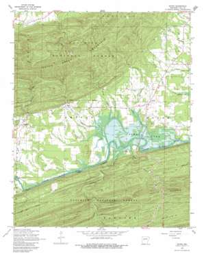
Rover Topo Map Arkansas
To zoom in, hover over the map of Rover
USGS Topo Quad 34093h4 - 1:24,000 scale
| Topo Map Name: | Rover |
| USGS Topo Quad ID: | 34093h4 |
| Print Size: | ca. 21 1/4" wide x 27" high |
| Southeast Coordinates: | 34.875° N latitude / 93.375° W longitude |
| Map Center Coordinates: | 34.9375° N latitude / 93.4375° W longitude |
| U.S. State: | AR |
| Filename: | o34093h4.jpg |
| Download Map JPG Image: | Rover topo map 1:24,000 scale |
| Map Type: | Topographic |
| Topo Series: | 7.5´ |
| Map Scale: | 1:24,000 |
| Source of Map Images: | United States Geological Survey (USGS) |
| Alternate Map Versions: |
Rover AR 1968, updated 1970 Download PDF Buy paper map Rover AR 1968, updated 1983 Download PDF Buy paper map Rover AR 2011 Download PDF Buy paper map Rover AR 2014 Download PDF Buy paper map |
| FStopo: | US Forest Service topo Rover is available: Download FStopo PDF Download FStopo TIF |
1:24,000 Topo Quads surrounding Rover
> Back to 34093e1 at 1:100,000 scale
> Back to 34092a1 at 1:250,000 scale
> Back to U.S. Topo Maps home
Rover topo map: Gazetteer
Rover: Bridges
Whitely Bridge elevation 111m 364′Rover: Populated Places
Briggsville elevation 131m 429′Gilkey (historical) elevation 129m 423′
Rover elevation 119m 390′
Wing elevation 145m 475′
Rover: Post Offices
Briggsville Post Office elevation 131m 429′Rover Post Office elevation 128m 419′
Rover: Streams
Atcheson Creek elevation 111m 364′Barnhart Creek elevation 129m 423′
Brogan Creek elevation 119m 390′
Kinks Creek elevation 110m 360′
Kirkos Creek elevation 122m 400′
Sinkler Branch elevation 105m 344′
Stowe Creek elevation 110m 360′
Twomile Creek elevation 122m 400′
Rover: Summits
Long Mountain elevation 314m 1030′Rover digital topo map on disk
Buy this Rover topo map showing relief, roads, GPS coordinates and other geographical features, as a high-resolution digital map file on DVD:


