Gillham Topo Map Arkansas
To zoom in, hover over the map of Gillham
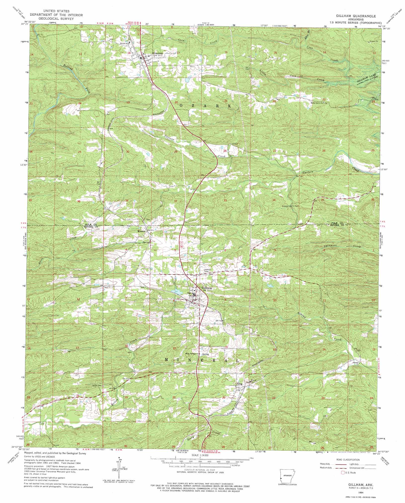
USGS Topo Quad 34094b3 - 1:24,000 scale
| Topo Map Name: | Gillham |
| USGS Topo Quad ID: | 34094b3 |
| Print Size: | ca. 21 1/4" wide x 27" high |
| Southeast Coordinates: | 34.125° N latitude / 94.25° W longitude |
| Map Center Coordinates: | 34.1875° N latitude / 94.3125° W longitude |
| U.S. State: | AR |
| Filename: | o34094b3.jpg |
| Download Map JPG Image: | Gillham topo map 1:24,000 scale |
| Map Type: | Topographic |
| Topo Series: | 7.5´ |
| Map Scale: | 1:24,000 |
| Source of Map Images: | United States Geological Survey (USGS) |
| Alternate Map Versions: |
Gillham AR 1964, updated 1966 Download PDF Buy paper map Gillham AR 1964, updated 1975 Download PDF Buy paper map Gillham AR 2011 Download PDF Buy paper map Gillham AR 2014 Download PDF Buy paper map |
1:24,000 Topo Quads surrounding Gillham
Watson |
Cove |
Vandervoort |
Eagle Mountain |
Nichols Nountain |
Big Hudson Creek |
Bog Springs |
Wickes |
Baker Springs |
Umpire |
Toblerville |
De Queen Nw |
Gillham |
Gillham Dam |
Dierks Dam |
Eagletown |
Chapel Hill |
De Queen |
Geneva |
Dierks |
Goodwater |
Cerrogordo |
Horatio |
Lockesburg |
Silver Ridge |
> Back to 34094a1 at 1:100,000 scale
> Back to 34094a1 at 1:250,000 scale
> Back to U.S. Topo Maps home
Gillham topo map: Gazetteer
Gillham: Dams
Gillham Lake Dam elevation 234m 767′Land Processing Lake Dam elevation 277m 908′
Gillham: Populated Places
Antioch (historical) elevation 231m 757′Fairview elevation 134m 439′
Gillham elevation 228m 748′
Grannis elevation 284m 931′
Holly Grove elevation 232m 761′
King elevation 186m 610′
Mineral elevation 247m 810′
Gillham: Reservoirs
Aeration Lake elevation 277m 908′Gillham Lake elevation 234m 767′
Gillham: Streams
Allen Branch elevation 188m 616′Little Coon Creek elevation 177m 580′
Gillham digital topo map on disk
Buy this Gillham topo map showing relief, roads, GPS coordinates and other geographical features, as a high-resolution digital map file on DVD: