Bethel Topo Map Oklahoma
To zoom in, hover over the map of Bethel
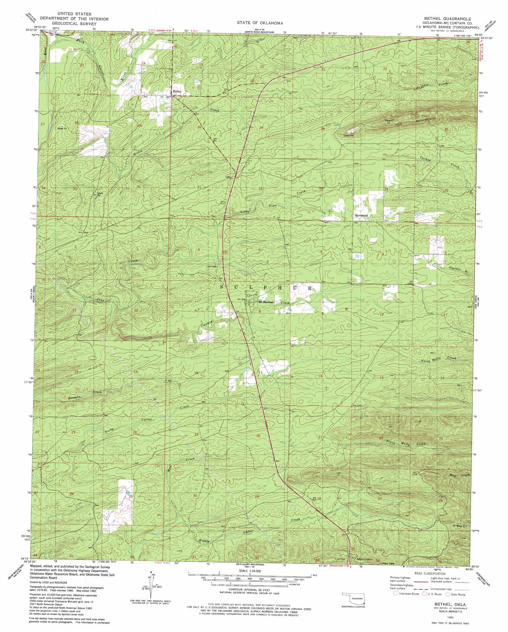
USGS Topo Quad 34094c7 - 1:24,000 scale
| Topo Map Name: | Bethel |
| USGS Topo Quad ID: | 34094c7 |
| Print Size: | ca. 21 1/4" wide x 27" high |
| Southeast Coordinates: | 34.25° N latitude / 94.75° W longitude |
| Map Center Coordinates: | 34.3125° N latitude / 94.8125° W longitude |
| U.S. State: | OK |
| Filename: | o34094c7.jpg |
| Download Map JPG Image: | Bethel topo map 1:24,000 scale |
| Map Type: | Topographic |
| Topo Series: | 7.5´ |
| Map Scale: | 1:24,000 |
| Source of Map Images: | United States Geological Survey (USGS) |
| Alternate Map Versions: |
Bethel OK 1982, updated 1983 Download PDF Buy paper map Bethel OK 2010 Download PDF Buy paper map Bethel OK 2013 Download PDF Buy paper map Bethel OK 2016 Download PDF Buy paper map |
| FStopo: | US Forest Service topo Bethel is available: Download FStopo PDF Download FStopo TIF |
1:24,000 Topo Quads surrounding Bethel
Albion Se |
Honobia |
Ludlow |
Octavia |
Lynn Mountain |
Clebit |
Battiest |
White Rock Mountain |
Smithville |
Watson |
Signal Mountain |
Rockey Creek |
Bethel |
Hee Creek |
Big Hudson Creek |
Alikchi |
Bear Mountain |
Old Glory Mountain |
Stephens Gap |
Toblerville |
Wright City |
Golden |
Steel Junction |
Broken Bow |
Eagletown |
> Back to 34094a1 at 1:100,000 scale
> Back to 34094a1 at 1:250,000 scale
> Back to U.S. Topo Maps home
Bethel topo map: Gazetteer
Bethel: Populated Places
Bethel elevation 262m 859′Mount Herman elevation 277m 908′
Sherwood elevation 317m 1040′
Bethel: Streams
Canyon Creek elevation 215m 705′Carpenter Branch elevation 207m 679′
Coon Creek elevation 205m 672′
Little Pine Creek elevation 246m 807′
Mud Creek elevation 237m 777′
Bethel: Summits
Carter Mountain elevation 403m 1322′Bethel digital topo map on disk
Buy this Bethel topo map showing relief, roads, GPS coordinates and other geographical features, as a high-resolution digital map file on DVD: