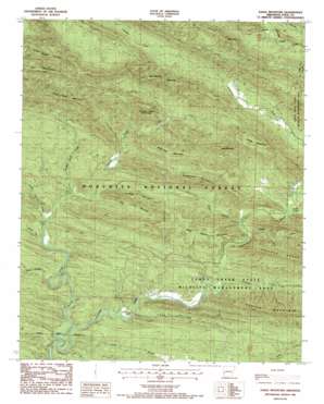
Eagle Mountain Topo Map Arkansas
To zoom in, hover over the map of Eagle Mountain
USGS Topo Quad 34094d2 - 1:24,000 scale
| Topo Map Name: | Eagle Mountain |
| USGS Topo Quad ID: | 34094d2 |
| Print Size: | ca. 21 1/4" wide x 27" high |
| Southeast Coordinates: | 34.375° N latitude / 94.125° W longitude |
| Map Center Coordinates: | 34.4375° N latitude / 94.1875° W longitude |
| U.S. State: | AR |
| Filename: | o34094d2.jpg |
| Download Map JPG Image: | Eagle Mountain topo map 1:24,000 scale |
| Map Type: | Topographic |
| Topo Series: | 7.5´ |
| Map Scale: | 1:24,000 |
| Source of Map Images: | United States Geological Survey (USGS) |
| Alternate Map Versions: |
Eagle Mountain AR 1986, updated 1986 Download PDF Buy paper map Eagle Mountain AR 2011 Download PDF Buy paper map Eagle Mountain AR 2014 Download PDF Buy paper map |
| FStopo: | US Forest Service topo Eagle Mountain is available: Download FStopo PDF Download FStopo TIF |
1:24,000 Topo Quads surrounding Eagle Mountain
> Back to 34094a1 at 1:100,000 scale
> Back to 34094a1 at 1:250,000 scale
> Back to U.S. Topo Maps home
Eagle Mountain topo map: Gazetteer
Eagle Mountain: Springs
Gillham Springs elevation 264m 866′Eagle Mountain: Streams
Brushy Creek elevation 241m 790′Caney Creek elevation 287m 941′
Holly Branch elevation 302m 990′
Holly Creek elevation 280m 918′
Little Brushy Creek elevation 285m 935′
Long Branch elevation 251m 823′
Rock Creek elevation 268m 879′
Short Creek elevation 305m 1000′
Smoke Rock Creek elevation 299m 980′
Sugar Creek elevation 316m 1036′
Eagle Mountain: Summits
Baker Mountain elevation 616m 2020′Bald Knob elevation 591m 1938′
Bee Mountain elevation 613m 2011′
Boar Tusk Mountain elevation 601m 1971′
Dog Mountain elevation 537m 1761′
Eagle Mountain elevation 677m 2221′
Fodderstack Mountain elevation 499m 1637′
High Point elevation 567m 1860′
Rocky Mountain elevation 565m 1853′
Smoke Rock Mountain elevation 540m 1771′
Sugartree Mountain elevation 563m 1847′
West Hanna Mountain elevation 619m 2030′
Eagle Mountain: Valleys
Dog Hollow elevation 310m 1017′Long Hollow elevation 276m 905′
Eagle Mountain digital topo map on disk
Buy this Eagle Mountain topo map showing relief, roads, GPS coordinates and other geographical features, as a high-resolution digital map file on DVD:


