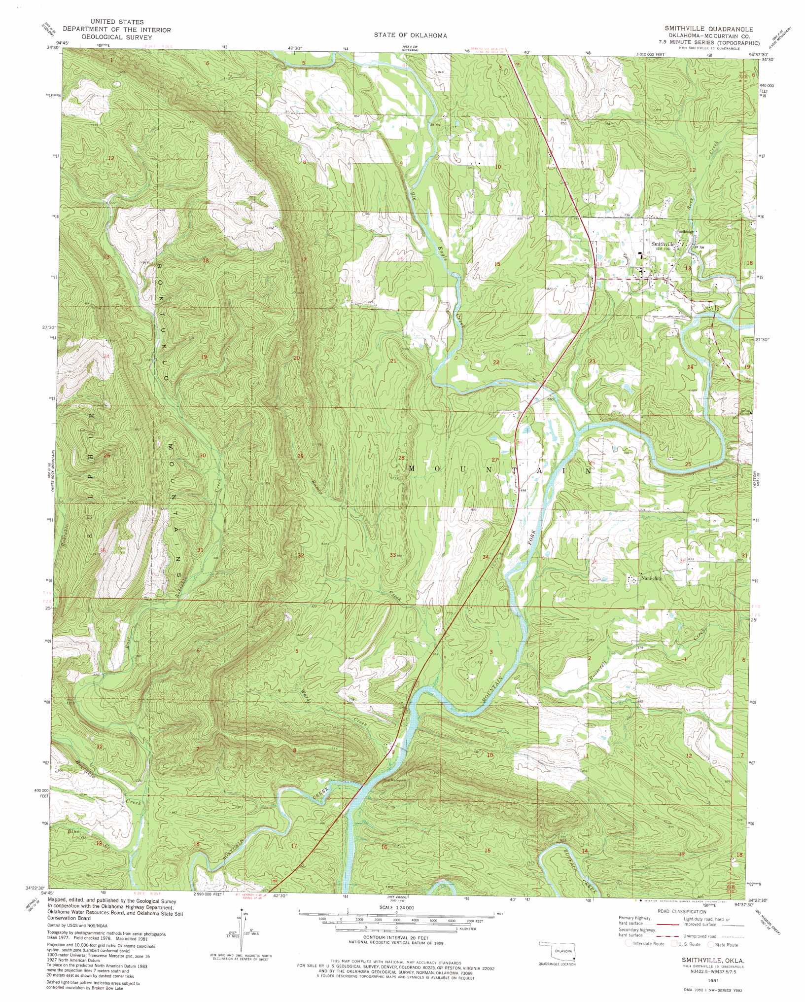
Smithville Topo Map Oklahoma
To zoom in, hover over the map of Smithville
USGS Topo Quad 34094d6 - 1:24,000 scale
| Topo Map Name: | Smithville |
| USGS Topo Quad ID: | 34094d6 |
| Print Size: | ca. 21 1/4" wide x 27" high |
| Southeast Coordinates: | 34.375° N latitude / 94.625° W longitude |
| Map Center Coordinates: | 34.4375° N latitude / 94.6875° W longitude |
| U.S. State: | OK |
| Filename: | o34094d6.jpg |
| Download Map JPG Image: | Smithville topo map 1:24,000 scale |
| Map Type: | Topographic |
| Topo Series: | 7.5´ |
| Map Scale: | 1:24,000 |
| Source of Map Images: | United States Geological Survey (USGS) |
| Alternate Map Versions: |
Smithville OK 1981, updated 1981 Download PDF Buy paper map Smithville OK 2010 Download PDF Buy paper map Smithville OK 2013 Download PDF Buy paper map Smithville OK 2016 Download PDF Buy paper map |
| FStopo: | US Forest Service topo Smithville is available: Download FStopo PDF Download FStopo TIF |
1:24,000 Topo Quads surrounding Smithville
Whitesboro |
Muse |
Big Cedar |
Page |
Mountain Fork |
Honobia |
Ludlow |
Octavia |
Lynn Mountain |
Zafra |
Battiest |
White Rock Mountain |
Smithville |
Watson |
Cove |
Rockey Creek |
Bethel |
Hee Creek |
Big Hudson Creek |
Bog Springs |
Bear Mountain |
Old Glory Mountain |
Stephens Gap |
Toblerville |
De Queen Nw |
> Back to 34094a1 at 1:100,000 scale
> Back to 34094a1 at 1:250,000 scale
> Back to U.S. Topo Maps home
Smithville topo map: Gazetteer
Smithville: Gaps
The Narrows elevation 187m 613′Smithville: Populated Places
Nani-chito elevation 234m 767′Smithville elevation 212m 695′
Smithville: Streams
Big Eagle Creek elevation 198m 649′Blue Creek elevation 234m 767′
Boktuklo Creek elevation 189m 620′
East Boktuklo Creek elevation 232m 761′
Hurricane Creek elevation 211m 692′
Ramos Creek elevation 190m 623′
Rock Creek elevation 207m 679′
Roosevelt Creek elevation 194m 636′
Ward Creek elevation 189m 620′
Smithville digital topo map on disk
Buy this Smithville topo map showing relief, roads, GPS coordinates and other geographical features, as a high-resolution digital map file on DVD: