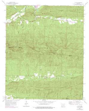
Y City Topo Map Arkansas
To zoom in, hover over the map of Y City
USGS Topo Quad 34094f1 - 1:24,000 scale
| Topo Map Name: | Y City |
| USGS Topo Quad ID: | 34094f1 |
| Print Size: | ca. 21 1/4" wide x 27" high |
| Southeast Coordinates: | 34.625° N latitude / 94° W longitude |
| Map Center Coordinates: | 34.6875° N latitude / 94.0625° W longitude |
| U.S. State: | AR |
| Filename: | o34094f1.jpg |
| Download Map JPG Image: | Y City topo map 1:24,000 scale |
| Map Type: | Topographic |
| Topo Series: | 7.5´ |
| Map Scale: | 1:24,000 |
| Source of Map Images: | United States Geological Survey (USGS) |
| Alternate Map Versions: |
Y City AR 1958, updated 1959 Download PDF Buy paper map Y City AR 1958, updated 1976 Download PDF Buy paper map Y City AR 2011 Download PDF Buy paper map Y City AR 2014 Download PDF Buy paper map |
| FStopo: | US Forest Service topo Y City is available: Download FStopo PDF Download FStopo TIF |
1:24,000 Topo Quads surrounding Y City
> Back to 34094e1 at 1:100,000 scale
> Back to 34094a1 at 1:250,000 scale
> Back to U.S. Topo Maps home
Y City topo map: Gazetteer
Y City: Populated Places
Chant (historical) elevation 217m 711′Posey Hollow elevation 382m 1253′
Y City elevation 225m 738′
Y City: Ridges
Fourche Mountain elevation 709m 2326′Y City: Streams
Gap Creek elevation 331m 1085′Johnson Creek elevation 220m 721′
Rough Creek elevation 218m 715′
Slaty Creek elevation 361m 1184′
Steep Hollow Creek elevation 226m 741′
Tan-a-hill Creek elevation 222m 728′
Turner Creek elevation 399m 1309′
Y City: Summits
Blue Mountain elevation 790m 2591′Irons Fork Mountain elevation 548m 1797′
Lamb Mountain elevation 511m 1676′
Wolf Pinnacle elevation 745m 2444′
Y City: Valleys
Gap Creek Valley elevation 333m 1092′Posey Hollow elevation 331m 1085′
Y City digital topo map on disk
Buy this Y City topo map showing relief, roads, GPS coordinates and other geographical features, as a high-resolution digital map file on DVD:


