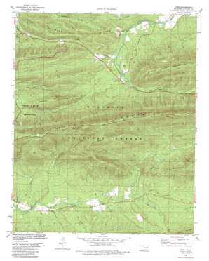
Page Topo Map Oklahoma
To zoom in, hover over the map of Page
USGS Topo Quad 34094f5 - 1:24,000 scale
| Topo Map Name: | Page |
| USGS Topo Quad ID: | 34094f5 |
| Print Size: | ca. 21 1/4" wide x 27" high |
| Southeast Coordinates: | 34.625° N latitude / 94.5° W longitude |
| Map Center Coordinates: | 34.6875° N latitude / 94.5625° W longitude |
| U.S. State: | OK |
| Filename: | o34094f5.jpg |
| Download Map JPG Image: | Page topo map 1:24,000 scale |
| Map Type: | Topographic |
| Topo Series: | 7.5´ |
| Map Scale: | 1:24,000 |
| Source of Map Images: | United States Geological Survey (USGS) |
| Alternate Map Versions: |
Page OK 1981, updated 1981 Download PDF Buy paper map Page OK 1981, updated 1989 Download PDF Buy paper map Page OK 2011 Download PDF Buy paper map Page OK 2013 Download PDF Buy paper map Page OK 2016 Download PDF Buy paper map |
| FStopo: | US Forest Service topo Page is available: Download FStopo PDF Download FStopo TIF |
1:24,000 Topo Quads surrounding Page
> Back to 34094e1 at 1:100,000 scale
> Back to 34094a1 at 1:250,000 scale
> Back to U.S. Topo Maps home
Page topo map: Gazetteer
Page: Forests
Quachita National Forest elevation 801m 2627′Page: Populated Places
Page elevation 281m 921′Page: Ridges
Shawnee Ridges elevation 379m 1243′Page: Streams
Big Branch elevation 268m 879′Golden Branch elevation 275m 902′
Horse Bone Creek elevation 293m 961′
Little Pigeon Creek elevation 317m 1040′
Pashubbe Creek elevation 277m 908′
Pigeon Creek elevation 317m 1040′
Rattlesnake Creek elevation 275m 902′
Page: Summits
Honess Mountain elevation 566m 1856′Pine Mountain elevation 650m 2132′
Quentin Peak elevation 664m 2178′
Wilton Mountain elevation 775m 2542′
Page digital topo map on disk
Buy this Page topo map showing relief, roads, GPS coordinates and other geographical features, as a high-resolution digital map file on DVD:


