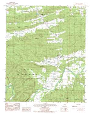
Boles Topo Map Arkansas
To zoom in, hover over the map of Boles
USGS Topo Quad 34094g1 - 1:24,000 scale
| Topo Map Name: | Boles |
| USGS Topo Quad ID: | 34094g1 |
| Print Size: | ca. 21 1/4" wide x 27" high |
| Southeast Coordinates: | 34.75° N latitude / 94° W longitude |
| Map Center Coordinates: | 34.8125° N latitude / 94.0625° W longitude |
| U.S. State: | AR |
| Filename: | o34094g1.jpg |
| Download Map JPG Image: | Boles topo map 1:24,000 scale |
| Map Type: | Topographic |
| Topo Series: | 7.5´ |
| Map Scale: | 1:24,000 |
| Source of Map Images: | United States Geological Survey (USGS) |
| Alternate Map Versions: |
Boles AR 1983, updated 1984 Download PDF Buy paper map Boles AR 2011 Download PDF Buy paper map Boles AR 2014 Download PDF Buy paper map |
| FStopo: | US Forest Service topo Boles is available: Download FStopo PDF Download FStopo TIF |
1:24,000 Topo Quads surrounding Boles
> Back to 34094e1 at 1:100,000 scale
> Back to 34094a1 at 1:250,000 scale
> Back to U.S. Topo Maps home
Boles topo map: Gazetteer
Boles: Airports
Ratliff and Sons Ranch Airport elevation 198m 649′Strickland Landing Strip elevation 208m 682′
Boles: Bridges
Buffalo Bridge elevation 198m 649′Boles: Dams
Truman Baker Lake Dam elevation 231m 757′Boles: Populated Places
Boles elevation 204m 669′Buffalo (historical) elevation 201m 659′
Keener elevation 203m 666′
Needmore elevation 211m 692′
The Pines elevation 275m 902′
Boles: Post Offices
Boles Post Office elevation 202m 662′Boles: Reservoirs
Truman Baker Lake elevation 231m 757′Boles: Streams
Buffalo Creek elevation 188m 616′Countis Creek elevation 187m 613′
Little Buffalo Creek elevation 205m 672′
Mill Creek elevation 209m 685′
Negro Creek elevation 185m 606′
Northern Creek elevation 194m 636′
Session Creek elevation 190m 623′
Stevens Branch elevation 192m 629′
Turkey Creek elevation 208m 682′
Boles: Summits
Bruce Mountain elevation 312m 1023′Buffalo Mountain elevation 288m 944′
High Point Mountain elevation 419m 1374′
Key Mountain elevation 413m 1354′
Piney Mountain elevation 308m 1010′
Ross Mountain elevation 320m 1049′
Boles digital topo map on disk
Buy this Boles topo map showing relief, roads, GPS coordinates and other geographical features, as a high-resolution digital map file on DVD:


