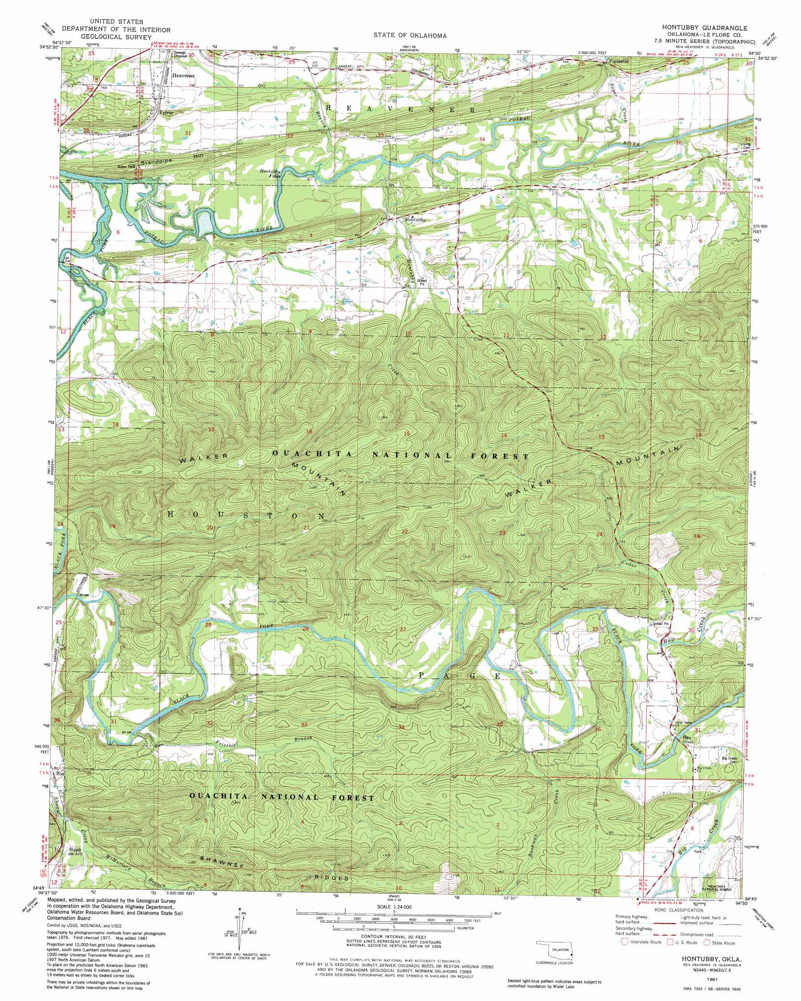
Hontubby Topo Map Oklahoma
To zoom in, hover over the map of Hontubby
USGS Topo Quad 34094g5 - 1:24,000 scale
| Topo Map Name: | Hontubby |
| USGS Topo Quad ID: | 34094g5 |
| Print Size: | ca. 21 1/4" wide x 27" high |
| Southeast Coordinates: | 34.75° N latitude / 94.5° W longitude |
| Map Center Coordinates: | 34.8125° N latitude / 94.5625° W longitude |
| U.S. State: | OK |
| Filename: | o34094g5.jpg |
| Download Map JPG Image: | Hontubby topo map 1:24,000 scale |
| Map Type: | Topographic |
| Topo Series: | 7.5´ |
| Map Scale: | 1:24,000 |
| Source of Map Images: | United States Geological Survey (USGS) |
| Alternate Map Versions: |
Hontubby OK 1981, updated 1981 Download PDF Buy paper map Hontubby OK 2011 Download PDF Buy paper map Hontubby OK 2013 Download PDF Buy paper map Hontubby OK 2016 Download PDF Buy paper map |
| FStopo: | US Forest Service topo Hontubby is available: Download FStopo PDF Download FStopo TIF |
1:24,000 Topo Quads surrounding Hontubby
Potato Peaks |
Poteau West |
Poteau East |
Hartford |
Huntington |
Summerfield |
Wister |
Heavener |
Bates |
Cauthron |
Leflore Se |
Hodgens |
Hontubby |
Loving |
Horseshoe Mountain |
Muse |
Big Cedar |
Page |
Mountain Fork |
Rich Mountain |
Ludlow |
Octavia |
Lynn Mountain |
Zafra |
Potter |
> Back to 34094e1 at 1:100,000 scale
> Back to 34094a1 at 1:250,000 scale
> Back to U.S. Topo Maps home
Hontubby topo map: Gazetteer
Hontubby: Falls
Hontubby Falls elevation 152m 498′Hontubby: Populated Places
Forrester elevation 163m 534′Haw Creek elevation 220m 721′
Hontubby elevation 159m 521′
Petros elevation 168m 551′
Stapp elevation 204m 669′
Hontubby: Streams
Black Fork elevation 150m 492′Bushman Creek elevation 201m 659′
Cedar Creek elevation 206m 675′
Fizzell Branch elevation 179m 587′
Frizzell Branch elevation 179m 587′
Haw Creek elevation 208m 682′
Haw Creek elevation 207m 679′
Hontubby Creek elevation 154m 505′
McMurtery Branch elevation 187m 613′
Oil Branch elevation 152m 498′
Sugar Creek elevation 156m 511′
Hontubby: Summits
Standpipe Hill elevation 205m 672′Hontubby digital topo map on disk
Buy this Hontubby topo map showing relief, roads, GPS coordinates and other geographical features, as a high-resolution digital map file on DVD: